Saturday 23 November 2019

Exploring the Township of Puketapu

This is my latest article, published in Motorhomes, Caravans & Destinations Magazine
Heather Whelan goes off the beaten track and discovers tourism gems hidden in the township of Puketapu, near Napier

With its beautiful Art Deco buildings and stunning street art, Napier is a drawcard for visitors to the Hastings region. The city also has an excellent network of cycle trails, north and south, that leads to beautiful beaches, seaside settlements, and past vineyards and wineries.
Whelan_14-The-track-looped-back.jpg
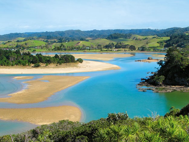
But as motorhomers know, there are often hidden gems to be found by venturing off the beaten track. My partner Malcolm and I discovered some when we headed inland to cycle the Puketapu Loop, a circuit along the banks of the Tutaekuri River.
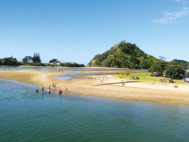
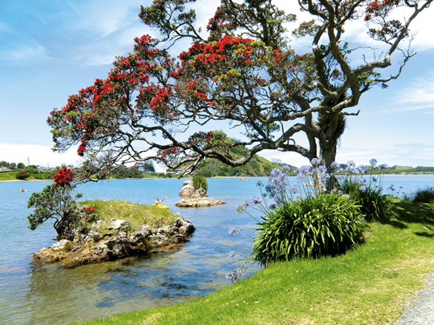
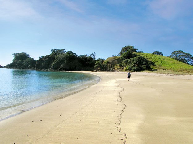
On the trail

Alt TEXT HERE
On the cycle trail
The cycle ride can be started in Taradale, but we began in Puketapu village, parking opposite the pub and store. (We had left our motorhome at the NZMCA park in Napier and taken our bikes on the car, but there are freedom camping areas in Puketapu.) A sign on the tavern wall featured a bicycle and set the scene for the expedition.
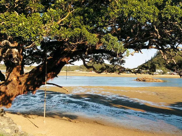
Lonely Planet has listed this ride as one of the 10 most beautiful in New Zealand and it certainly lived up to its reputation. The cycle trail took us from the village to the banks of the river, and then beside the river through some of Hawke’s Bay’s lush, fruit-growing countryside. After about 7km of easy cycling we saw some high cliffs, topped with wooden palisades and left the trail to investigate further.
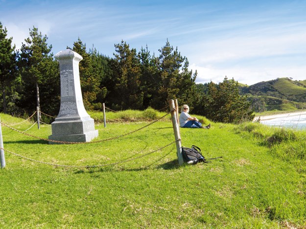
Historic sites

Alt TEXT HERE
The carved entranceway at Otatara Pā
Across the road, we came to a carved gateway, full of information panels. We learned that this was Otatara Pā Historic Reserve, which encompassed the palisaded pā we had seen from the cycle trail and, on the hilltops behind, the site of Hikurangi Pā. The pā complex covered more than 40ha and was one of the oldest and largest in the area, with access to a range of natural resources.
It is of archaeological importance because it has retained its features: Heritage New Zealand has listed the pā as a category one historic place. Leaving our bikes at the entranceway, we walked up a wide track to Otatara Pā. On the slopes beside the trail, atmospheric carved pouwhenua (poles) stood tall beside cabbage trees and pockets of bush.
Alt TEXT HERE
Pouwhenua at Otatara Pā
In the 1500s, the pā was fiercely fought over because of its position and proximity to resources. It was eventually abandoned and made tapu because of the numbers who had died in the fighting. From the clifftops, it was easy to see why this would have been a great place for Māori tribes to live.
The earthquake of 1931 altered the landscape. But, before this, the land between the pā and the coast would have been a network of estuaries, lakes and wetlands, good for food-gathering and waka travel. Our view was of neat blocks of horticultural land, paddocks and, in the distance, the white headland at Cape Kidnappers.
Turning inland we followed a narrow track through dried brown grass uphill to the summit of Hikurangi Pā. On the way, we read signs that explained that when this was a thriving settlement, there were terraces for housing, gardens and kūmara storage areas.
From the ridges and the summit, the views were amazing – across hills to mountain ranges in the distance. Apparently, on a clear day, Mount Ruapehu can be seen. After taking in the scene, we followed the loop track down to the entrance gateway.

The reward at the end

Alt TEXT HERE
Great food at the Puketapu Hotel
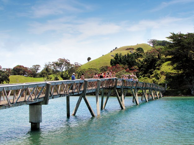
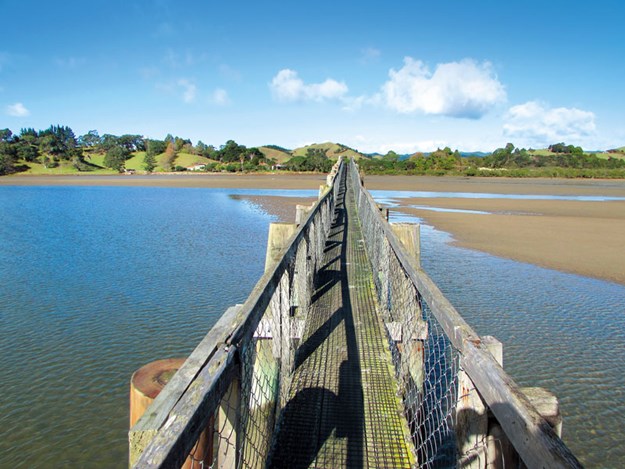
Back on the cycle trail, we crossed a bridge over the Tutaekuri River and began to ride back towards Puketapu. This side of the river had more trees, giving the trail a woodland feel. It didn’t seem long before we reached the outskirts of Puketapu, the track ending at Vicarage Road.
Puketapu has a lovely, relaxed ‘village’ feel. We cycled past Saint Michael and All Angels Church, a pretty wooden building dating to 1910, before arriving back at the parking area. Across the road, the village store, complete with petrol pumps, stood beside the Puketapu Hotel, a typical country tavern.
The original pub was built in 1885 but, like so many of New Zealand’s old wooden buildings, it was destroyed by fire. The present tavern dates from the 1920s. We headed inside, feeling sure that with all our cycling and walking, we deserved a good lunch.
Billed as an award-winning, classic Kiwi country pub, the bars and outdoor area were packed. We grabbed the last table and ordered. We weren’t disappointed. The day had proved that sometimes the most interesting and memorable things can be found just off the beaten track.


GETTING AROUND

  • There are two freedom camping spots nearby. Puketapu Reserve is at 56 Dartmoor Road, beside a children’s playground. There are toilets, picnic tables and barbecues here, but the resident cockerels are known for their early-morning wake-up calls. Dartmoor Bridge Reserve is about 9km further along Dartmoor Road. Parking is on a flat area just before the bridge.
  • Silky Oak Chocolates cafe is not far from the cycle trail (about 1km from the Tutaekuri River Bridge). This is a good stop for a coffee or lunch. It even has a chocolate museum. silkyoakchocs.co.nz
  • The menu and opening times for the Puketapu Hotel can be found at thepuketapu.co.nz
  • The Puketapu Loop cycle trail is 18km in length and is grade 1–2 (easy, mostly flat with room for two people to ride side by side). The Hawke’s Bay Trails website is hbtrails.nz
  • For information about the history and walk at Otatara Pā Historic Reserve, visit doc.govt.nz. The walk takes about an hour and is approximately 1.5km.
  • Several bike shops in the region offer cycle hire.

Kerikeri River Track

This article was published in Wilderness Magazine
I have added a few more pictures here
For a relatively short walk, the Kerikeri River Track has a lot to offer, including waterfalls and historic sites. We started at the car park on Rainbow Falls Road on the outskirts of Kerikeri and began by taking in the spectacular Rainbow Falls. There are three viewing platforms within 10-minutes’ walk from the car park and from here we looked down the 27m drop from the top of the waterfall.  


Rainbow Falls (above) and the track below the falls (below)


birdlife on the track

 Nearby are the remains of a weir that supplied water to an early hydro-electric station further down the river. Parts of the old water race could be seen beside the track in places. Although, only minutes from the road, we were already amongst the bush that flanked both sides of the river. This regenerating forest was mainly puriri, karaka, totara and manuka, with tree fern and flax. Fantails flitted around as we walked. 
The track winds down past some interesting rocky cliffs to the base of the falls. The Kerikeri River flows through a valley of basalt lava, formed by volcanic activity around 200 million years ago, and we passed more rocky outcrops along the trail. At the base of the waterfall, there is a swimming hole and some adventurous people were investigating a cave behind the cascades of water. 
We continued walking the River Track, which is part of the Te Araroa Trail, towards the Kerikeri Basin. This section of the track has a boardwalk but most of the walk is on a flat, well-surfaced path. Because the track follows the river, we found ourselves looping right around in almost a full circle before the walkway turned back towards Kerikeri. There are some more swimming spots here called the Fairy Pools.

Wharepuke Falls


The modern world intruded a little further on, the concrete bridge of the Heritage Bypass loomed above.
At an open area along the track is the Wharepuke Falls; these are not as high as Rainbow Falls but are equally as pretty. Then it’s back amongst mossy rocks and gnarly puriri, before coming across a building besides the track. Informative signs inside tell the story of Kerikeri’s first hydro pumping station, built in 1930 to produce power for settlers arriving from England. The water ran to here, in races dug by Yugoslavian gum-diggers, all the way from the weir at Rainbow Falls.
The final part of the walk goes beside some lily ponds before the bush is left and we arrived at the Kerikeri Basin Reserve. A modern curved footbridge links the two banks of the river and from here there are lovely views of the historic buildings, Kemp House and the Stone Store, and of the yachts moored in the basin.

Kemp House and the cafe


The Kerikeri River Trail ends here but we decided to extend our walk by taking the short track to the summit of the hill overlooking the basin. This area, the Kororipo Heritage Park, was once Māori chief Hongi Hika’s headquarters. It was beneath this pa, and under Hongi Hika’s protection, that the Church Mission Society established its settlement.
Past the Stone Store, a carved entrance marks the start of the walk. To reach the summit of Kororipo Pa, we walked up a slope beside gum trees planted in the 1800s. A palisaded viewing platform has information panels and stunning views of the Kerikeri Basin.


Koropiro Pa


Discovering Mackenzie Country


Another of my articles published in Motorhomes Caravans & Destinations Magazine
Motorhomer Heather Whelan and her partner, Malcolm, investigate the legacies of a sheep-rustler and a plant-lover in the heart of the South Island

It’s known as the Mackenzie region, but we call it ‘lupin-land’. Some people consider lupins a weed on a par with broom and briar but, judging by the number of people taking photographs at the roadsides, others find them as beautiful as we do.
iStock-924315012.jpg
A local woman, Connie Scott, planted £100 worth of seeds along the verges in 1949 – just wanting to make the area more beautiful. The lupins thrived and spread and now, from November to February, swathes of the flowers can be seen.
Vast areas of pink, red, purple and lavender lupins frame views of turquoise lakes and snow-capped mountains. Connie Scott is buried in Burkes Pass Cemetery, and is remembered on her tombstone as the ‘lupin lady’.

The story of Mackenzie

Alt TEXT HERE
A footbridge links the Church of the Good Shepherd at Tekapo with the town
We entered the Mackenzie District at Fairlie, a small town that markets itself as the Gateway to the Mackenzie. Fairlie has four distinct seasons. Summer boasts long, hot days. Spring is colourful with flowers and blossom.
In autumn, the tree-lined main street puts on a show of gold and orange; in winter, it may be dusted with snow. (Fairlie is popular in the winter, as it is close to the Mount Dobson ski field.) We visited in summer, the area basking in long, hot days, and found Fairlie an interesting place to visit, if only for a coffee and a stroll.
For those who want to stay longer there is a holiday park, and freedom camping is permitted behind the Grand Hotel. In the centre of Fairlie, we admired a memorial statue of James Mackenzie and his dog, Friday.
Mackenzie was a Scot who arrived in New Zealand from the Australian gold rushes. In 1855, he was apprehended with 1000 sheep belonging to the Rhodes Station, which he had driven from nearby Timaru. John Sidebottom, the station overseer, and two Māori shepherds had pursued Mackenzie to the inland pass that now bears his name.
Mackenzie pleaded innocence and fled to Lyttelton where he was recaptured, tried and sentenced to five years’ hard labour. After escaping twice from prison, his case was reinvestigated, and he was pardoned. Mackenzie returned to Australia and obscurity.
But, in the South Island, he became a Robin Hood-like folk hero, admired for his rebellious nature, brave escapades and extraordinary ability as a shepherd. When Mackenzie was caught, the pursuing shepherds noticed signs that this wasn’t the first huge mob of sheep he had smuggled through the pass to Dunedin, where they would have been sold.
Mackenzie and his dog became symbolic of the struggle of the ordinary emigrant, trying to make a living in the new country. His feats of exploration are now recognised: he was the first European to discover the areas now known as the Lindis Pass, Mackenzie Pass and the Mackenzie Basin. This whole district is named after the sheep rustler.

In Mackenzie’s path

Alt TEXT HERE
Mackenzie and his dog are immortalised at Fairlie
We followed in Mackenzie’s footsteps, driving a circuit from Fairlie. State Highway 8 loops north and west to Burkes Pass. There, we stopped to admire the pretty, Gothic-style Saint Patrick’s Church and read the information panel that describes the Burkes Pass area.
The village itself is tiny and looks hardly changed since its pioneering heyday. At the interestingly named Dog Kennel Corner, we turned onto Haldon Road. The scenery here is amazing – a dusty basin stretching across to distant snow-capped ranges. It isn’t hard to imagine Mackenzie passing by, driving his herd of stolen sheep before him.
A short way along Mackenzie Pass Road, we came to a small, three-sided monument. On each face, the same story is told – in English, Māori and Gaelic. "In this spot, James Mackenzie, the freebooter, was captured by John Sidebottom and the Māoris Taiko and Seventeen and escaped from them the same night, 4th March 1855." It’s a remote place now and must have been considerably more isolated more than 150 years ago.

Magnificent lakes

Alt TEXT HERE
Lake Tekapo from Mount John summit
We spent a few days at Lake Opuha, just north of Fairlie, where there are three freedom-camping areas from which to choose. Lake Opuha is a lovely spot, with expansive views of the lake and mountains. We found a lakeside path that took us around to a dam, where sailors and kayakers were enjoying the calm waters.
Next, we checked out the more well-known and tourism-orientated Lake Tekapo. The NZMCA park where we stayed was a contrast to the Lake Opuha site – it is hidden away in a clearing in a pine forest. We walked from here around the lakeside into Lake Tekapo township, passing the famous church of the Good Shepherd.
Alt TEXT HERE
The Church of the Good Shepherd
Built in 1935, this church has become one of the most photographed buildings in New Zealand because of its attractive structure and the picturesque backdrop of lake and mountains. The church was built in recognition of the pioneers of the Mackenzie Country.
Nearby is a bronze statue of a collie dog, a memorial to the working dogs that assisted the pioneering leaseholders and farmers. There is a wealth of activities to choose from at Lake Tekapo, including canoeing, jet-boating, yachting, fishing, tramping, cycling, golf and walking.
Alt TEXT HERE
Domes at Mount John Observatory
We followed a walking track to the summit of Mount John, home to the Mount John Observatory, one of the best places in the world to observe the night sky. The observatory houses New Zealand’s largest telescope and there are tours for those who want to view the evening or night skies.
During the day, we discovered the breath-taking views of Lake Tekapo, Lake Alexandrina and Lake McGregor as we walked the three-hour loop to the summit of Mount John. The elevation gain is 311m, so I was glad of the excuse to stop and take photos.
Alt TEXT HERE
Tekapo Springs
After exploring the mountain top, we had a coffee at the aptly named Astro Café before heading back down to the lakeside, where we soaked our aching legs in the hottest of the Tekapo Springs hot pools. Each pool is shaped like one of the district’s lakes: Ohau, Pukaki and Tekapo.

Mighty Mount Cook

Alt TEXT HERE
Freedom camping at Lake Opuha
Next stop on our itinerary was lakeside at Lake Pukaki, where there is a large area for freedom camping near the dam. A track beside the lake is part of the Alps to Ocean cycle trail, although we just meandered a few kilometres and back again on our bikes.
Christmas was approaching, and we pulled out a tiny wilding pine to decorate our bus. Although it was summer, the glacier-fed lake water was icy, and only a few brave tourists attempted a quick dip.
We left our bus parked beside Lake Pukaki and drove by car to Aoraki/Mount Cook. This World Heritage site covers more than 70,000ha and includes New Zealand’s tallest mountain and largest glacier. There are several walks here, ranging between 10 minutes and an hour.
We wandered around for a couple of hours admiring the splendour – where else in the country can you go for a stroll and see icebergs? The Mackenzie Country is full of contrasts and is well worth exploring.

MORE TO DO

  • There are several walks in Fairlie and the surrounding area. We loved the Fairlie River Loop Walk. There are some good eateries in the township; we can recommend the pies from The Bakehouse.
  • Freedom camping is allowed at Lake Opuha for up to seven nights, except from 23 December to the second Monday of January.
  • As well as the NZMCA park at Lake Tekapo, there is a holiday park on Lakeside Drive and freedom camping at Pattersons Ponds.
  • Information on the Mount John Observatory and Tekapo Springs can be found at the information centre in Lake Tekapo township or at laketekaponz.co.nz

Joined By A Footbridge - Pataua and Whananaki

Recently published in Motorhomes Caravans and Destinations Magazine
Pataua and Whananaki are tricky to get to, but once you discover their delights, it’s all water under the bridge, says Heather Whelan

The communities of Pataua and Whananaki on the Northland coast are each divided in half by rivers, both halves connected only by picturesque footbridges. There is no road that joins these two settlements, clustered around estuaries on the coast north of Whangarei. Each is discovered individually after a tortuous drive through rugged bush and rural paddocks, but they are well worth it.

Whelan_15-Whananaki-Estuary-from-the-Headland-Track.jpg

A honey of a place

Whelan_3-The-Honey-House-Cafe.jpg
The Honey House Cafe
The road to Pataua North wiggled east from Whangarei, skirting the banks of the Horahora River before turning south. A couple of kilometres before reaching Pataua we saw brightly coloured flags at the roadside and a paddock full of cars.
People were buzzing around a red barn like the bees around the hives across the road. We discovered that Tahi – home to honey producers, a cafe and a nature sanctuary – was having its annual open day.
Whelan_4-Clydesdale-rides-at-the-open-day.jpg
Clydesdale rides at the open day
We were keen to see what was happening, and before long had signed up for the ‘bee experience’ and ‘honey house’ visit. We strolled over to the cafe for a coffee before our first tour was due. 
Sustained by some very chocolate-y brownies, we joined a group of people donning beekeepers’ suits and, looking something like a crowd of astronauts, we gathered around the hives and learned all about bees and honey.
Whelan_2-Learning-about-honey-at-Tahi.jpg
Learning about honey at Tahi
Later we were shown around the processing area and discovered how the honey gets from comb to jar. Tahi’s name comes from the mountain and pa, Ohua Tahi, which means ‘first place of plenty’. The honey they sell is a testament to the pristine location of the hives.
Before leaving Tahi we explored one of the four walks in the 315-hectare sanctuary. The boardwalk track took us beside a lake and through wetlands. We had tackled the longer forest walk previously (Tahi is open to the public on Sundays over summer) and looked forward to doing the estuary walk and beach walk another time.

Picturesque Pataua

Whelan_8-Pataua-South.jpg
Pataua South
Leaving Tahi, we soon arrived at Pataua North. There’s not a lot of parking space during busy times but there is usually room to freedom camp at the little reserve close to where the estuary meets the sea.
Whelan_7-Pataua-estuary.jpg
Pataua estuary
There is also a small car park near the footbridge that links Pataua North with Pataua South. Clustered around the river mouth and beachfront, much of the settlement is made up of holiday homes and baches. 
Pataua is a typical Kiwi holiday spot. Pohutukawa trees line the sandy shores of the estuary, brilliant red with blossom in summer. The calm water is popular with kayakers and swimmers, while the footbridge is often crowded with those waiting their turn to fling themselves down into the water.
Surfers love the long, sandy  Parauwanui Beach, while families flock to the shallow estuary and more protected beach at Pataua South, known to locals as Frogtown. Lively in summer, Pataua is peaceful out of season.

Longest footbridge

Whelan_5-Pataua-footbridge.jpg
Further north, Whananaki boasts an even longer footbridge than Pataua’s. With a length of 395 metres, it’s the longest footbridge in the southern hemisphere, and was built so children living on the south side of the Whananaki Inlet could attend the school in Whananaki North.
Before it was constructed the teacher had to row the students back and forth. There is still a school at Whananaki and the village also boasts a store, hall and holiday park. There is a long history of Maori settlement in the area.
Whelan_20-Whananaki-footbridge.jpg
Whananaki footbridge
Whananaki, which means kicking, is said to have been named by the captain of the Mataatua canoe, who spent a sleepless night on account of the mosquitoes here. Insect screens make life easier nowadays – motorhomers can stay at the holiday park, one of the two campgrounds, or freedom camp at the reserve on Whananaki North Road.
Whelan_9-The-estuary-at-Pataua-North.jpg
The estuary at Pataua North
Like Pataua, Whananaki has a sheltered estuary, great for swimming, fishing and gathering pipis. Kayakers can explore the mangroves, a haven for birdlife. There are popular beaches tucked into headlands along the coast – Moureeses and Otamure Bay are accessible from the road while Tauwhara Bay is a short walk through flax, cabbage trees and manuka.
Whelan_14-On-the-Headland-Track-at-Whananaki-North.jpg
On the Headland Track at Whananaki North
A longer, two-hour return walk took us along the Motutara Track to the headland, where we had gorgeous 360 degree views of the coast, mountains and forests of the interior.

A shipwreck memorial

Whelan_11-Beautiful-beaches-at-Whananaki-North.jpg
Beautiful beaches at Whananaki North
Across the footbridge at Whananaki South we found we were even further off the beaten track. A long, sandy beach led us to rocky Pitokuku Point, and from here we walked part of the Whananaki Walkway.
Whelan_19-The-Capitaine-Bougainville-Monument.jpg
The Capitaine Bougainville Monument
The whole track goes south to Sandy Bay and takes three hours one way, but we only completed the first section this time, to the Capitaine Bougainville Monument. A side track took us through pine forest to the monument marking the place where the Capitaine Bougainville, a freighter carrying meat and dairy products, caught fire and sank in 1975.
Sixteen of the crew and passengers aboard perished, as lifeboats capsized in stormy seas. On a peaceful, sunny day, with fabulous views, it was hard to imagine the deadly conditions that led to the tragedy.
Back in Whananaki North we enjoyed a coffee at the cafe outside the store. We might have had to travel long and winding roads to reach both Whananaki and Pataua, but we were glad we did. And discovering the remarkable footbridges that linked the two halves of the settlements was the icing on the cake.

FURTHER INFORMATION

  • Details about the cafe and walks at Tahi can be found at tahinz.com.
  • Access to Pataua North is via Whareora and Pataua North Roads, while to get to Pataua South, take Whangarei Heads Road, then turn onto Pataua South Road. Both routes are around 30km from Whangarei.
  • Details of the Pataua South campground can be found at treasureislandnz.co.nz.
  • Freedom camping at Pataua North is for self-contained vehicles only; maximum stay three nights
  • Whananaki North is about 35km north of Whangarei. Turn off SH1 onto Whananaki North Road. To get to Whananaki South turn off SH1 at Hikurangi and follow Marua and Whananaki South Roads.
  • Information about camping at Whananaki can be found at whananakiholiday.co.nz; Motutara Farm’s website is campingholiday.co.nz; for the DOC campsite at Otamure Bay visit doc.govt.nz.
  • Details of the Whananaki Walkway can be found on the Whangarei District Council’s website: wdc.govt.nz. If walking the track one-way, it is good to be picked up at Sandy Bay, though the drive back to Whananaki is 32km.

South Island's Iconic Sheep and Cattle Stations

MCD writer Heather Whelan explores some of the South Island’s iconic sheep and cattle stations

The South Island is famous for its towering mountain ranges, sweeping plains, picturesque lakes and majestic fjords. Many beauty spots are justifiably well-known and, amazing though they are to visit, are often crowded with visitors.
Alt TEXT HERE
Molesworth is New Zealand’s largest farm
When hubby Malcolm first suggested visiting some high country stations, I was a little anxious – after all, a glance at the map showed nothing but empty spaces. Some online research reassured me it was possible, in fact desirable, to drive through these remote stations and see for ourselves the little-known, wide expanses of wilderness that make up these gigantic farms.


MIGHTY MOLESWORTH

Alt TEXT HERE
The historic Acheron Accommodation House is getting a facelift
Molesworth Station is open to the public over summer, and the 207km journey from Hanmer Springs to Blenheim through the station makes a great alternative route for campervans and vehicles under seven metres.
There are camping spots at the Acheron Accommodation House and Molesworth Cob Cottage, so there are options to break the trip and explore some of the walks along the route, or just park and admire the views.
The main road through Molesworth is the Acheron Road – other roads are 4WD only. Because our bus was too long, we left it parked at the NZMCA Park at Hanmer Springs and explored by car as a day trip. From Hanmer Springs the Clarence Valley Road leads north.
Cut into the side of a vertigo-inducing, steep hillside, this goes over Jacks Pass and into the station. At over 180,000 hectares, Molesworth is New Zealand’s largest farm and is administered by the Department of Conservation, with Landcorp Farming responsible for the station’s 10,000 head of beef cattle.
Driving through the station, it is hard to believe that 70 years ago the area was abandoned, the land untenable because of the destruction caused by thousands of sheep and millions of rabbits. Luckily, rabbit control, re-sowing and conservation practices have turned Molesworth around – now visitors can be awed by the beauty of the landscape. 

A welcome sight

The Acheron Accommodation House, built in 1862 as an overnight stop for stockmen and travellers, is the oldest building at Molesworth. Of cob construction, it has a roof of beech rafters, thatched with tussock.
I had been looking forward to seeing the historic buildings on the station and was sad to see that they had been damaged by the 2016 earthquake. However, despite red tape, the Accommodation House still looks picturesque and was no doubt a welcome sight for early travellers.
(Renovation of the house has recently begun, with contractors planning to retain as much as is possible of the original fabric of the building. Hopefully this summer’s visitors will be able to safely admire the house, inside and out.)
Alt TEXT HERE
The Lower Acheron Suspension Bridge
The Accommodation House marks the start of 59km of road leading to the Molesworth Cob Cottage at the northern boundary of the station. This section of road can be driven in two hours but we took much longer as we lingered – to read information panels, at shelters, at suspension bridges and at every spot that called to be photographed.
Alt TEXT HERE
Roadside shelters  provide information panels
Our first stops were by the river, where wooden suspension bridges span clear, fast-flowing water. On this quiet day, with only birds for company, it’s hard to imagine that once 15,000 sheep were driven over the river where the Lower Acheron Suspension Bridge now stands.
Further on we admired Pig Trough Suspension Bridge, named for the wild pigs living in a nearby gully. Both these bridges are relatively new, replacing earlier bridges washed away by floods.

Murder at Molesworth

Near the confluence of the Severn and Acheron Rivers is an area still called Red Gate, though the gate is long gone. A signboard tells the sad tale of Ivanhoe Augarde. The young man wrote a letter to his sweetheart and entrusted its delivery to a worker called German Charlie. Unfortunately, Charlie read the letter to other men as he travelled north.
When Ivanhoe discovered that he’d been the subject of ridicule he set off in pursuit of Charlie and killed him. He then returned to the Red Gate, where he turned the gun on himself. The tale is memorialised in the name of nearby Mount Augarde.


LAKES, VALLEYS AND MOUNTAINS

Alt TEXT HERE
Lake Wakatipu
Our next station visit took us to Walter Peak, on the shores of Lake Wakatipu. Walter Peak is primarily a sheep station, founded in 1860 and still going strong. It runs around 18,000 sheep and 800 beef cows.
Small compared to Molesworth, the station still covers more than 25,000 hectares. There is no through route – the drive is around 90km each way, starting form a small turn-off on the Te Anau-Mossburn Highway, SH9.
With our usual number of photo stops, explorations and a relaxing break at Walter Peak Station, it took six hours for the round-trip. Mavora Lakes was our first stop. Situated in a mountainous landscape, surrounded by tussock grassland and beech forests, it is a magical place and was used by Sir Peter Jackson when filming The Lord of the Rings.
Alt TEXT HERE
There are photo-worthy spots aplenty in Molesworth 
The forests of South Mavora Lake became ‘Fangorn Forest’, while the Mararoa River became the ‘Silverlode’. Enthusiastic trampers can trek the 50km Mavora-Greenstone walkway starting here, but we just wandered around the lakeside and adjacent bush, imagining hobbits and elves behind every tree.
There is a DOC camping ground at the lakes, accessible to motorhomes and caravans, and the area is popular with those who love the outdoors. Many activities that are not normally allowed in national parks are permitted here, including 4WD driving (on tracks), hunting, water sports, horse trekking, trout fishing and mountain biking.
Alt TEXT HERE
A glimpse of Lake Wakatipu at Walter Peak
It’s a great base for the drive to Lake Wakatipu. The road from Mavora Lakes to Walter Peak leads straight towards the horizon, with the high Eyre and Thomson mountain ranges on each side.
There are a couple of fords to negotiate and some narrow bridges that have fords beside them – so heavy vehicles can use the route. Suddenly, and unexpectedly, the valley was revealed to be a plateau. A lower valley appeared and the road dipped steeply into it.
Alt TEXT HERE
The road to Walter Peak Station
Then it was on as before until we reached the shores of Lake Wakatipu, where there were views up the lake towards Glenorchy and across towards Queenstown. The road then skirted past Mt Nicholas Station, finally arriving at the lakeside at Walter Peak Station.

Picturesque Peak

Alt TEXT HERE
Walter Peak is rich in colonial history
As a contrast to the empty, open drive, this felt like an oasis. There were old, white-painted buildings, including the Colonel’s Homestead – rebuilt on a grander scale after a fire in 1977–surrounded by English-style cottage gardens and lawns. There were jetties and a boat was pulled up on the beach.
There was also a hotel with a restaurant and a bar, where we gratefully ordered long cold drinks. On the drive we only passed one vehicle, a couple of cyclists and a posse of horse-trekkers, but the station buildings were busy – a group of tourists had come across earlier by boat, the Earnslaw, from Queenstown.
Alt TEXT HERE
Shearing at Mesopotamia Station
As we sat enjoying the view they made their way to the shearing shed for an agricultural show and we had the place to ourselves. In the distance the TSS Earnslaw could be seen making her way back from Queenstown, across the blue waters of the lake.
Alt TEXT HERE
Coal-fired passenger ship the TSS Earnslaw
Built in 1912, the picturesque Earnslaw is the last remaining coal-fired passenger vessel in the southern hemisphere. When the boat arrived to pick up the tourists for their return trip to Queenstown we decided it was time we left Walter Peak Station too, as it was now late afternoon and we had the return journey ahead.

The road to ‘Nowhere’

Alt TEXT HERE
Mesopotamia is one of the country’s oldest high country stations
A later road trip took us to the curiously named Mesopotamia Station. We were exploring the Peel Forest area, near Geraldine, and realised that the station was only about an hour further on.
Mesopotamia means ‘the land between two rivers’, and originally referred to the area between the Tigris and Euphrates, in present-day Syria and Iraq. Mesopotamia Station was named by Samuel Butler, the English writer who established it in 1860, and it’s one of the country’s oldest high country stations.
Because the area is so isolated, Butler called the satirical novel he wrote there Erewhon – ‘nowhere’ spelled backwards. Our drive took us alongside the braided Rangitata River, and through the valley between the Rangitata and Forest Creek rivers.
At 6000 hectares, Mesopotamia is a comparatively small station but was equally as scenic as Molesworth and Walter Peak. The station has been owned by the Prouting family since 1945 and runs 11,000 sheep, 3000 deer and 500 cattle.
We pass several herds of deer, the stags proudly sporting massive antlers, but it’s sheep that are the main attraction. We saw sheep wandering in the road, sheep in paddocks and sheep being penned and shorn in a woolshed.
Mesopotamia wool is still baled with the stencilled candlestick logo used since the 1860s. We stopped at the end of the road to take photos at the station’s outbuildings. Mesopotamia certainly is in the middle of nowhere, a wide valley with a backdrop of snowy mountains.
As the crow flies, Fox Glacier is probably as close as Geraldine; just the impenetrable Southern Alps between us! But that’s the lure of these remote stations on less-travelled roads: New Zealand at its wildest and most picturesque.

Further Information

  • Information about Molesworth Station, including a downloadable brochure, can be found at doc.govt.nz.
  • The Acheron Road through Molesworth Station isn’t suitable for caravans or buses over seven metres long. Small campervans will have no problem. We left our bus parked and used the car for our station road trips.
  • Access to Molesworth Station is seasonal. This year the road will be open from 7am to 7pm from Labour Weekend to Easter Monday (or the second Sunday of April, whichever is the later date).
  • Access by road to Walter Peak Station is from SH94. Details of the boat trip can be found at queenstownnz.co.nz.
  • It is 50km from Peel Forest to Mesopotamia Station, along unsealed Rangitata Gorge Road. The station’s website is mesopotamia.co.nz.