Showing posts with label campervan. Show all posts

Saturday, 8 January 2022

Northern Highlights in Kerikeri


Rainbow Falls

Northern Highlights in Kerikeri

Heather Whelan explores what Kerikeri has to offer on a short break.

Being in Northland with some fine days forecast around opens up a world of possibilities for travellers. This time, our destination was Kerikeri, the region’s largest town. 

Kerikeri is 80km north of Whangārei — a great base for exploring the Bay of Islands. There’s no shortage of things to see and do in and around the area, so we decided to revisit some old favourites, and uncover some new finds. In this beautiful part of New Zealand there’s always something new to discover.
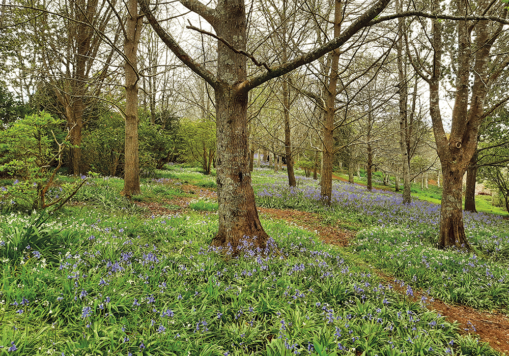
Roland's Wood
THE BLUEBELLS CREATE A ROMANTIC SCENE AT ROLAND’S WOOD

Roland’s Wood

Someone had told us about Roland’s Wood, famed for its springtime bluebells, so that was our first stop. The woods are on the outskirts of Kerikeri, about 3.5km from the town centre, along Kerikeri Inlet Road. Common in England, bluebell woods are rarer in New Zealand, but Roland Sansom was a man with a dream. After purchasing land from his uncle in 1985, Sansom worked on what had been a bare hillside, creating a wooded landscape of deciduous trees, mainly English beech, with masses of bluebells planted beneath them. Roland died in 2001, leaving ten acres of his woodland to the people of Kerikeri. Since his death, the wood has been cared for by a community group, Friends of Roland. 

The swathes of blue really are a sight to behold and we couldn’t help taking lots of photos. The wood is obviously popular, and there were quite a few others enjoying the bluebells when we visited. A group of elderly folk were enjoying morning tea at a picnic bench, while a preschooler clasped a few blooms in her hand as she wandered among the flowers. After strolling through the woodland we realised there were paths leading downhill past banks of clivia, so we headed in that direction. As well as the bluebells, we found bursts of bright colour from rhododendrons, camellias and magnolias. There were cherry blossoms, freesias and daffodils; a utopia of fresh colour. 

Roland's Wood
ROLAND’S WOOD IS AN EXPLOSION OF COLOUR

Rainbow Falls

Members of the NZMCA are lucky to have the park at Rainbow Falls on the north side of Kerikeri, across the bypass and along Waipapa Road. From here it’s a short drive or a one-hour walk through native bush to the Kerikeri Basin, now also known as Kororipo Heritage Park.

We opted for the walk, first stopping to admire the waterfall. Because of recent rain the river was in full flow and the resulting mists of spray created the rainbow effect that gives the Falls its name. Along the track – which follows the Kerikeri River – we admired the Fairy Pools, the Wharepuke Falls, some gnarly old puriri, tall tōtara and kauri, and checked out a historic hydro pumping station.
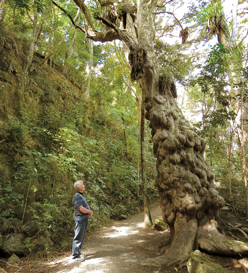

On the Kerikeri River Track
FACING NATURE’S BEAUTY ON THE KERIKERI RIVER TRACK

Kororipo Heritage Park

Where the river tumbles over rocks and enters the Kerikeri Inlet, there are a cluster of historic buildings and sites. New Zealand’s oldest building, Kemp Mission House, and the iconic Stone Store stand beneath St James Church and Kororipo Pā. The pā was the stronghold of Hongi Hika, the mission station’s protector.

Since the Kerikeri Basin was bypassed in 2008 and the road replaced by a footbridge, the area has become a calm oasis. We enjoyed coffee and cake in the Honey House Cafe, owned by Heritage New Zealand Pouhere Taonga. The cafe has views of Kemp House’s cottage garden, orchard and grapevines, and looks down onto the riverbanks where this season’s clutches of fluffy ducklings were charming onlookers. Past the wharf area you’ll find New Zealand’s oldest pear tree and a restaurant, the Plough and Feather. Tracks lead from here to Kororipo Pā, but we were bound for the other side of the basin.


Te Ahurea

Te Ahurea sits in one of the most significant historical sites in New Zealand for Māori and early European settlement. There has been a tourist attraction called Rewa’s Village on the north side of the Kerikeri Basin since the 1970s. Recently the land here has been returned to the Ngāti Rēhia iwi, and the rather tired and dated Rewa’s Village has made way for a new venture – Te Ahurea. 

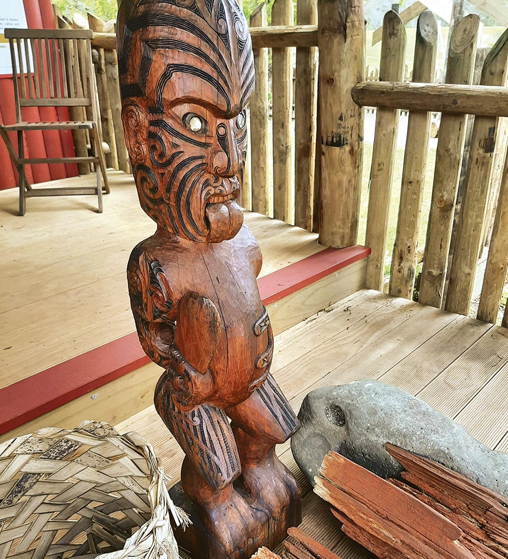
Beside the river we found a new canoe house, where a waka was being built. A path led up to a palisaded area with views across to heritage buildings and pā on the opposite side of the inlet. After paying for admittance we were given a short tour of the rooms that make up a small museum. There were artefacts here that have been found on Kororipo Pā and a taiaha (traditional Māori weapon) that had belonged to Tāreha, an important Ngāti Rēhia chief. Our guide told us that she was a descendant of Tāreha and lifted the taiaha down for us to examine.

Outside, we explored an area of reconstructed buildings, showing what a village would have been like in the time of Rewa, Hongi Hika and Tāreha, when the missionaries first arrived in 1814. There was a whare hui (meeting house) and several living quarters (whare noho). Down beside the river there was a waka tētē (fishing canoe) beside a new jetty. There are plans for waka tours soon; check the website (see ‘More Information’ box) for dates and times.

Whare at Te Ahurea
HISTORY ON SHOW AT TE AHUREA
Te Ahurea
ENTER TE AHUREA UNDER THIS WATCHFUL EYE
The Stone Store viewed from Te Ahurea
THE STONE STORE, VIEWED FROM TE AHUREA

Gardens

According to the Te Ahurea website, the name Kerikeri means ‘digging associated with gardening’. An early alternative name, Kirikiri, means ‘river gravel’. This was brought from the river and used on kūmara gardens. Either name is appropriate for the area, as it is a town based on horticulture. At Te Ahurea the gardens have been extensively planted, and administered by the Department of Conservation. Paths wind through the gardens and there are many information signs explaining the plants used by Māori: as food, medicine, or for use in building, among other uses.

Wharepuke

Up the hill past St James’ Church, we discovered the Wharepuke Subtropical Garden and Sculpture Trail. These are gardens of national significance and, although new to us, they were established in 1992 by Robin Booth, whose family have owned the property since 1938. It was originally a citrus and kiwifruit orchard and is reputedly the first land in New Zealand to be ploughed.

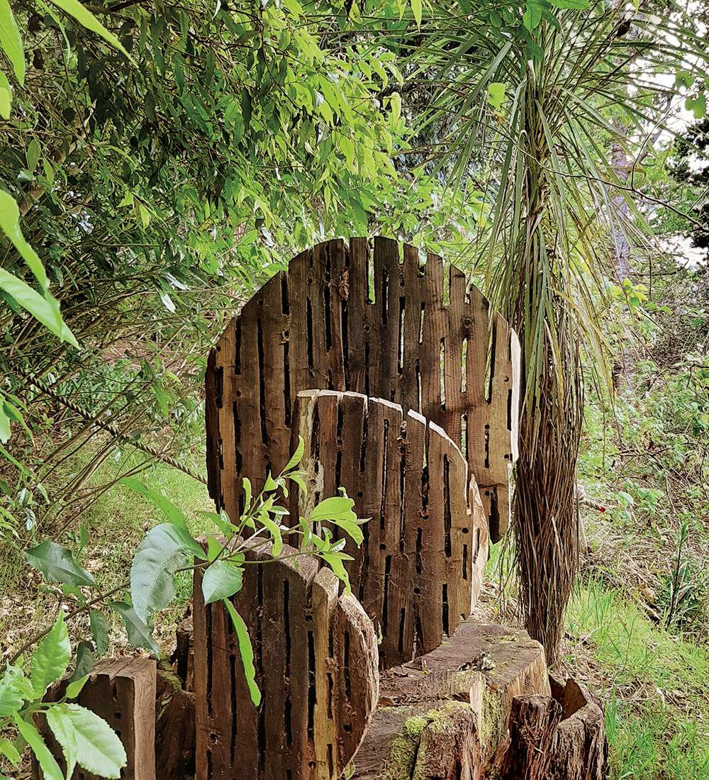
In contrast to both the practical beauty of Māori gardens at Te Ahurea and the English-style bluebell woods, the Wharepuke Garden has a collection of rare and unusual subtropical plants and trees. We followed the sculpture trail through these dramatic plantings, where there were more than 40 works on display among the foliage and flowers.

We are no strangers to Kerikeri, but this trip showed there are always new discoveries, even if we know the area well.
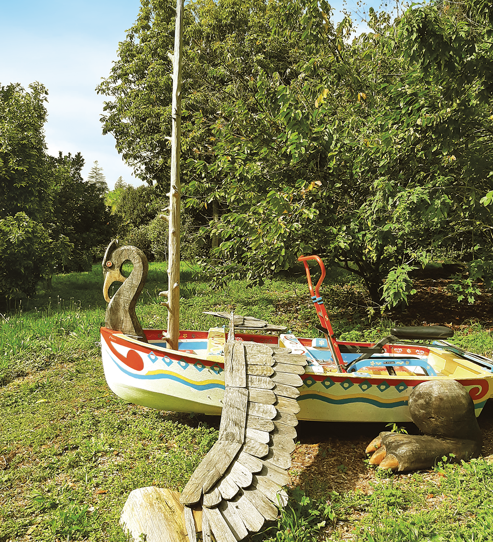
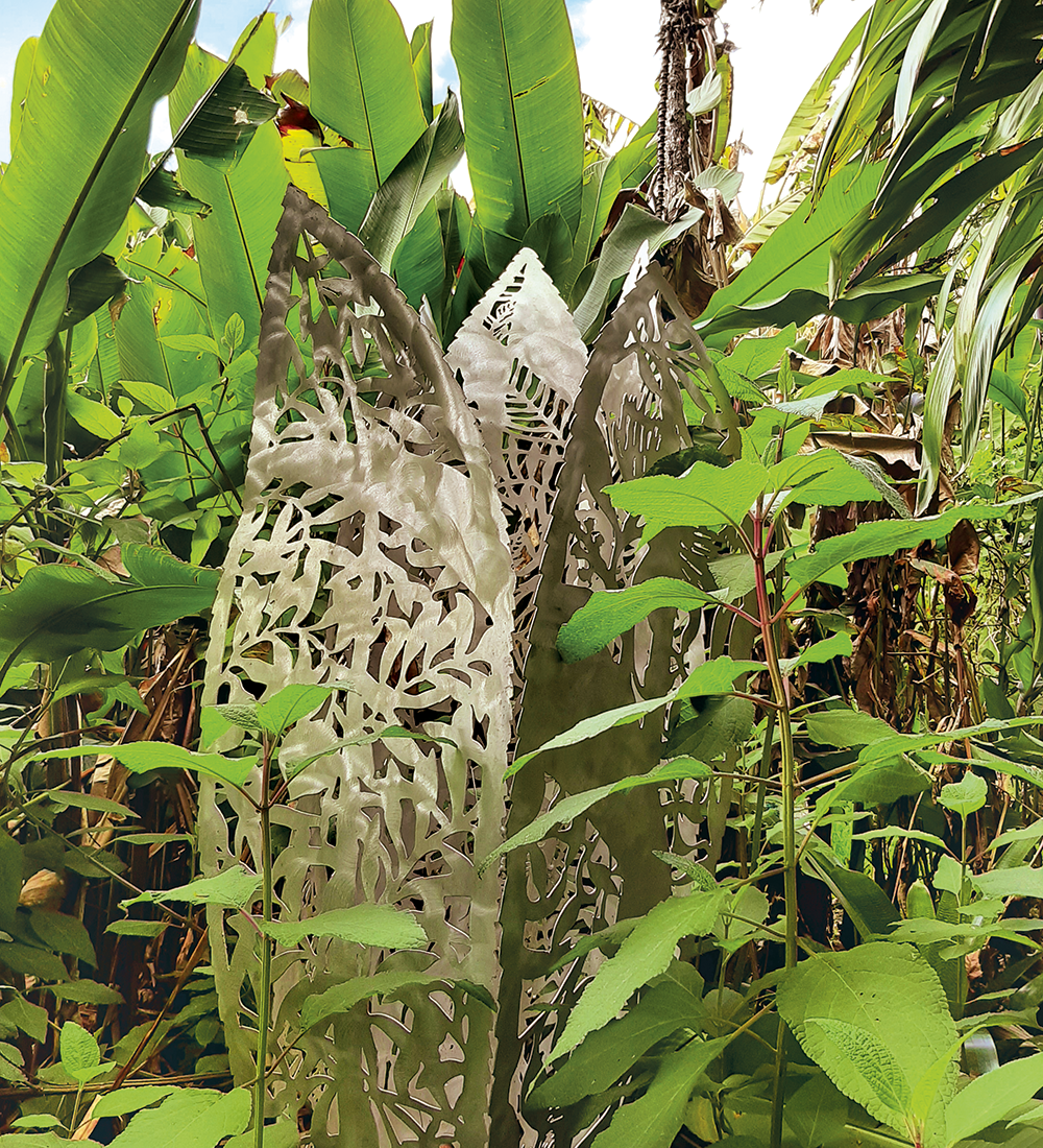
Sculpture at Wharepuke
ANYONE KEEN FOR A SAIL IN THIS SCULPTURE?
Sculpture at Wharepuke
SOME OF THE WHAREPUKE SCULPTURES CAN BE HARD TO FIND
Sculpture at Wharepuke
MAKE TIME FOR THE SCULPTURES AT WHAREPUKE

More Information

  • For those who haven’t visited the Kerikeri Basin before, the Kemp House Mission Station and the Stone Store are well worth exploring. Full details at: heritage.org.nz; also at: Kororipo.co.nz
  • Details about Te Ahurea can be found at: teahurea.co.nz
  • There is parking available on both sides of the river at the Kerikeri Basin but larger motorhomes should take the bypass and park on the north side where there is more space available.
  • Roland’s Wood is on Kerikeri Inlet Road, on the right hand side just after Blacks Road. There is a small parking area but there’s more parking on the roadside further along. Information about the wood: rolandswood.blogspot.com
  • The NZMCA Park is on Rainbow Falls Road. There are several holiday parks in the area.


Monday, 22 November 2021

Whangarei's Kiwi North

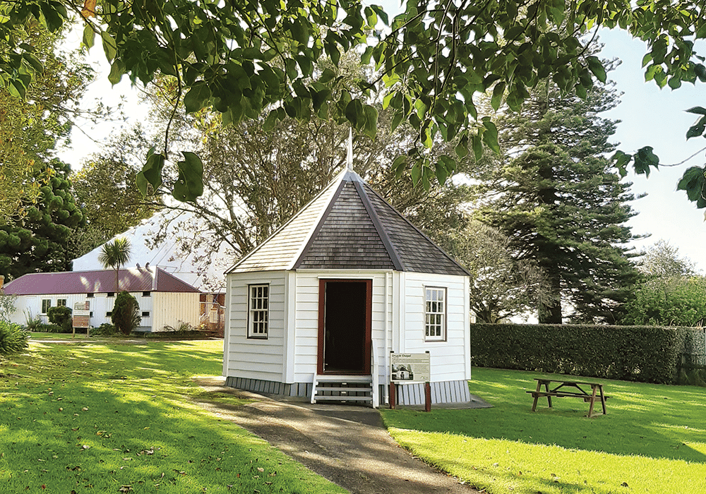
 Oruaiti Chapel, Kiwi North

Family Fun at Whangārei’s Kiwi North Museum & Heritage Park

Heather Whelan found there’s fun to be had for all ages at Whangārei’s Museum and Heritage Park, Kiwi North.

Just two hours north of Auckland lies Kiwi North, a 62-acre park that’s an excellent stop for travellers of all ages. Kiwi North’s mission is the preservation and conservation of natural and social history; if you’re an NZMCA member visiting Whangārei with littlies during the school holidays, or on the third Sunday of the month, you’ll be able to park up at a Park Over Property (POP) in the midst of the excitement of a live day.

If you’re more interested in a peaceful walk, then you can explore tracks in the 25 hectares of bush and farmland that make up the park. And if history is your thing then there’s plenty to discover in the museum and the nearby heritage buildings.

Kiwi and More

Kiwi North is home to Northland’s only nocturnal house. On our visit, we had visitors who were keen to see our national bird. Don’t be afraid to ask questions: Joey and Kevin at the reception desk have a wealth of knowledge and information about the kiwi, not only those in the kiwi house but also the ones that have been released into the adjacent Pukenui Forest. Before reaching the kiwi enclosure we spent a few minutes searching for different species of native gecko, cleverly camouflaged amongst sticks and twigs behind glass insets in the wall. There’s also a tuatara, who sat immobile and unblinking beside rocks, as his ancestors have been doing for the last 250 million years.

The kiwi house itself is kept in darkness during the day, so visitors can observe the birds in their nocturnal environment. When our eyes adjusted to the gloom we saw two kiwi foraging in their enclosure, using their long beaks like drills as they searched for food.

Moa and Muskets

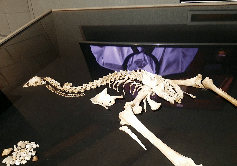
The Whangārei Museum is housed in the same building as the Kiwi House. Founded around 1890, there are over 80,000 items in its collection. We were fascinated to see skeletons of moa that had been discovered in a local cave, having lain there for more than 2000 years. There were also giant moa bones that had been found along the coast.

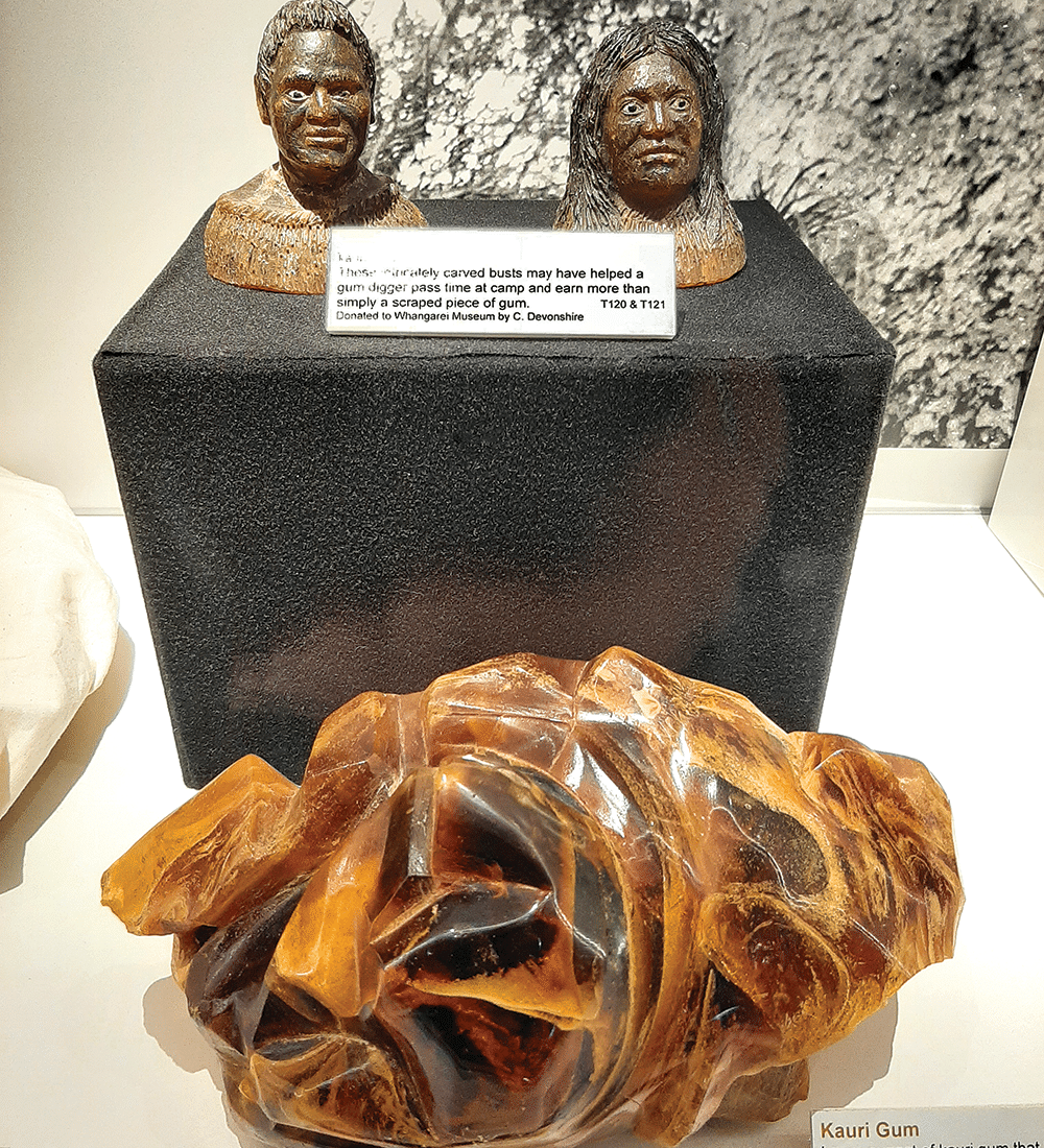
Nearby, two 300-year-old kauri waka were displayed. The larger canoe is a waka taua (war canoe) while the smaller one was made for river travel. There were also bone, stone and wooden artefacts, examples of Māori taonga. We were fascinated by displays related to gum digging, surveying and early settler life as well as military paraphernalia. We could have lingered longer but outdoor activities exerted their pull.

Kauri gum exhibits
KAURI GUM EXHIBITS
Moa skeleton in the museum
MOA SKELETON IN THE MUSEUM

Trains Big and Small

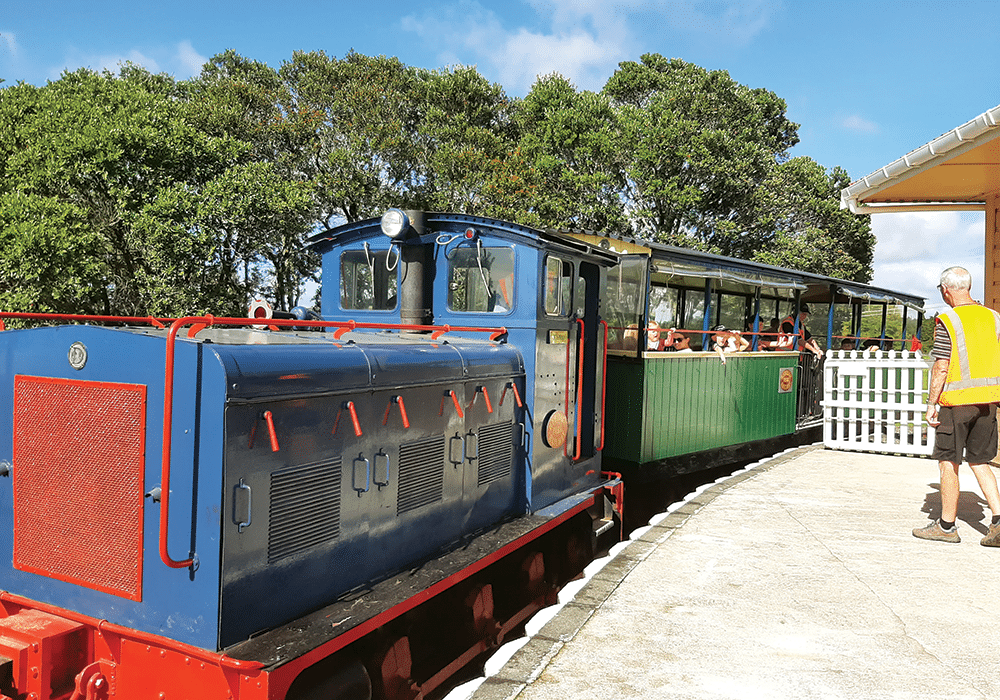
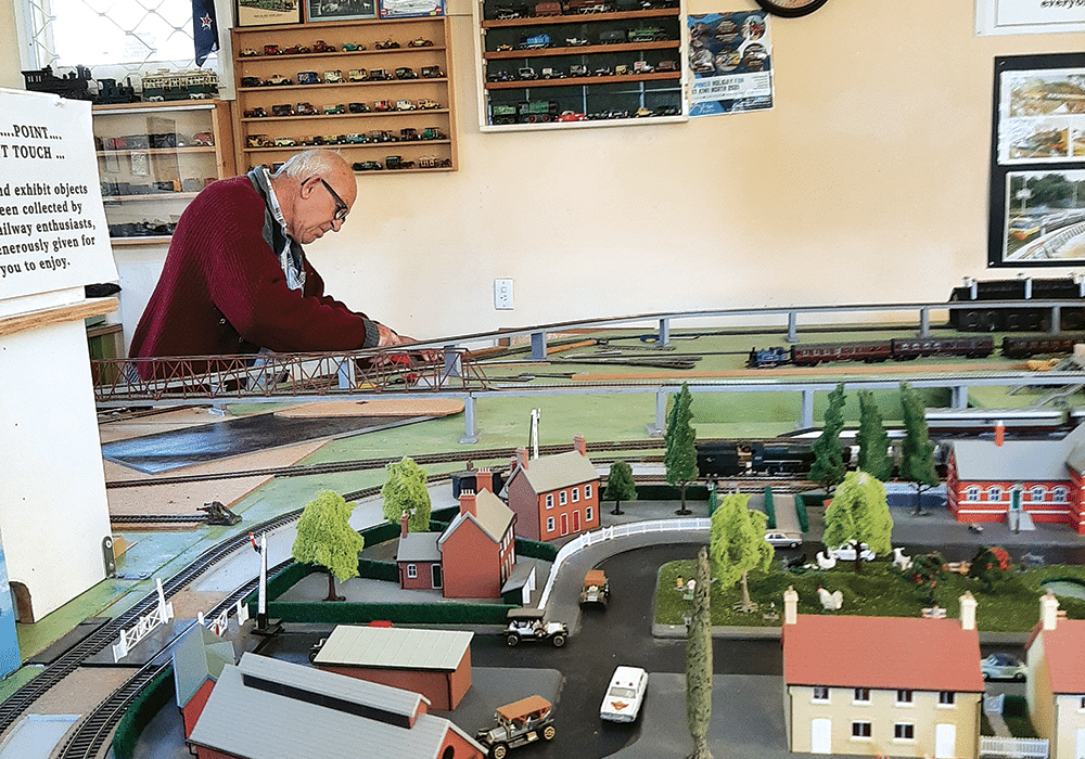
Kiwi North is a train lover’s paradise; there’s something about a train ride that appealed to the child in us, as well as the excited children that gathered at the station. The Whangārei Steam and Model Railway Club at Kiwi North, and operate trains on special live days and holidays. We bought a ticket for ‘Johnny’, a diesel train, and checked out the model railway housed in the station building while we waited.

Soon we were rattling along the tracks to Millington Bush station, at the end of the line. En route we passed the mini train, built by the Whangārei Model Engineering Club. 


Train rides at Kiwi North
TRAIN RIDES AT KIWI NORTH
A volunteer works on the model railway
A VOLUNTEER WORKS ON THE MODEL RAILWAY

Clubs Galore

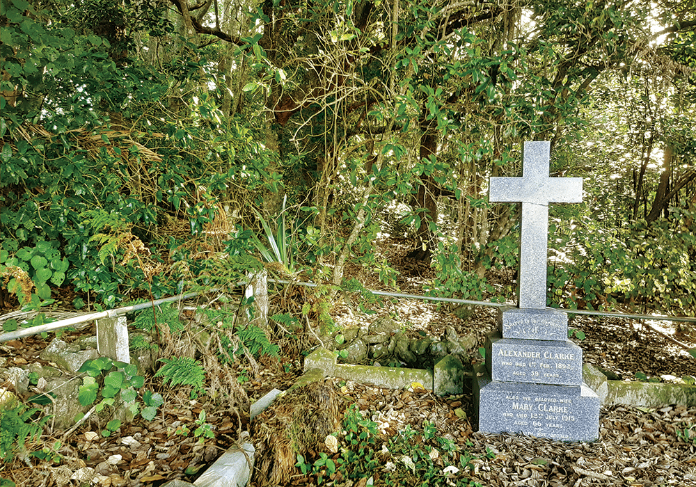
From Millington Bush Station we took a short bush walk that took us to the Clarke family graveyard. The Clarke family owned the property, and farmed it for almost 90 years, until its purchase by the museum in 1972. History buffs will enjoy visiting the colonial Glorat, the Clarke’s family homestead, built in 1885 by Dr Alexander Clarke, a Scots-born former ship’s doctor who brought his wife and three sons to New Zealand in 1884. Modifications can be seen where the homestead had been designed with a surgery, open on a Wednesday from 11am until noon for performing and inspecting vaccinations.

As we walked back beside the railway track we visited some of Kiwi North’s many clubs. At the Rock and Gemstone Club we found crystals for sale, while children worked on craft projects. The Vintage Machinery Club has an array of tractors and farm machinery. Other clubs include the Amateur Radio Club, the Vintage Car Club and the Northland Astronomical Society.

The Clarke family graveyard
THE CLARKE FAMILY GRAVEYARD
Vintage farm machinery
VINTAGE FARM MACHINERY

Built Heritage

Very little change was made to Glorat from the early 1900s to the 1970s, when it was taken over by the museum, making it a fascinating place to investigate. Glorat is currently closed for conservation, but Kiwi North’s excellent website has a link for a virtual tour. 

Scattered between the museum and Glorat you’ll find a unique collection of colonial buildings, illustrating Northland history from the 1850s. The Oruaiti Chapel dates from 1859 and is thought to be the smallest hexagonal chapel in New Zealand. It was built from a single kauri log, while the door lock was crafted from a piece of oak brought to New Zealand by a local settler. The pretty building is now used for weddings.

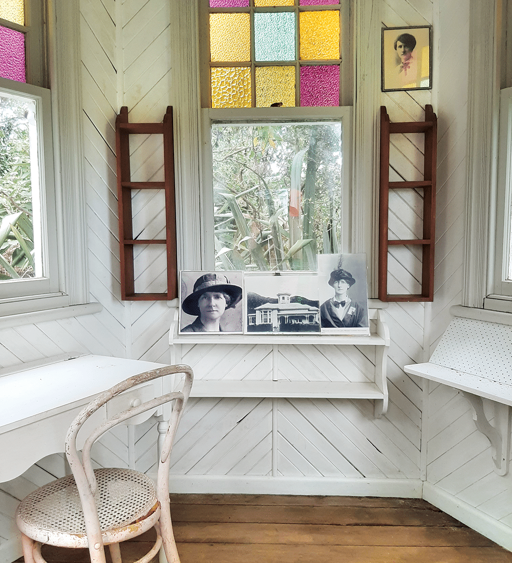
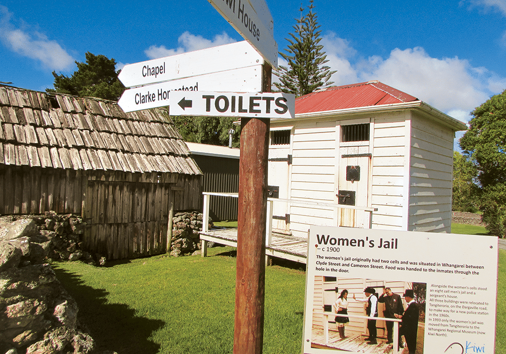
A similar little building nearby was once the turret of the Mander family villa. It was here that author Jane Mander wrote articles for her father Francis Mander’s newspaper, The Northern Advocate. Jane’s most famous novel, The Story of a New Zealand River, was published in 1920. The Whangārei Women’s Jail is another of Kiwi North’s little buildings. Around 1900 it stood in the centre of town, beside a larger men’s jail and the police sergeant’s house.

Children are fascinated by the school building, originally Riponui Pah School, built in 1898. Local students get to dress in period costumes and have a lesson as part of the educational experience provided for schools at Kiwi North. Another glimpse of life in days gone by is the Medical Museum, where visitors can admire (or cringe at) a collection of instruments and equipment.

Inside Jane Mander's study
INSIDE JANE MANDER’S STUDY
Security was different to nowadays at the women's jail
SECURITY WAS DIFFERENT TO NOWADAYS AT THE WOMEN’S JAIL

Bird Recovery Centre

Tucked away beside the museum is the Whangārei Native Bird Recovery Centre. Since its inception in 1991, the centre has cared for tens of thousands of injured birds, from kiwi to albatross. Founded by Robert and Robyn Webb, the centre is run by volunteers who care for the injured birds. 

The day we visited there were two kingfishers recovering from damaged wings, and a poor one-eyed tui, who will remain living at the centre as it will be unable to survive in the wild. This tui may live as long as a predecessor called Woof Woof, a  tūī who could talk as well as sing and who lived to be 16 years of age.

Beside the aviaries there is a kiwi recovery area and incubation unit. Chicks are raised here before being released into the wild. 

At the bird recovery centre
AT THE BIRD RECOVERY CENTRE
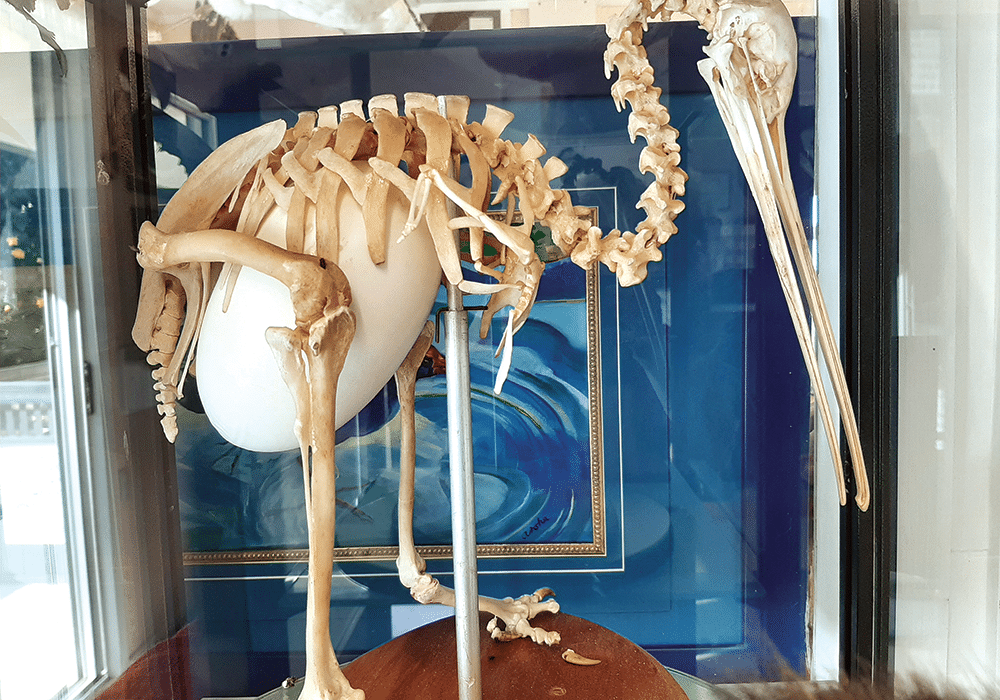
Kiwi skeleton and egg at the bird recovery centre
KIWI SKELETON AND EGG AT THE BIRD RECOVERY CENTRE

More Information

  • Kiwi North is at 500 State Highway 14, Maunu, Whangarei
  • NZMCA members can book a site at Kiwi North via the app or at reception. Maximum three nights stay. Free showers and toilet facilities. $5 off entry to the Museum and Kiwi House when staying overnight.
  • Useful websites: Kiwinorth.co.nznbr.org.nz

Friday, 8 October 2021

Winter on the Pohutukawa Coast


Winter on the Pōhutukawa Coast

Heather Whelan spends a few crisp days on a coastline graced with parks, beaches and a remarkable garden.

The Pōhutukawa Coast must look magical in summer when the cliff tops and beaches are bright with red blossoms; even in winter, my partner Malcolm and I were entranced by the lovely views. The area is south-east of Auckland city, about 20km from Manukau. Around Whitford it’s horse country, with stud farms and stables tucked into the rolling countryside. Settled by Europeans in 1843, the village retains a historical charm. What was once the general store, built in 1910, is now The Stables, a country pub and restaurant. We were tempted to stop, but daylight hours are short in winter and we wanted to explore nearby Ayrlies Gardens.

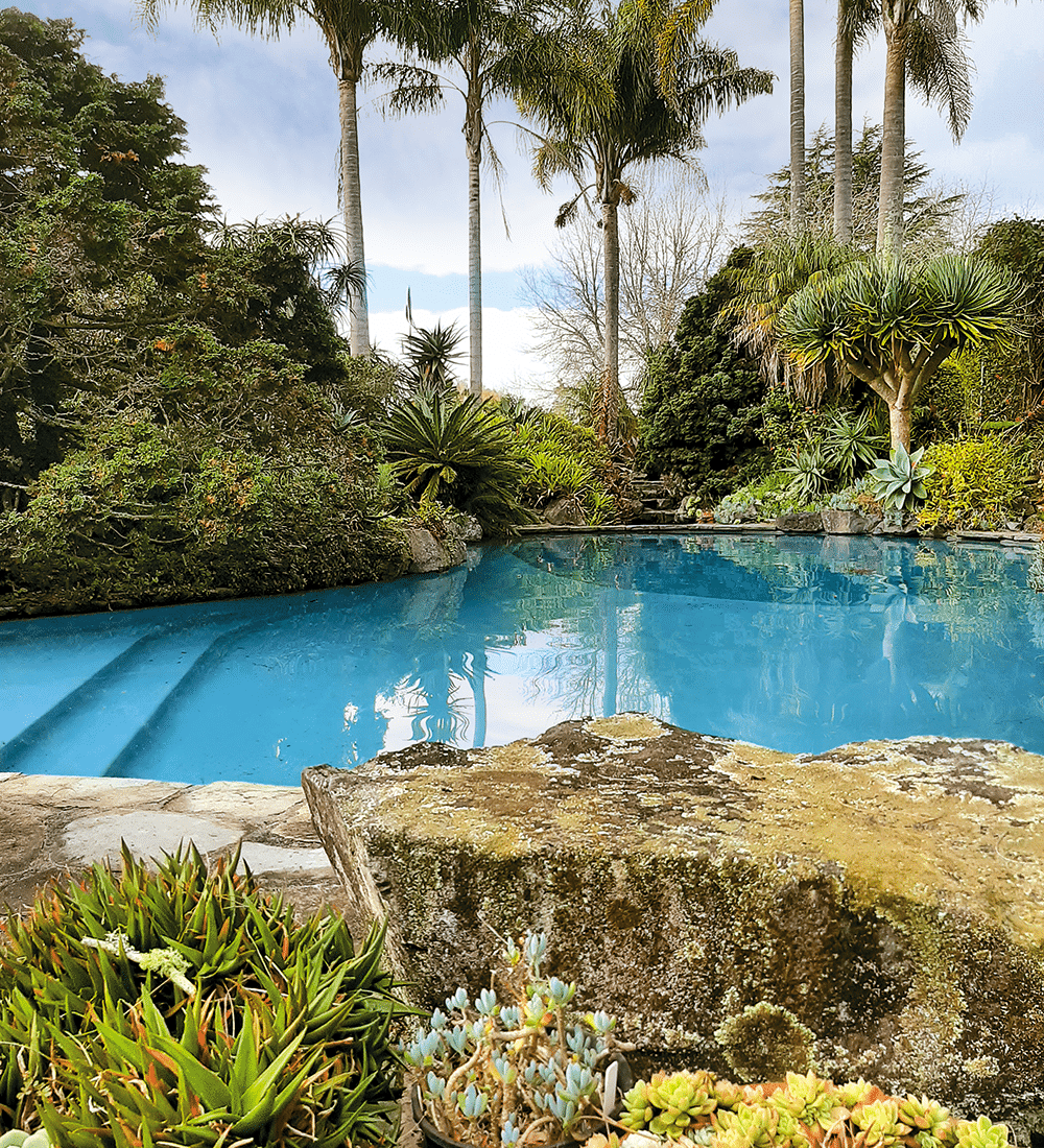
NZMCD Pool at Ayrlies Garden
THE POOL AT AYRLIES

Ayrlies garden

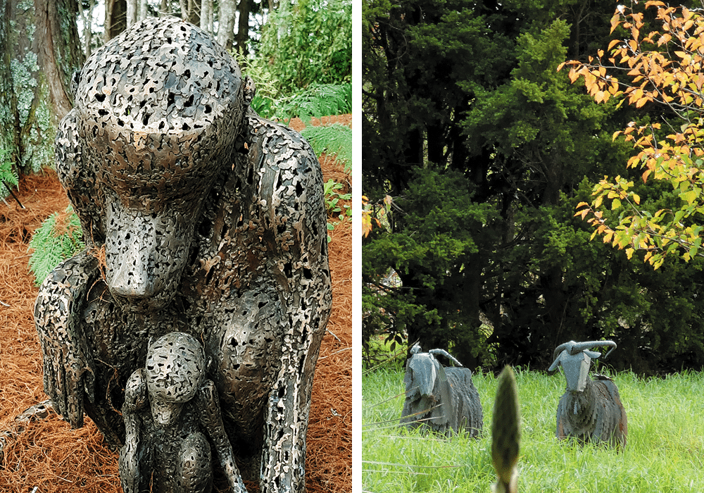
It’s hard to believe that in the 1960s, Ayrlies (named after the family farm in Scotland) was little more than a house in an empty paddock. Now the 4.8 hectares are a Garden of International  Significance, created by the owners, Beverley and the late Malcolm McConnell. Surrounding the house are lawns with mature trees, ponds, waterfalls, rockeries, walkways and steps, arbours and plantings in profusion. Areas of subtropical plantings are contrasted elsewhere by old roses, clematis and perennials. Around every corner we found a surprise. There were sculptures that ranged from classical Greek to corrugated iron goats. There were swathes of early daffodils beneath the trees in one corner, while rhododendrons splashed bright colours in another. We took a break in the ‘Sitooterie’, which we learned is a Scottish phrase for a place to ‘sit oot’ and relax in. From here we had views down to the wetlands that border the estuary.

Since the millennium, the swamp flats at Ayrlies have been transformed into wetlands, with man-made lakes and more than 15,000 native seedlings planted. We followed the Gingko Track and spent another hour on the pathways and boardwalks that circle one of the lakes. There was plenty of aquatic birdlife, the black swans in particular looking majestic as they drifted across the water.

It was the network of waterways and wetlands that led to Māori settling in the area; the Turanga Creek gave access as far as Whitford. Later European settlers followed the same route – there was a passenger boat service and mail delivery from Auckland from 1848 until 1927.

NZMCD Winter colour at Ayrlies Garden
ORCHIDS AND PLENTY OF WINTER COLOUR IN BLOOM AT AYRLIES GARDEN
NZMCD Ayrlies Garden
SCULPTURE AT AYRLIES (LEFT) AND VIEW FROM THE SITOOTERIE

Ōmana

Luckily for us, roads have taken the place of water travel and we could easily drive to our overnight destination, Ōmana Regional Park near Maraetai. The park’s name derives from the pā, O-Manawatere, where Manawatere settled after his arrival from Hawaiki. A mission station and farm were established in 1837, and Ōmana was worked until 1970 when Auckland Regional Council purchased the land. There’s 40 hectares of parkland to explore here, from mangrove mudflats and sandy beaches to regenerating forest and open grassy areas. We parked at the cliff-top campground, where gaps in the pōhutukawa trees gave us views across the Hauraki Gulf to Rangitoto Island. A walkway runs from Beachlands to Maraetai, and there are other walks within the park. We just wandered along the cliff tops at sunset, enjoying the view.

NZMCD Overnight parking at Omana
OVERNIGHT PARKING AT ŌMANA
NZMCD Ōmana sunset
ŌMANA SUNSET

Maraetai

Maraetai means ‘meeting place by the sea’, and it’s easy to see why people have been drawn to this beautiful area. Sandy Maraetai Beach, with views across to Waiheke and Ponui islands, was a great place to stop and admire the scene the following morning, before we continued on to another regional park, Duder, on the Whakakaiwhara Peninsula.


A walk through history

The peninsula has a long history, dating back to the arrival of the Tainui canoe in the 1300s. The peninsula and surrounding area was purchased by Thomas Duder in 1866, and the family farmed the land for the next 130 years until it was sold to Auckland Regional Council in 1994. The Duder family retained some property at Umupuia Beach, including the old homestead, ‘Rozel’, named after Jannette Duder’s childhood home in Guernsey. The residence was built after an accident with an explosive sent a large stump flying into the original cottage, destroying the dining room table. Mrs Duder, who had been inside the cottage, was placated by her husband offering to build a new home.

We walked the 4.3km Farm Loop Track, one of four walks at Duder. This took us steeply uphill and then through rolling farmland with great views of the Hauraki Gulf islands. Below us we could see sandy Umupuia Beach and the Duder homestead. As the Farm Track looped around, another track led to Whakakaiwhara Pā and the Tainui anchorage. The travellers from Hawaiki went ashore to gather food – hence the name Whakakaiwhara, which means to eat (kai) the edible bracts (whara) of the kiekie vine. We continued on our loop walk, looking across to where kauri was sent down the hillside to waiting ships at Malua Bay, and to the bird breeding areas of Duck Bay and the adjacent wetlands.

NZMCD Maraetai Beach
MARAETAI BEACH
NZMCD On the wetlands walk
ON THE WETLANDS WALK

Clevedon and beyond

From Duder the road took us inland to Clevedon, established in 1866 and named after the English town. Clevedon is noted for the farmer’s market it holds every Sunday. Unfortunately we passed through on a weekday, so will have to return to check that out. For future reference we decided to visit two other regional parks further along the road – Waitawa and Tāpapakanga. All these parks have overnight camping for self-contained motorhomes, and we have obviously only scratched the surface of what the area has to offer.

Waitawa is about 10 minutes’ drive from Clevedon. Like Ōmana and Duder, the park has a variety of walks and beaches. The area was once a testing site for explosives used in mining and construction. Ships carrying the explosives docked at the wharf at the end of the road, now a favourite spot for fishermen. 

NZMCD At Duder Regional Park
DUDER REGIONAL PARK
NZMC DPou at Tāpapakanga Regional Park
POU AT TĀPAPAKANGA REGIONAL PARK

Like Duder, Tāpapakanga Regional Park was once a farm, owned by a settler family. James Ashby settled at Tāpapakanga Bay in 1899, and he and his wife raised 14 children in the cottage that stands just up from the beach. In 1990 the family sold the land to Auckland Regional Council for the creation of the park.

There’s a pā site along the beach – Māori have a long history here. To celebrate this, two pou whenua are installed at the park entrance. Unusually, some of the carving on the pou depicts James Ashby holding an axe. Local Māori worked in partnership with Ashby, selling timber to Auckland.

We’re definitely going to have to spend more time on this stretch of coastline, hopefully in summer when the pōhutukawa are blossoming. 

NZMCD On the Farm Loop Track
ON THE FARM LOOP TRACK

VIEW FROM THE ASHBY COTTAGE AT TĀPAPAKANGA REGIONAL PARK

More Information