
The little rural town of Maungaturoto is known as ‘the heart of the Kaipara’. Heather Whelan took a drive along SH12 to the gateway to the stunning Kaipara district to find out more.
The Kaipara Harbour is one of the largest harbours in the world. Covering 947 square kilometres, it is connected to the Tasman Sea by an eight kilometre-wide passage, with several arms extending far inland. The estuaries of five rivers and many creeks and bays give the harbour a huge coastline.
The little town of Maungaturoto styles itself as the ‘heart of the Kaipara’; however that label could easily apply to the whole area that’s accessed along State Highway 12 from Brynderwyn to Dargaville. Maungaturoto is in the north-eastern part of the harbour, on the Otamatea River. With a population of just over 1000, it’s the largest town in this part of the Kaipara district. Maungatoroto is a hub for the rural communities that have developed on this rich agricultural land.
The villages of Paparoa, Matakohe and Ruawai are linked by the main road, while Pahi, Tinopai and Port Albert are found on peninsulas that jut into the Kaipara Harbour. Several of these settlements were established in the early 1860s by religious settlers known as Albertlanders, when the waterways were easier to navigate than the roadless swamps and bush-clad hills inland.
To the mountain and beyond
After turning west at Brynderwyn, we soon came to Maungaturoto. Founded in 1863, the town’s name means ‘mountain standing in the lagoons’ – an apt description, as much of the Kaipara region is low-lying but studded with extinct volcanic cones.
There are many tales told about the historic Maungaturoto Hotel. It was nearly lost at sea when the prefabricated sections were shipped from Onehunga by tug, barge and cattle punt. Bad weather and a drunken crew nearly spelled disaster, but the pub was finally constructed and has been accommodating guests for 120 years. Ghost sightings – a woman walking the hallway and a man behind the bar, together with wardrobe doors that open and close of their own accord, coupled with rattling coat hangers – led to paranormal investigators setting up video recorders to try and capture a sighting. Unfortunately the ghost hunters described their experience as ‘inconclusive’.
A second-hand shop across the road from the hotel was signposted from the turn onto SH12, so we pulled in for a look. This was a real Aladdin’s cave, with several rooms crammed with interesting collections ranging from furniture, crockery and glassware to dolls, paintings and old tin signs. We managed to leave without spending too much, but did pick up some useful-sized containers for storage in our bus. In the town centre we found several cafés to choose from; we can recommend Coast, housed in a renovated heritage building, where they served great coffee and fresh date scones.

A walk through history
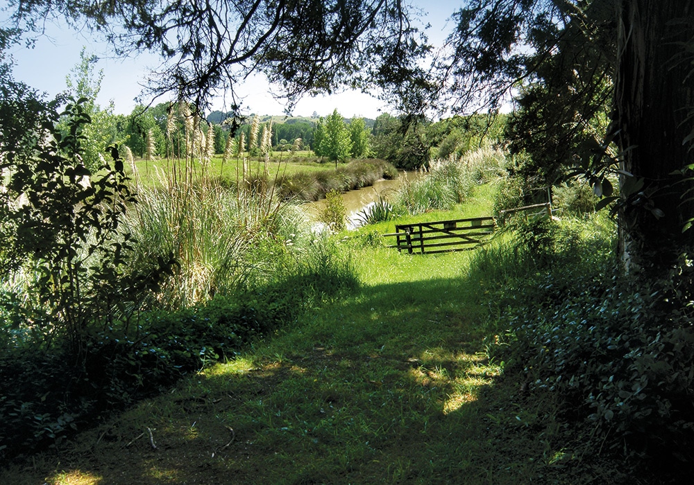
Our next stop was Paparoa, 12km from Maungaturoto.There’s a little river that reaches Paparoa and in the 1800s a steamer connected the town with Helensville, 66km away on the southern side of the harbour. The landing site, now a quiet village green area, was once a busy spot as kauri logs were delivered here before being rafted downriver to a sawmill at Pahi.
We crossed the river on a tiny footbridge as we wanted to visit an ancient pā site on the pleasant 45-minute Paparoa Bush Walk, established by the local Lions group. The walk first took us beside the peaceful river and we tried to imagine small boats and rafts of logs navigating their way down to Pahi, 7km down the adjacent peninsula. After crossing another stream, the track took us quite steeply up, through some bush-covered slopes, to the pā. This bush is over 250 years old, the inhabitants of the extensive pā having mysteriously left long before European settlers arrived. From the pā the track continues through farmland, then along a boardwalk before finishing at the road on the other side of Paparoa.
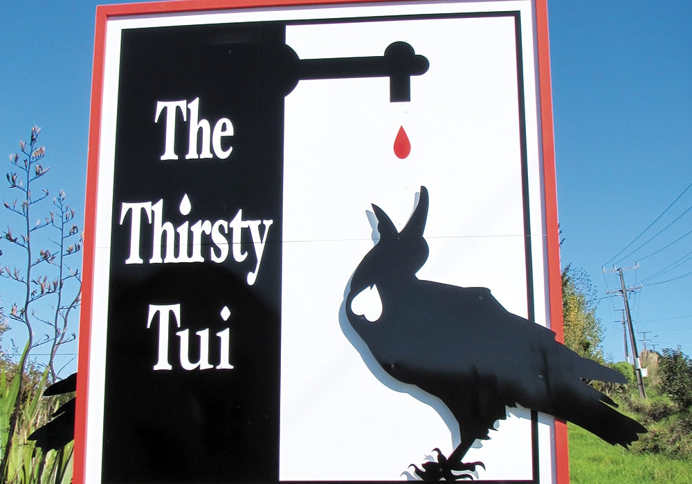
Needing a cold drink after our walk we headed to the Thirsty Tui, Paparoa’s retro-style pub. We had lunch in the garden area, watched over by sparrows roosting in a nesting box crafted to look like a mini replica of the pub. There’s accommodation available at the Thirsty Tui and motorhomes can park overnight. However, we were headed for what our map book called the ‘seaside resort’ of Tinopai.
Camping by the beach
Tinopai is at the very end of a peninsula, about 20km from Matakohe. There’s an amazing museum at Matakohe with free overnight parking and discounted entry for NZMCA members. If you haven’t visited before, it really is a must-see, with displays of everything kauri – from the world’s largest collection of kauri gum, to antique furniture and huge logs. There’s a steam sawmill, fascinating displays of logging and gum-digging and even a two-storey life-sized replica boarding house. It’s worth spending several hours at the museum so overnight parking might come in useful.
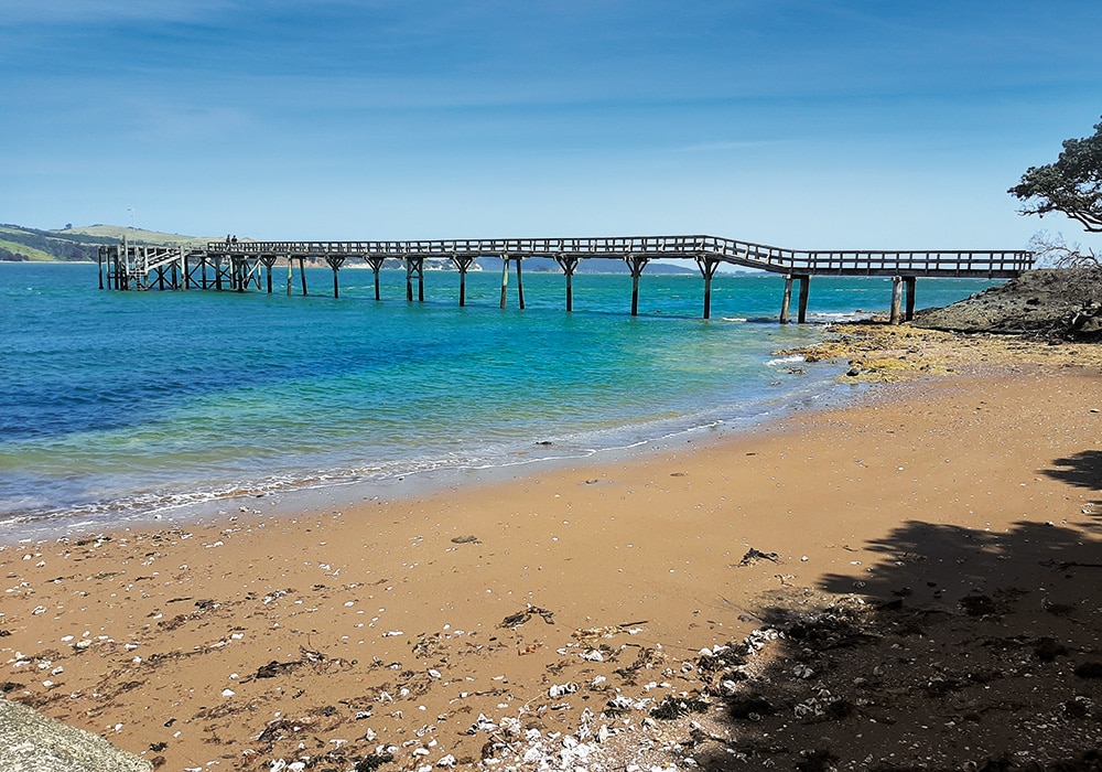
Tinopai was originally called Te Komiti and was a regular stopping point for Māori travellers. It was renamed Tinopai Fruitlands in 1918 when the area was planted with apple trees and a wharf was built to export the fruit. The apple growing finished in the 1930s, but the wharf remains, now a popular fishing spot.
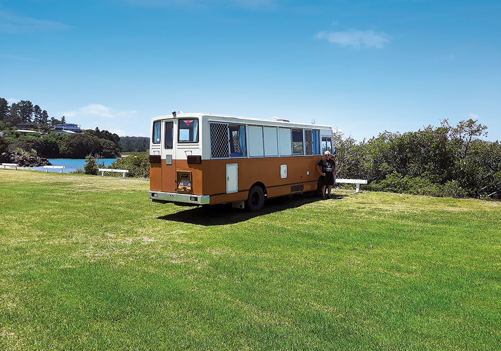
There is a lovely old-school style campground on the waterfront at Tinopai and we parked a stone’s throw from the beach. The campground is popular in summer, and beautiful year-round; what a spot. We wandered along the shore, meeting a local on the wharf who couldn’t have spoken more highly about the fantastic fishing in the waters off Tinopai. He’d just come back from a day’s fishing with a haul of snapper. Later, as the tide went out, we watched shellfish gatherers collecting oysters and mussels.
A productive cycle
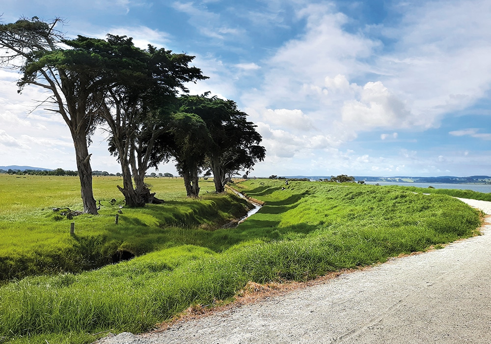
The following day we made our way back to SH12 and into Ruawai. This town (the name means ‘two waters’) is situated where the Wairoa River meets the Kaipara Harbour. The area used to be very watery; swamp was extensive here until a stopbank was built in 1905 and the area drained. The land is now very productive and Ruawai is known as the kūmara capital of New Zealand.
The stopbank was the town’s first road and is now a walking and cycle trail, developed in 2018 by the Ruawai walkway-cycle track group. After walking along the stopbank for a while we decided to return later and cycle the 3km loop.
Six of us met at Ruawai the next week and, after a coffee in the township, we set off on our bikes along the stopbank. There were several information boards which had early photographs, giving us an insight into Ruawai’s early days and the draining of the land. The workmen who dug the stopbank had to be strong enough to throw shovels full of wet mud twelve feet, so they must have been a hardy breed. The land is below the level of the harbour’s high tide, so the drainage canals through the stopbank can only empty out when the water level is low.
Our ride continued at the end of the stopbank, along quiet country roads back into Ruawai. It was a pleasant hour’s cycle ride and would take about three hours to walk.
Top of the peak
Driving north from Ruawai it’s impossible to miss Tokatoka Peak. From most angles it looks like a perfect cone and is a distinctive landmark. There are many stories about this extraordinary mountain that looks like it belongs in a fantasy movie – it is in fact the plug of an ancient volcano, a very rare phenomenon. Māori tell how Tokatoka came from Hawaiki along with some other mountains. Manaia went ahead and came to rest beside Whangarei Harbour. The Wairoa River proved to be dangerous and one mountain drowned, so Tokatoka and nearby Maungaraho decided to halt their journey right there.
Having previously climbed to the summit of Maungaraho Rock, this time we decided to check out the views from the summit of Tokatoka. After turning up a steep road beside the Tokatoka Tavern we found a small parking space beside a sign indicating the start of the walk. From here it was a twenty minute walk to the summit, mainly up a steep unformed track. The final 20m section was a scramble up rocks and I realised the significance of the name Tokatoka: ‘rocks upon rocks’.
Once at the summit we were rewarded by some outstanding 360˚ views. We could look along the river to Dargaville and Maunganui Bluff in the north, while past Maungaraho Rock the Tangihua Range was a shadowy purple. All around was lush farmland interspersed with pockets
of native bush.

Riding the rails
Dargaville was the final stop on our Kaipara tiki tour, and it was easy to set up for the night at the NZMCA park in town. Dargaville was founded in 1872 and prospered initially due to the timber trade and kauri gum digging. The town is still thriving, with plenty of shops and cafés as it’s the commercial centre for the region’s dairy, beef and sheep farming industry. It’s also, like Ruawai, a kūmara growing area.
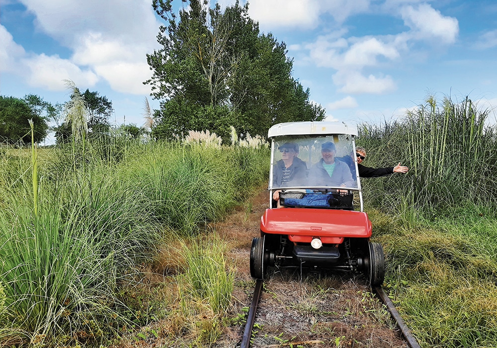
One of Dargaville’s quirkiest attractions can be found at the old railway station. Dargaville Rail Tours takes visitors along a disused railway line in golf carts.There are two trips to choose from and we opted for the two-hour return ride to Tangowahine. Our guides were two bearded locals who led the way out of Dargaville, checking the road crossings were safe. We stopped at a couple of places to learn a bit more of the history; we soon discovered that there had been a station platform built beside the original Dargaville racecourse, but it was never used because the locals objected to the proposed route of the railway; it had to loop away from the main road, leaving the platform abandoned in a paddock. Another spot was where the railway line used to branch north to Donnellys Crossing, now an overgrown piece of history.
After travelling through farmland and beside the Wairoa River to Tangowahine, where the carts are turned around for the return journey back to Dargaville, we were treated to homemade scones and jam with coffee and tea, before getting back into the golf carts.
This trip was a lot of fun and was typical of the area: low-key and authentic. It was a real taste of the Kaipara heartland. We’d visited a variety of rural towns and villages and seen the area’s rich history, from pā sites to colonial architecture, eaten great food in its cafes and pubs – and made sure we had a bag of kūmara to take home.
Further Information
- Information about the campground at Tinopai can be found at: camptinopai.co.nz. There are also motor camps at Pahi, Matakohe and Paparoa.
- The walk at Paparoa takes about 45 minutes. Return the same way or continue to the mangrove boardwalk and road. Details at: qeiinationaltrust.org.nz
- The stopbank at Ruawai is 4km in length. You can make a loop by returning along Simpson Road. This takes an hour to cycle and around three hours to walk.
- Details of the walk up to the Summit of Tokatoka Peak are at: doc.govt.nz
- It’s advisable to book the rail carts in advance. Their website is: portdargavillecruises.co.nz/rail-tours

.jpg)

.jpg)


.jpg)

