Showing posts with label travel. Show all posts

Monday, 22 November 2021

Whangarei's Kiwi North

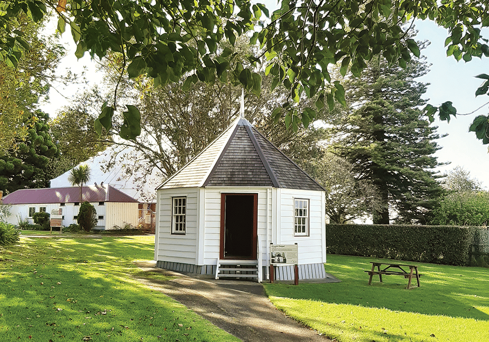
 Oruaiti Chapel, Kiwi North

Family Fun at Whangārei’s Kiwi North Museum & Heritage Park

Heather Whelan found there’s fun to be had for all ages at Whangārei’s Museum and Heritage Park, Kiwi North.

Just two hours north of Auckland lies Kiwi North, a 62-acre park that’s an excellent stop for travellers of all ages. Kiwi North’s mission is the preservation and conservation of natural and social history; if you’re an NZMCA member visiting Whangārei with littlies during the school holidays, or on the third Sunday of the month, you’ll be able to park up at a Park Over Property (POP) in the midst of the excitement of a live day.

If you’re more interested in a peaceful walk, then you can explore tracks in the 25 hectares of bush and farmland that make up the park. And if history is your thing then there’s plenty to discover in the museum and the nearby heritage buildings.

Kiwi and More

Kiwi North is home to Northland’s only nocturnal house. On our visit, we had visitors who were keen to see our national bird. Don’t be afraid to ask questions: Joey and Kevin at the reception desk have a wealth of knowledge and information about the kiwi, not only those in the kiwi house but also the ones that have been released into the adjacent Pukenui Forest. Before reaching the kiwi enclosure we spent a few minutes searching for different species of native gecko, cleverly camouflaged amongst sticks and twigs behind glass insets in the wall. There’s also a tuatara, who sat immobile and unblinking beside rocks, as his ancestors have been doing for the last 250 million years.

The kiwi house itself is kept in darkness during the day, so visitors can observe the birds in their nocturnal environment. When our eyes adjusted to the gloom we saw two kiwi foraging in their enclosure, using their long beaks like drills as they searched for food.

Moa and Muskets

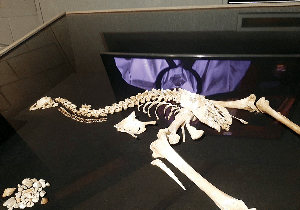
The Whangārei Museum is housed in the same building as the Kiwi House. Founded around 1890, there are over 80,000 items in its collection. We were fascinated to see skeletons of moa that had been discovered in a local cave, having lain there for more than 2000 years. There were also giant moa bones that had been found along the coast.

Nearby, two 300-year-old kauri waka were displayed. The larger canoe is a waka taua (war canoe) while the smaller one was made for river travel. There were also bone, stone and wooden artefacts, examples of Māori taonga. We were fascinated by displays related to gum digging, surveying and early settler life as well as military paraphernalia. We could have lingered longer but outdoor activities exerted their pull.
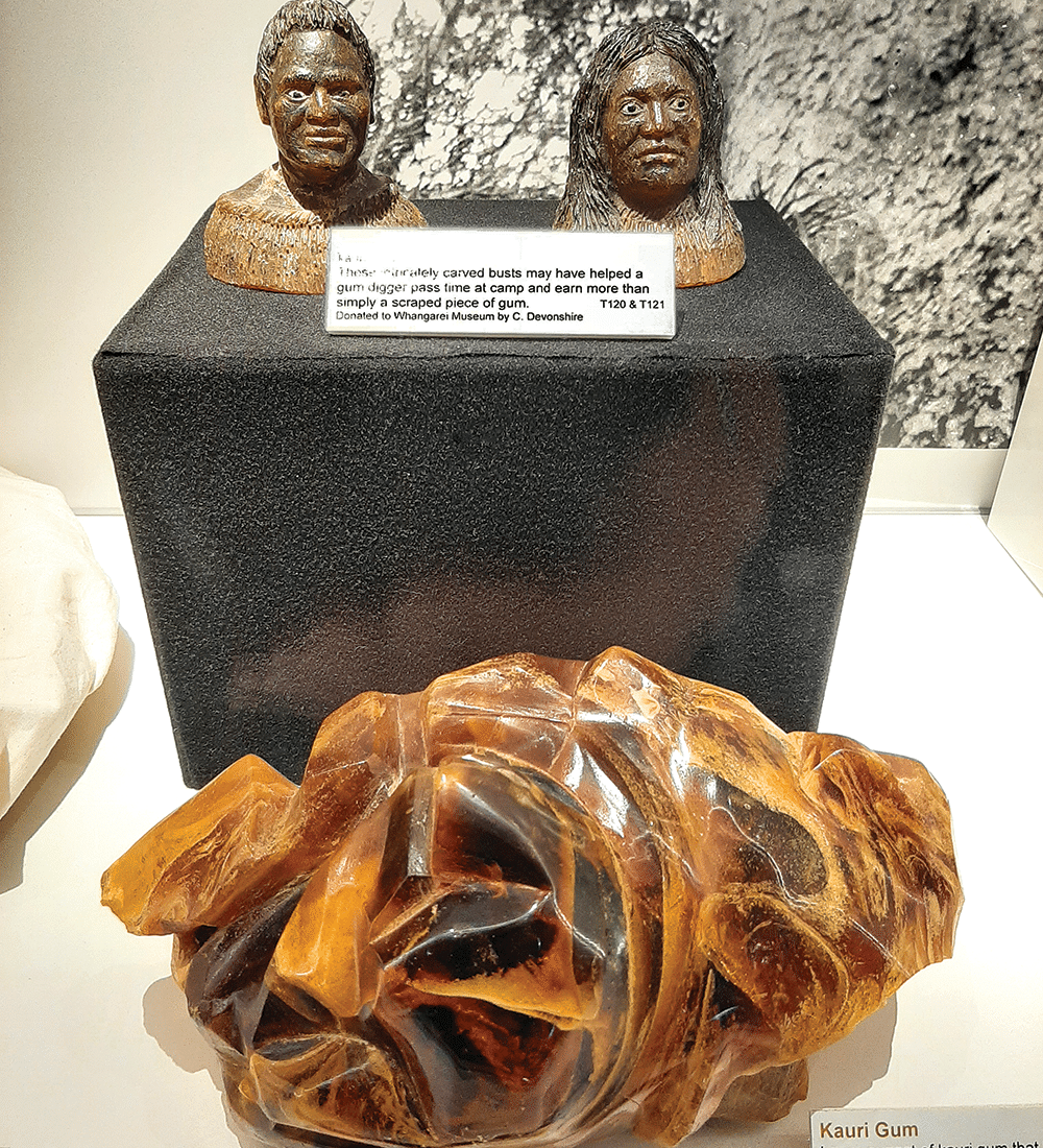
Kauri gum exhibits
KAURI GUM EXHIBITS
Moa skeleton in the museum
MOA SKELETON IN THE MUSEUM

Trains Big and Small

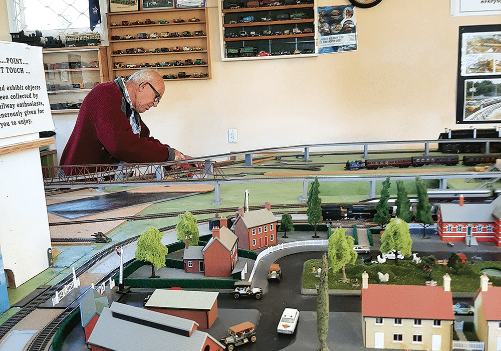
Kiwi North is a train lover’s paradise; there’s something about a train ride that appealed to the child in us, as well as the excited children that gathered at the station. The Whangārei Steam and Model Railway Club at Kiwi North, and operate trains on special live days and holidays. We bought a ticket for ‘Johnny’, a diesel train, and checked out the model railway housed in the station building while we waited.

Soon we were rattling along the tracks to Millington Bush station, at the end of the line. En route we passed the mini train, built by the Whangārei Model Engineering Club. 
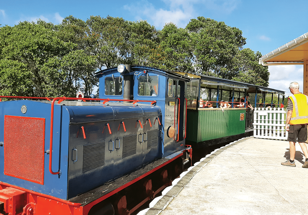

Train rides at Kiwi North
TRAIN RIDES AT KIWI NORTH
A volunteer works on the model railway
A VOLUNTEER WORKS ON THE MODEL RAILWAY

Clubs Galore

From Millington Bush Station we took a short bush walk that took us to the Clarke family graveyard. The Clarke family owned the property, and farmed it for almost 90 years, until its purchase by the museum in 1972. History buffs will enjoy visiting the colonial Glorat, the Clarke’s family homestead, built in 1885 by Dr Alexander Clarke, a Scots-born former ship’s doctor who brought his wife and three sons to New Zealand in 1884. Modifications can be seen where the homestead had been designed with a surgery, open on a Wednesday from 11am until noon for performing and inspecting vaccinations.

As we walked back beside the railway track we visited some of Kiwi North’s many clubs. At the Rock and Gemstone Club we found crystals for sale, while children worked on craft projects. The Vintage Machinery Club has an array of tractors and farm machinery. Other clubs include the Amateur Radio Club, the Vintage Car Club and the Northland Astronomical Society.
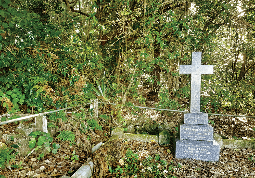
The Clarke family graveyard
THE CLARKE FAMILY GRAVEYARD
Vintage farm machinery
VINTAGE FARM MACHINERY

Built Heritage

Very little change was made to Glorat from the early 1900s to the 1970s, when it was taken over by the museum, making it a fascinating place to investigate. Glorat is currently closed for conservation, but Kiwi North’s excellent website has a link for a virtual tour. 

Scattered between the museum and Glorat you’ll find a unique collection of colonial buildings, illustrating Northland history from the 1850s. The Oruaiti Chapel dates from 1859 and is thought to be the smallest hexagonal chapel in New Zealand. It was built from a single kauri log, while the door lock was crafted from a piece of oak brought to New Zealand by a local settler. The pretty building is now used for weddings.

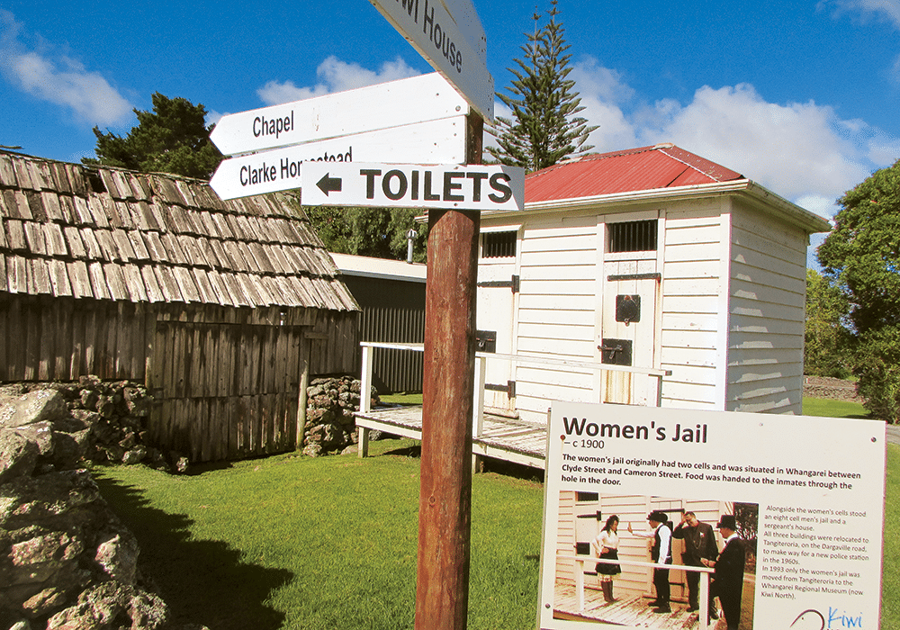
A similar little building nearby was once the turret of the Mander family villa. It was here that author Jane Mander wrote articles for her father Francis Mander’s newspaper, The Northern Advocate. Jane’s most famous novel, The Story of a New Zealand River, was published in 1920. The Whangārei Women’s Jail is another of Kiwi North’s little buildings. Around 1900 it stood in the centre of town, beside a larger men’s jail and the police sergeant’s house.

Children are fascinated by the school building, originally Riponui Pah School, built in 1898. Local students get to dress in period costumes and have a lesson as part of the educational experience provided for schools at Kiwi North. Another glimpse of life in days gone by is the Medical Museum, where visitors can admire (or cringe at) a collection of instruments and equipment.
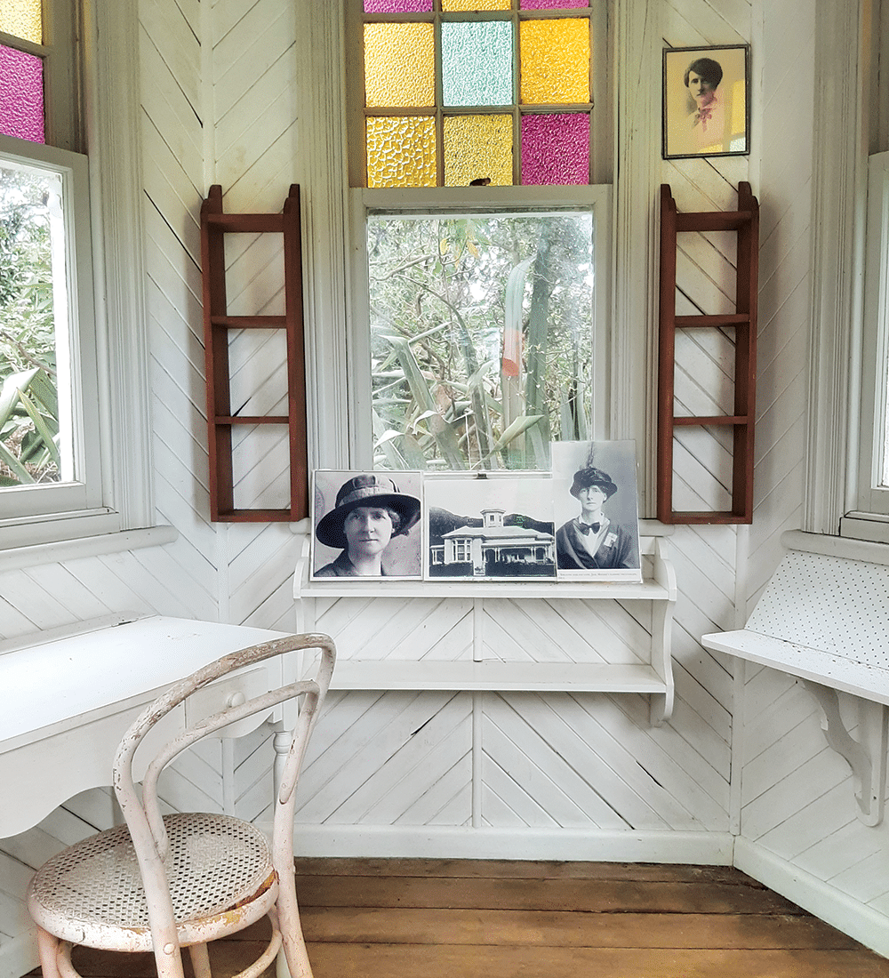
Inside Jane Mander's study
INSIDE JANE MANDER’S STUDY
Security was different to nowadays at the women's jail
SECURITY WAS DIFFERENT TO NOWADAYS AT THE WOMEN’S JAIL

Bird Recovery Centre

Tucked away beside the museum is the Whangārei Native Bird Recovery Centre. Since its inception in 1991, the centre has cared for tens of thousands of injured birds, from kiwi to albatross. Founded by Robert and Robyn Webb, the centre is run by volunteers who care for the injured birds. 

The day we visited there were two kingfishers recovering from damaged wings, and a poor one-eyed tui, who will remain living at the centre as it will be unable to survive in the wild. This tui may live as long as a predecessor called Woof Woof, a  tūī who could talk as well as sing and who lived to be 16 years of age.

Beside the aviaries there is a kiwi recovery area and incubation unit. Chicks are raised here before being released into the wild. 

At the bird recovery centre
AT THE BIRD RECOVERY CENTRE
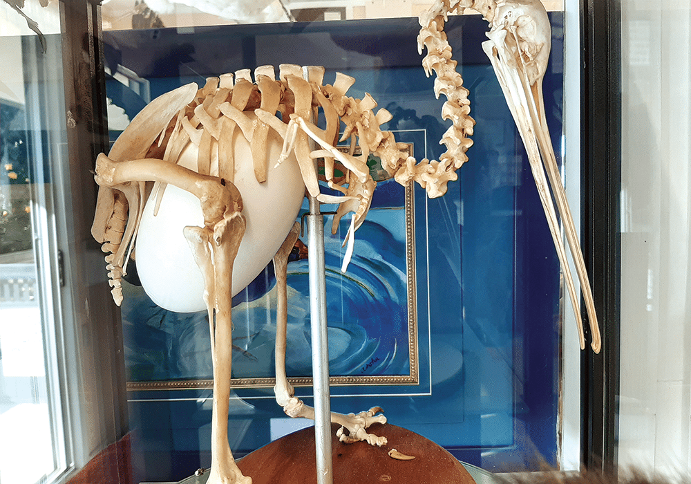
Kiwi skeleton and egg at the bird recovery centre
KIWI SKELETON AND EGG AT THE BIRD RECOVERY CENTRE

More Information

  • Kiwi North is at 500 State Highway 14, Maunu, Whangarei
  • NZMCA members can book a site at Kiwi North via the app or at reception. Maximum three nights stay. Free showers and toilet facilities. $5 off entry to the Museum and Kiwi House when staying overnight.
  • Useful websites: Kiwinorth.co.nznbr.org.nz

Friday, 5 March 2021

Hidden Treasures: Kai Iwi to Pouto

 Heather Whelan and partner Malcolm discover some peaceful and picturesque spots near Dargaville

Whelan_23 Shipwreck remains at Pouto.jpg
Shipwreck remains at Pouto

The weather was forecast to be good for a few days, so we stocked up our bus and headed west from Whangarei – first stop the Kai Iwi Lakes. These rain-fed, freshwater lakes are part of a 538-hectare recreational reserve, 35km north-west of Dargaville, and are popular with campers, fishermen and those who enjoy water sports.

There are two campgrounds on the shores of Lake Taharoa, the largest of the Kai Iwi Lakes. One is called Pine Beach – though the pines have been removed in recent years – and the other is at Promenade Point. We didn’t plan to stay overnight, so parked overlooking Marina Bay and set off to walk around the lake. There are tracks around all three of the lakes, and side paths lead to Lake Waikare and Lake Kai Iwi from the Lake Taharoa track. On a hot afternoon we thought the 8km loop would give us enough exercise, so stuck to the main track.

We started our stroll at the boat ramp, where a group were launching jet skis. Visitors can enjoy a whole range of water activities on Lake Taharoa and Lake Waikare, including waka ama, kayaking, sailing, windsurfing, water skiing, fishing and swimming. However, motorised craft are not allowed on Lake Kai Iwi.

Whelan_1 Lake Taharoa, Kai Iwi Lakes.jpg
Lake Taharoa, Kai Iwi Lakes

Lake Taharoa is New Zealand’s third largest dune lake and the country’s deepest. The lakes were formed 1.8 million years ago when rain fell in depressions of sand that had impermeable ironstone pans beneath them. There are no inlets or outlets so the depth in the lakes can vary, as can the water temperature; extremes range from 12C to 21C.

Kai Iwi Lakes have unique biodiversity and are home to many native species, some endangered. Bird life includes the North Island brown kiwi, white-faced heron, paradise shelduck, grey teal and the Australasian bittern. Rainbow trout were introduced in the 1960s.

Kai Iwi means ‘food for the people’ and early Maori settlers in the area enjoyed catching fish and eels in the lakes. During times of war, injured warriors recuperated at the lakeside. Later kauri gum diggers built huts in the area, however this industry died out in the 1920s, leaving little trace.

There were plenty of campers at Pine Beach, enjoying the shallow waters fronting the campground, the children’s playground, and generally relaxing. One family were unloading bikes as the loop tracks are suitable for cycling as well as walking.

Our path continued beside crystal-clear water and golden sandy beaches, giving the lake a tropical look. There were few walkers on the track as we passed the aptly named Sandy Bay and continued past Deep Water Cove to the strangely named Sin Bin area and on to Promenade Point. The campground here has fewer facilities than Pine Beach and is described as a relaxed kiwiana experience.

We arrived back at our bus after taking just over two hours to walk the Lake Taharoa loop. We stayed for a while longer, and then headed into Dargaville.

Whelan_7 Sunset at the Dargaville NZMCA Park.jpg
Sunset at the Dargaville NZMCA Park

HISTORIC DARGAVILLE

We always enjoy staying at the NZMCA Park, which is situated picturesquely at the junction of the Kaihu and Wairoa rivers. We spent happy hour – actually close to two hours – chatting with other motorhomers in one of the historic boatsheds that once belonged to Thompson Boat Builders.

Whelan_8 The NZMCA Park beside the Kaihu River.jpg
The NZMCA Park beside the Kaihu River

Swedish-born Erik Thompson was the first of three generations of boat builders to produce craft here. Hundreds of launches, sailing boats and whalers were constructed from kauri over the years, the most famous being the whaleboats constructed for Ernest Shackleton’s 1907-1909 Antarctic expedition. Full-scale drawings of these were discovered sketched out in pencil on the boatshed’s loft floor.

Earlier we’d strolled along Dargaville’s waterfront from the band rotunda, past the Boating Club and through the Riverside Gardens. Prominent at the junction of Parenga Street and Hokianga Road is a statue erected as a tribute to the area’s early gum diggers, who came mainly from Dalmatia (now Croatia).

Whelan_9 Statue commemorating gum diggers.jpg
Dargaville honours the memory of its gum diggers

There’s a brochure available at the information centre that details a 5km walking trail around Dargaville’s historic buildings. We just looked at some of the sites, including the ‘petticoat houses’, six identical cottages built for workers at the Dairy Company. They were built with fireplaces but you had to pay extra for a chimney!

Whelan_5 View of Lake Taharoa with Maunganui Bluff in the distance.jpg
Lake Taharoa with Maunganui Bluff in the distance

The following day we went to discover more local history at the Dargaville Museum. There’s a wealth of information here about early European pioneers, especially the gum diggers. Another section of the museum is dedicated to shipwrecks, as the Pouto Peninsula and Kaipara Harbour entrance were notorious for shifting shoals and a dangerous bar.

Whelan_12 Reconstructed gum diggers huts at Dargaville Museum.jpg
Reconstructed gum diggers’ huts at Dargaville Museum

Among the flotsam and jetsam displayed are portholes, anchors and substantial parts of ships and boats dug up from the sands of the area. These range from a punt used from the 1880s to the 1950s, an American ship built in 1870, and the Mathieu, wrecked in 1885.

PLACE OF HIDDEN TREASURES

From Dargaville we drove south on the Pouto Peninsula. This 55km long spit stretches from Dargaville to Pouto Point, separating the Kaipara Harbour from the Tasman Sea. Described as one of Northland’s best-kept secrets, the peninsula is off the beaten tourist track. Visitors and bach owners enjoy a quiet spot for fishing – Pouto means float for a fishing net – though tourist information describes it as ‘the place of hidden treasures’.

Whelan_16 Te Kopuru Church with Maungaraho Rock on the horizon.jpg
Te Kopuru Church with Maungaraho Rock on the horizon

Our first stop along the road was the little settlement of Te Kopuru. Once a thriving town with sawmills and a shipbuilding industry, in its heyday Te Kopuru had a population of 3000. It had banks, shops, a post office, church, library and cinema, but when the kauri was all gone the town’s prosperity dwindled. Now Te Kopuru has only a school, a post office/ store, a pretty wooden church and a community veggie garden.

Whelan_17 Entrance to the community gardens.jpg
The community veggie garden in the tiny settlement of Te Kopuru

It also has what must be Te Kopuru’s most photographed spot. Near the church on the main street there’s an old villa that has its garden decorated with hundreds of fishing floats and buoys. As well as the floats there are old ropes, fishing nets, sails, shells, whale bones and structures made from all kinds of things thrown up by the tide. It’s worth stopping in Te Kopuru just to gaze at this whimsical place. 

Whelan_18 Quirky garden decoration at Te Kopuru.jpg
Hundreds of floats and buoys decorate this garden in Te Kopuru

The road down the peninsula is sealed until the turn for Kellys Bay. From here the road to Pouto Point is gravelled, as is Kellys Bay Road. We took a short detour to the little community and parked on the grass beside the beach. While we enjoyed our morning tea we watched flocks of terns, oyster-catchers, stilts and gulls advance towards us as the incoming tide gave them wet feet. There’s a campground at the end of the road with some powered sites and lots of room for self-contained campers. Facilities are minimal here with long drop toilets and solar showers, but the beach is safe for children and is a good spot for catching flounder.

Finally we arrived at Pouto Point and parked beside the hall at the tiny campground. We signed in across the road and settled down to enjoy stunning views across the Kaipara Harbour. It’s always been hard for boats to enter the harbour, as evidenced by the remains of wrecks we’d seen at the Dargaville Museum. Maori history tells how the captain of the waka Mahuhu drowned when his ship was wrecked at the entrance. Both Cook and Tasman sailed by, leaving Marion du Fresne to be the first European explorer to identify the entrance, though it was 1836 before the first European sailors made their way into the harbour.

Whelan_21 At Pouto Campground.jpg
A fine view of the Kaipara Harbour at Pouto campground


Although the entrance was known as ‘the graveyard’ (there have been 113 recorded shipwrecks), the harbour offered ease of access to lucrative kauri. Early charts were misleading, and sandbars shifted constantly, but many sailing captains took the risk and entered. By 1884 there was a lighthouse, a signal station and custom house at Pouto. (In fact, the Marine Hall at the campground is the old custom house, New Zealand’s first.)

It’s a 7km walk out to Pouto lighthouse (disused since 1952 and now maintained by Heritage New Zealand) followed by an energetic 10-15 minute climb up steep dunes, but we opted for a stroll along the beach. We were delighted to come across the remains of a boat’s ribs protruding from the sand; another of the ‘graveyard’s’ wrecks coming to light, to be either recovered or reburied by the shifting sands.

FURTHER INFORMATION

  • Details about the camping grounds at Kai Iwi Lakes can be found at: kaiiwicamp.nz. There are limited power sites at Palm Beach and it is vital to book sites in both camps in advance in summer and on holiday weekends.
  • The NZMCA Park is at 2 River Road, Dargaville. Overnight parking is also available at Dargaville Museum, $15 per night, $12 for NZMCA members.
  • Phone 09 4390781 or 0274 509473 to book at Kellys Bay Reserve Campground.
  • Pouto Marine Hall Campground is at 16 Signal Station Road, Pouto.
  • At Kai Iwi Lakes the Lake Taharoa track is an easy 8km, Lake Waikare and Lake Kai Iwi are both 4km. There is also a walk along the beach from Kai Iwi to Maunganui Blu , 1.5 hours one way.

Thursday, 1 October 2020

Love and Lemons - Exploring Paeroa and Te Aroha

This is my latest story in Motorhomes, caravans & Destinations Magazine


 Heather Whelan discovers there’s more to the quiet townships of Paeroa and Te Aroha than soda water

Whelan_14 Te Aroha Hot Pools.jpg
Te Aroha Hot Pools

Linked by SH26, bounded by the Kaimai Ranges and Hauraki Plains, Paeroa and Te Aroha are often overlooked by visitors. ey are relaxing places to visit, a far cry from the days when they were busy settlements, swarming with gold miners and tourists.

Voyage back through time

European history in the Paeroa area dates back to 1769, when Captain Cook anchored the Endeavour near the mouth of the Waihou River – which he renamed the Thames – and a small party explored inland. After visiting a nearby pa, they continued for about 14 nautical miles. Here the party disembarked to explore the forest that grew beside the riverbanks. Cook was impressed by the size of some kahikatea; he measured the height of one and declared it to be ‘eighty-nine feet and as straight as an arrow’. is was the furthest inland that Cook would venture in New Zealand. His discovery of timber suitable for mast-building led to the arrival of many other ships and pioneering settlers.

Whelan_6 Paeroa Maritime Museum.jpg
The Paeroa Historical Maritime Museum is home to a treasure trove of artefacts

Later, when gold was discovered in the Karangahake Gorge, the small town of Paeroa became a staging post for goods and machinery that were brought up the Waihou River to supply the ‘rush’. The river had a regular passenger and cargo service until 1947.

Whelan_8 Steamship memorabilia.jpg
Steamship memorabilia

We learned all this and more as we explored the Paeroa Historical Maritime Park and Museum, at the site of the old Puke Wharf. This small museum is a treasure trove of information and artefacts related to the area, as well as boating in general. There were detailed models of yachts and ships – including the Endeavour, the Victory and the Cutty Sark – paintings, flags, nautical instruments and all manner of maritime memorabilia.

Outside, we contemplated the remains of the paddle steamer Kopu, salvaged after 40 years on the riverbed. Built in ames in 1896, the Kopu had an illustrious history with the Northern Steamship Company and it is hoped she can be restored one day.

Whelan_9 Paeroa Maritime Museum.jpg
The propellor of the Manawanui

Famous fizz

Paeroa is synonymous with L&P, the much-loved zzy beverage. e town’s huge bottle is a Kiwi icon and everyone likes to get a photo beside it. Surprisingly, it was originally a space rocket, built for the Christmas celebrations in 1967 and subsequently developed into the big bottle we all know so well.

The Paeroa soda spring was well known to Maori and early settlers. Bubbling up from a paddock, it was not only thirstquenching, but was claimed to have health-giving properties. The miners used it as a hangover cure. After some enterprising people added slices of lemon to their water, Lemon & Paeroa was born.

Whelan_3 Antique shops galore, Paeroa.jpg
Paeroa is a mecca for lovers of antiques...

Antiques galore

Paeroa markets itself as the country’s ‘antiques capital’ and we always love browsing around the many stores. Although there was motorhome parking at the museum, we preferred to join the row of buses and vans parked beside the Hauraki Rail Trail, a few minutes’ walk from the town centre. Once settled, we headed for the antique shops and spent a long time surrounded by everything from china and glassware to vintage linen, toys, jewellery, clocks and much more.

Whelan_2 The historic Paeroa Hotel.jpg
The historic Paeroa Hotel

There’s a whole block of antique shops, bounded by Granville’s at one end and Arkwrights at the other, and a smattering of stores on nearby streets. We headed back to our bus for coffee, intending to continue browsing later, but had run out of stamina. Ah well, there’s always next time.

Whelan_4 (alternative!) Antique shop interior.jpg
... you could spend the whole day fossicking

Town of flowing love

The nearby town of Te Aroha is said to have been named by a Maori chief, who spied his home from the mountain, the highest point in the Kaimai Range, and declared, "Te Aroha-a-uta," or in English, ‘love flowing inland’.

A township developed at the foot of the mountain when gold was discovered in 1880. The boom didn’t last long, but an area containing hot springs became a popular spot with miners as well as local Maori. After Ngati Rahiri chief Mokena Hau gifted the land to the government to be used as a public reserve, the Hot Springs Domain was developed as a spa. In its Victorian and Edwardian heyday the springs attracted thousands of visitors, but its popularity waned in the early 20th century.

Whelan_20 Te Aroha town centre.jpg
Te Aroha town centre

Today the Hot Springs Domain is a picturesque example of an Edwardian spa complex. We always wander through the grounds and go for a soak at what’s now called Te Aroha Leisure Pools. The adjacent Number Two Bathhouse, the last remaining in the domain, has recently opened after a 13-year hiatus.

It has had an $188,000 refurbishment, and now boasts a glass wall at the end of the pool. Bathers can look down on the old piles and rocks where warm mineral water used to bubble up to heat the pool.

Whelan_12 Newly restored bathhouse, Te Aroha.jpg
Te Aroha’s newly restored bathhouse

Unfortunately the 15-minute sessions at the bathhouse were booked out; we couldn’t get a slot for three days! Instead we took refuge in the Number 15 Spring and Shelter, a hot spa pool that overlooks the leisure pool. We usually visit in midsummer; now, in mid-winter clouds of steam billowed up into the cold, clear blue skies.

Whelan_1 Recently purchased bus with the iconic bottle in the background.jpg
Malcolm with the new bus and the iconic bottle in the background

Te Aroha and lemon

You can spend several hours walking around the Domain. There’s an information office at the entry on Whitaker Street, where we picked up a brochure that lists 21 points of interest.

Number three on the list is the Mokena Geyser, named for the chief who gifted the land. The geyser was caused by drilling work which created the only hot soda water geyser in the country.

Whelan_7 L_P wasn_t Paeroa_s only brew.jpg
L&P wasn't Paeroa's only brew

What was once called the Cadman Bath House is now the centrepiece of the Domain. Described in 1902 as the best appointed bathhouse in the southern hemisphere, it is now the Te Aroha & District Museum.

Inspecting exhibits here, we discovered that a drink called Te Aroha and Lemon was created 19 years before its more famous rival down the road in Paeroa. Launched in 1888, the fizzy drink was produced until the 1960s. Visitors to the spa not only bathed in the waters, they drank them too. Te Aroha’s mineral water was claimed to cure everything from bladder problems to gout.

Whelan_17 Parked beside the Te Aroha Domain.jpg
Parked beside the Te Aroha Domain

Walking trails

For walkers there’s plenty of choice in Te Aroha. Starting beside the Mokena Geyser, there’s a track up to the summit of Mount Te Aroha. Malcolm and I walked for about 45 minutes up this track to the Whakapipi Lookout, from where we had great views across the Hauraki Plains. From here I returned to Te Aroha to browse around the shops, while Malcolm continued on to the summit. At the top he looked down into the Bay of Plenty and right across the Waikato.

Whelan_21 On the wetlands walk.jpg
On the wetlands walk

One summer’s evening we strolled around the Howarth memorial Wetlands. There’s a freedom camping area for self-contained vehicles at Spur Street, close beside the start of the track. It’s an hour’s easy loop-walk around the wetlands, on a formed track with areas of boardwalk. There’s a bird-watching point where you might spot king sher and heron, pied stilt, grey teal, black shag and pukeko. At one point the wetlands pass close to the Waihou River, where a group of youngsters were cooling off by jumping into the water from a handy tree.

Whelan_18 One of Adrian Worsley_s wacky sculptures.jpg
One of Adrian Worsley’s wacky sculptures

Summer or winter, there’s plenty to explore in Te Aroha and Paeroa. We’re planning to revisit; we want to have a soak in the newly restored bathhouse in Te Aroha – and we definitely need to spend more time in Paeroa’s antique shops.

FURTHER INFORMATION

  • There are a variety of places to stay in the area. Self-contained campers can stay at the Paeroa Maritime Park for $15 per night. In Paeroa the overnight parking is $5. Freedom camping is allowed at Spur Street, Te Aroha, for a maximum of four consecutive nights.
  • Paeroa’s Information Centre is on Normanby Road; Te Aroha’s i-SITE is at the Domain entrance on Whitaker Street.
  • Te Aroha’s Wetland Track is an easy one-hour loop; Te Aroha Summit Track is a tramping track and takes three hours one way.
  • Useful websites: historicalmaritimepark.co.nztearohamineral spas.co.nz.