Showing posts with label walk. Show all posts

Friday, 4 June 2021

Matietie Track, Waiheke Island

 This story was recently published in Wilderness Magazine: www.wildernessmag.co.nz


There are over 100km of walking track on Waiheke Island and the Matietie Historic Reserve Track is a good example of what the island has to offer.  We chose the track because it started beside the ferry terminal, which is regularly serviced by the island’s busses - handy when using public transport – and found it a perfect one to two-hour circular walk.

The tide lapped against the rocks of Matiatia Bay as we ducked under the pohutukawas lining the beach.  This ten minute section of the walk is not accessible (or would be a paddle) at high tide but we kept our feet dry and knew the tide was on its way out so we’d be okay on our return too.  A sign marked our turn off the beach and we set off along a wide track through a valley, then uphill, before spotting a marker showing our route leading off through a short area of bush.  This took us to a ridge top road with our track, well-signed, on the other side.


Steps led down from here to Owhanake Bay.  The track was marked as a tramping track, and the DOC website describes the track as being ‘mostly unformed with steep, rough or muddy sections’, but we found it to be well-formed, with wooden stairs on the steeper parts. The track had obviously been up-graded recently.  It was summer and we walked in sandals, not boots as DOC advises, though the track may well be muddy in places during wet periods.

We turned left at Owhanake Bay and the walkway wound around clifftops, giving us peeks through the bush of yachts at anchor below.  As we got closer to Cable Bay our view was of the waters and islands of the Hauraki Gulf.  Cable Bay was memorable for a strange, large, dog-on-wheels sculpture, sitting on a section of railway track.  Sculptures were a feature of the next section of the walk too, as it took us past a number of large properties complete with manicured gardens and interesting and impressive examples of garden art.


As we followed the path southwards it took us through native bush and past hills punctuated by shingly beaches.  Kereru flapped noisily in pohutukawa that clung to the hillsides surrounding these little bays.  Kayakers had pulled their craft ashore in one place and were enjoying a break.  We could have been a million miles away from anywhere when, unexpectedly, the ferry from Auckland appeared and sailed into what looked like another tiny inlet.  Matiatia Bay was revealed around the next headland, the ferry tied up at the jetty.  The track took us down one final slope to the beach and we followed it around to our starting point.  


Friday, 21 May 2021

Paradise in Waipu


This is my latest article, published in Motorhomes, Caravans & Destinations Magazine

Scottish immigrants found an ideal setting in Waipu; locals and holidaymakers feel the same way. Heather Whelan discovers more about this idyllic Northland town

Whelan_18 At the Waipu Pancake Rocks.jpg

The small Northland town of Waipu is unique in that it was settled entirely by Scottish Highlanders, followers of a controversial minister, Norman McLeod. Back in 1817 the group fled from clearances and famine in their homeland and formed a community in Nova Scotia. This thrived until the 1840s, when cold winters and crop failures drove McLeod and some of his followers to leave for Australia. Here they had more bad luck, and they eventually continued to New Zealand. Settling in Waipu, they finally found the haven they were seeking. About 1000 family members and friends joined them from Nova Scotia, and the group became a tight-knit, Gaelic-speaking community.

Whelan_15 Bream Bay views on the coast walk.jpg

SCOTTISH TRADITIONS

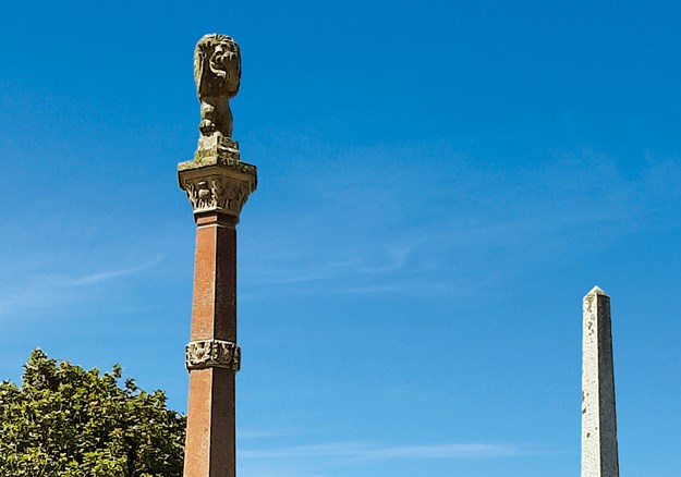
You can’t visit Waipu without being aware of the highland heritage. The town centre is dominated by tall memorials showing the pioneering ships and listing the settlers’ clan names. The adjacent museum sports a large sign of the serious-looking Rev McLeod, and visitors can learn all about the unique settlement. Descendants of the original families who are interested in genealogy will find all the information they desire – and there’s plenty to interest the non-Scots among us too. The museum boasts a UNESCO award and an international reputation.

Whelan_2 Memorials to the Scottish settlers.jpg

Waipu is famous locally for its Highland Games, held on New Year’s Day since 1871 – until Covid-19 put a damper on things. This year the town couldn’t hold the normal shindig: a day-long celebration with pipers, drummers and fiddlers, highland dancing, and shows of strength with tug-of-war teams and caber tossing. However, it did host a market day with stalls along the street and in the Caledonian Barn, and a family carnival at the adjacent park.

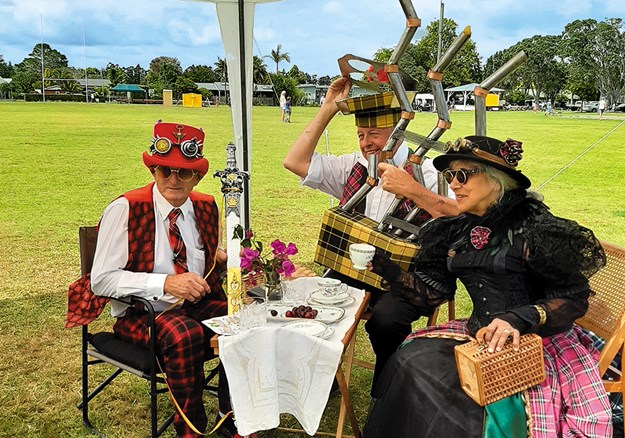
I wandered around the market stalls until I was drawn to a little stage where children were competing in Scottish dancing competitions. It’s not every day you see tiny boys in full Scottish costumes! Past the food stalls a group of steampunk enthusiasts had managed to combine Victoriana with tartan. Who could have imagined steam-powered bagpipes?

Whelan_7 Steampunk meets Scotland.jpg

ART ’N TARTAN

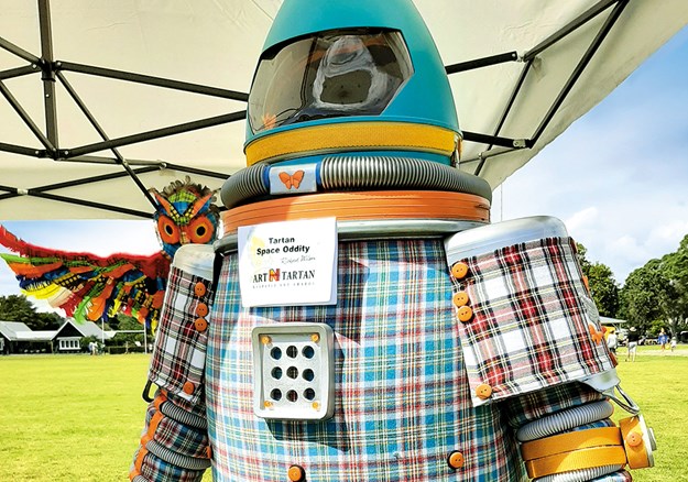
Also on display were some of the creations from previous Art ’n Tartan shows – the town’s wearable art extravaganza. Usually held in mid-winter, the event will be in October this year. It draws competitors from all over the country, and should be even bigger and better this year as it was cancelled last year, again due to Covid-19. The organisers believe the creative entrants will have used the lockdown to work on their designs.

Whelan_8 Art _n Tartan.jpg

Waipu is home to lots of artistic folk. Tucked in among the street stalls is the Old Garage, where I couldn’t resist buying a print by Patsy Montgomery, one of the artists who had work for sale inside. The picture showed tui flying above the river mouth, with Hen/Taranga Island on the horizon. You can see this stunning view on the road between Waipu and Waipu Cove, a short drive away.

COASTAL PARADISE

The Waipu river mouth and estuary are a haven for birds; there’s a wildlife refuge that’s a nesting area for the New Zealand dotterel, variable oystercatcher and fairy tern. Other protected, threatened or rare species visit the area, including the banded dotterel, reef heron, wrybill and Caspian tern. Waipu Cove is buzzing in summer, but the reserve and estuary areas are quieter – a birdwatcher’s paradise.

Whelan_17 Rock formations at Waipu Cove.jpg

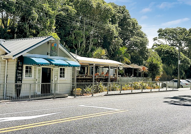
The cove has a long sandy beach with a campground behind the dunes. There’s a traditional little store and, across the road, the Cove Cafe overlooks the beach. I recently had a long lunch with friends there and can thoroughly recommend it. For those who don’t have time to visit Waipu Museum, a look at the impressive murals on the toilet block will provide a quick history lesson. The beach is safe for swimming; it’s patrolled by lifeguards every day during the holiday period and on weekends between Labour Day and Easter. At the southern end, a shallow tidal creek overhung by pohutukawa is a favourite spot for littlies to splash around and build sand castles.

PANCAKE ROCKS

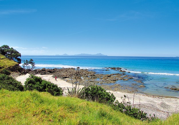
Across the creek there’s the start of one of our favourite walks – to Waipu’s own ‘pancake rocks’. This track has been created and maintained by the local Lions Club and takes walkers through magnificent coastal scenery. In some parts there are ancient pohutukawa forests, and the views across Bream Bay to the Hen and Chicken Islands and the Whangarei Heads are stunning.

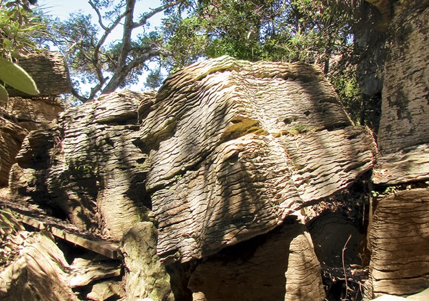
The most fascinating features of the walk are the pancake rocks, similar to the famous ones at Punakaiki. These limestone outcrops, dating back 36 million years, have weathered to the unusual stack-of-pancakes shape after being exposed to the elements. Unlike at Punakaiki though, Waipu’s rocks are never crowded with tourists, and they are unfenced: in some places the track goes through and over them.

Whelan_10 Waipu shopping.jpg

Whelan_14 Coastal dining.jpg

SHOPPING AND DINING

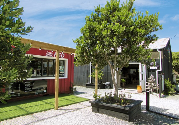
The township is fun to explore. As well as the supermarket, hardware store, butcher and chemist, there are antique and op shops to rummage through. Goody Goody Deli and Cafe, rebuilt after a fire a couple of years ago, is better than ever. Across the road there are a couple of summertime pop-ups, Little Red Coffee and the Black Barn Homewares store.

Whelan_3 McLeod_s Pizza Barn.jpg

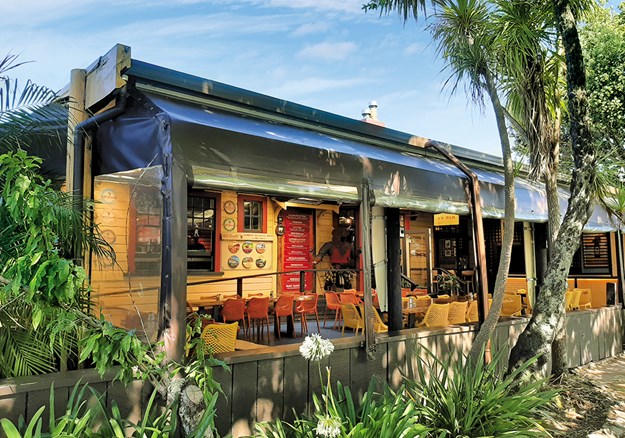
In the evening McLeod’s Pizza Barn and Brewery is the place to eat. In what was once the town’s post office, you can sample a range of hand-made pizzas and award-winning beers, including Black Watch Imperial Dark Ale and (of course) Paradise Pale Ale.

Whelan_20 Jazz Festival at Waipu Cove.jpg

FIND OUT MORE

  • Waipu hosts lots of markets. Street markets are held on Easter Saturday and the Sundays of Auckland Anniversary, Queen’s Birthday and Labour Weekend. Antique markets are also held on these Sundays. Boutique markets are held the second Sunday of each month, with crafts, food and music.
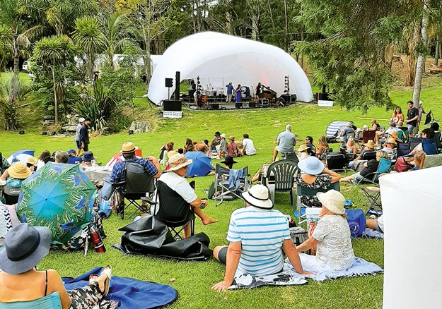
  • The town has plenty to offer music lovers, especially during summer. We recently enjoyed an afternoon of jazz at a farm overlooking Waipu Estuary, and a Scottish folk music duo at the church hall.
  • The Waipu Cove walkway is a 2km track taking about 1.5 hours to Waterman Drive. There’s an extension to Ding Bay that takes a further 45 minutes.
  • Information about camping at Waipu Cove: campwaipucove.com. There’s a DOC campground at Uretiti, o SH1, 5km north of Waipu. Caledonian Park has an area for motorhome parking, with powered sites and an honesty box.
  • Details of the museum opening times and prices: waipumuseum.com

Friday, 5 March 2021

Hidden Treasures: Kai Iwi to Pouto

 Heather Whelan and partner Malcolm discover some peaceful and picturesque spots near Dargaville

Whelan_23 Shipwreck remains at Pouto.jpg
Shipwreck remains at Pouto

The weather was forecast to be good for a few days, so we stocked up our bus and headed west from Whangarei – first stop the Kai Iwi Lakes. These rain-fed, freshwater lakes are part of a 538-hectare recreational reserve, 35km north-west of Dargaville, and are popular with campers, fishermen and those who enjoy water sports.

There are two campgrounds on the shores of Lake Taharoa, the largest of the Kai Iwi Lakes. One is called Pine Beach – though the pines have been removed in recent years – and the other is at Promenade Point. We didn’t plan to stay overnight, so parked overlooking Marina Bay and set off to walk around the lake. There are tracks around all three of the lakes, and side paths lead to Lake Waikare and Lake Kai Iwi from the Lake Taharoa track. On a hot afternoon we thought the 8km loop would give us enough exercise, so stuck to the main track.

We started our stroll at the boat ramp, where a group were launching jet skis. Visitors can enjoy a whole range of water activities on Lake Taharoa and Lake Waikare, including waka ama, kayaking, sailing, windsurfing, water skiing, fishing and swimming. However, motorised craft are not allowed on Lake Kai Iwi.

Whelan_1 Lake Taharoa, Kai Iwi Lakes.jpg
Lake Taharoa, Kai Iwi Lakes

Lake Taharoa is New Zealand’s third largest dune lake and the country’s deepest. The lakes were formed 1.8 million years ago when rain fell in depressions of sand that had impermeable ironstone pans beneath them. There are no inlets or outlets so the depth in the lakes can vary, as can the water temperature; extremes range from 12C to 21C.

Kai Iwi Lakes have unique biodiversity and are home to many native species, some endangered. Bird life includes the North Island brown kiwi, white-faced heron, paradise shelduck, grey teal and the Australasian bittern. Rainbow trout were introduced in the 1960s.

Kai Iwi means ‘food for the people’ and early Maori settlers in the area enjoyed catching fish and eels in the lakes. During times of war, injured warriors recuperated at the lakeside. Later kauri gum diggers built huts in the area, however this industry died out in the 1920s, leaving little trace.

There were plenty of campers at Pine Beach, enjoying the shallow waters fronting the campground, the children’s playground, and generally relaxing. One family were unloading bikes as the loop tracks are suitable for cycling as well as walking.

Our path continued beside crystal-clear water and golden sandy beaches, giving the lake a tropical look. There were few walkers on the track as we passed the aptly named Sandy Bay and continued past Deep Water Cove to the strangely named Sin Bin area and on to Promenade Point. The campground here has fewer facilities than Pine Beach and is described as a relaxed kiwiana experience.

We arrived back at our bus after taking just over two hours to walk the Lake Taharoa loop. We stayed for a while longer, and then headed into Dargaville.

Whelan_7 Sunset at the Dargaville NZMCA Park.jpg
Sunset at the Dargaville NZMCA Park

HISTORIC DARGAVILLE

We always enjoy staying at the NZMCA Park, which is situated picturesquely at the junction of the Kaihu and Wairoa rivers. We spent happy hour – actually close to two hours – chatting with other motorhomers in one of the historic boatsheds that once belonged to Thompson Boat Builders.

Whelan_8 The NZMCA Park beside the Kaihu River.jpg
The NZMCA Park beside the Kaihu River

Swedish-born Erik Thompson was the first of three generations of boat builders to produce craft here. Hundreds of launches, sailing boats and whalers were constructed from kauri over the years, the most famous being the whaleboats constructed for Ernest Shackleton’s 1907-1909 Antarctic expedition. Full-scale drawings of these were discovered sketched out in pencil on the boatshed’s loft floor.

Earlier we’d strolled along Dargaville’s waterfront from the band rotunda, past the Boating Club and through the Riverside Gardens. Prominent at the junction of Parenga Street and Hokianga Road is a statue erected as a tribute to the area’s early gum diggers, who came mainly from Dalmatia (now Croatia).

Whelan_9 Statue commemorating gum diggers.jpg
Dargaville honours the memory of its gum diggers

There’s a brochure available at the information centre that details a 5km walking trail around Dargaville’s historic buildings. We just looked at some of the sites, including the ‘petticoat houses’, six identical cottages built for workers at the Dairy Company. They were built with fireplaces but you had to pay extra for a chimney!

Whelan_5 View of Lake Taharoa with Maunganui Bluff in the distance.jpg
Lake Taharoa with Maunganui Bluff in the distance

The following day we went to discover more local history at the Dargaville Museum. There’s a wealth of information here about early European pioneers, especially the gum diggers. Another section of the museum is dedicated to shipwrecks, as the Pouto Peninsula and Kaipara Harbour entrance were notorious for shifting shoals and a dangerous bar.

Whelan_12 Reconstructed gum diggers huts at Dargaville Museum.jpg
Reconstructed gum diggers’ huts at Dargaville Museum

Among the flotsam and jetsam displayed are portholes, anchors and substantial parts of ships and boats dug up from the sands of the area. These range from a punt used from the 1880s to the 1950s, an American ship built in 1870, and the Mathieu, wrecked in 1885.

PLACE OF HIDDEN TREASURES

From Dargaville we drove south on the Pouto Peninsula. This 55km long spit stretches from Dargaville to Pouto Point, separating the Kaipara Harbour from the Tasman Sea. Described as one of Northland’s best-kept secrets, the peninsula is off the beaten tourist track. Visitors and bach owners enjoy a quiet spot for fishing – Pouto means float for a fishing net – though tourist information describes it as ‘the place of hidden treasures’.

Whelan_16 Te Kopuru Church with Maungaraho Rock on the horizon.jpg
Te Kopuru Church with Maungaraho Rock on the horizon

Our first stop along the road was the little settlement of Te Kopuru. Once a thriving town with sawmills and a shipbuilding industry, in its heyday Te Kopuru had a population of 3000. It had banks, shops, a post office, church, library and cinema, but when the kauri was all gone the town’s prosperity dwindled. Now Te Kopuru has only a school, a post office/ store, a pretty wooden church and a community veggie garden.

Whelan_17 Entrance to the community gardens.jpg
The community veggie garden in the tiny settlement of Te Kopuru

It also has what must be Te Kopuru’s most photographed spot. Near the church on the main street there’s an old villa that has its garden decorated with hundreds of fishing floats and buoys. As well as the floats there are old ropes, fishing nets, sails, shells, whale bones and structures made from all kinds of things thrown up by the tide. It’s worth stopping in Te Kopuru just to gaze at this whimsical place. 

Whelan_18 Quirky garden decoration at Te Kopuru.jpg
Hundreds of floats and buoys decorate this garden in Te Kopuru

The road down the peninsula is sealed until the turn for Kellys Bay. From here the road to Pouto Point is gravelled, as is Kellys Bay Road. We took a short detour to the little community and parked on the grass beside the beach. While we enjoyed our morning tea we watched flocks of terns, oyster-catchers, stilts and gulls advance towards us as the incoming tide gave them wet feet. There’s a campground at the end of the road with some powered sites and lots of room for self-contained campers. Facilities are minimal here with long drop toilets and solar showers, but the beach is safe for children and is a good spot for catching flounder.

Finally we arrived at Pouto Point and parked beside the hall at the tiny campground. We signed in across the road and settled down to enjoy stunning views across the Kaipara Harbour. It’s always been hard for boats to enter the harbour, as evidenced by the remains of wrecks we’d seen at the Dargaville Museum. Maori history tells how the captain of the waka Mahuhu drowned when his ship was wrecked at the entrance. Both Cook and Tasman sailed by, leaving Marion du Fresne to be the first European explorer to identify the entrance, though it was 1836 before the first European sailors made their way into the harbour.

Whelan_21 At Pouto Campground.jpg
A fine view of the Kaipara Harbour at Pouto campground


Although the entrance was known as ‘the graveyard’ (there have been 113 recorded shipwrecks), the harbour offered ease of access to lucrative kauri. Early charts were misleading, and sandbars shifted constantly, but many sailing captains took the risk and entered. By 1884 there was a lighthouse, a signal station and custom house at Pouto. (In fact, the Marine Hall at the campground is the old custom house, New Zealand’s first.)

It’s a 7km walk out to Pouto lighthouse (disused since 1952 and now maintained by Heritage New Zealand) followed by an energetic 10-15 minute climb up steep dunes, but we opted for a stroll along the beach. We were delighted to come across the remains of a boat’s ribs protruding from the sand; another of the ‘graveyard’s’ wrecks coming to light, to be either recovered or reburied by the shifting sands.

FURTHER INFORMATION

  • Details about the camping grounds at Kai Iwi Lakes can be found at: kaiiwicamp.nz. There are limited power sites at Palm Beach and it is vital to book sites in both camps in advance in summer and on holiday weekends.
  • The NZMCA Park is at 2 River Road, Dargaville. Overnight parking is also available at Dargaville Museum, $15 per night, $12 for NZMCA members.
  • Phone 09 4390781 or 0274 509473 to book at Kellys Bay Reserve Campground.
  • Pouto Marine Hall Campground is at 16 Signal Station Road, Pouto.
  • At Kai Iwi Lakes the Lake Taharoa track is an easy 8km, Lake Waikare and Lake Kai Iwi are both 4km. There is also a walk along the beach from Kai Iwi to Maunganui Blu , 1.5 hours one way.

Saturday, 20 June 2020

Matamata Magic

A recent article published in Motorhomes, Caravans & Destinations Magazine
Heather Whelan finds there’s more to Matamata than Hobbits, as she and her partner Malcolm explore the area
Alt TEXT HERE
Matamata’s Tolkien-inspired i-SITE
The little town of Matamata lies beneath the Kaimai Range, the mountains that separate the Waikato from the Bay of Plenty. We’d never spent time here so, on a recent trip, partner Malcolm and I decided to stay a while and explore the area.
Matamata has become synonymous with Hobbiton since trips to the film-set attraction leave from the town. You can’t ignore the Hobbit connection – pizzas at one restaurant include ‘Frodo’s Secret’ and ‘Sauron’s Fury’ – and the i-SITE is charmingly Tolkien-inspired in design.
But there’s more to Matamata than Middle Earth: the town’s history dates back to 1830 when Te Waharoa established a pā. Three years later, missionaries arrived, and a mission station was built, though warfare led to this being moved.
In 1865 an Auckland entrepreneur named Josiah Firth leased – and later bought – land, including the future site of the town. He called his estate Matamata, the name of the pā. Locals dubbed him the Duke of Matamata.

Exploring the past

Alt TEXT HERE
The McCaw homestead
Curious to learn more about the history of the area, we visited the Firth Tower Historical Reserve on the outskirts of town. This was once the homestead and headquarters of Firth’s enterprise and today houses a variety of buildings, surrounded by gardens, lawns and mature trees.
The tower itself was built in 1882 to provide a lookout over the surrounding countryside. It is 16m high and is one of New Zealand’s earliest reinforced concrete buildings. The interior is now a museum that tells the story of Firth and his family, and of the developments he made in opening the land for agriculture and in the introduction of innovative agricultural machinery.
From the lookout atop the tower, we realised what an extensive estate this once was.
Josiah Firth eventually became bankrupt and lost his land. It was divided into 117 farms owned by the Bank of New Zealand and managed by John McCaw.
The McCaw homestead next to the tower dates back to 1902: the previous house was destroyed by fire. Stepping through the front door is like going back in time, the rooms furnished in the style of the late 1880s.

Heritage buildings

Alt TEXT HERE
Firth Tower Methodist Church
Grouped attractively around the tower are a variety of old buildings, giving the look of a rural village. We wandered around and peeped into the old Matamata Methodist church, the original Okoroire post office, an old schoolroom, a jail built in 1892 in Karangahake, and a settler’s cottage.
This cottage is shown with furniture and household objects from the early 20th century.
Around the back of the grounds are a group of large sheds, containing a history of agriculture in the area.
One shed has an exhibition of tractors; another has shearing gear, wool bales and fleece. Another shed’s exhibits illustrate the changes in agriculture from Māori times to early motorised machinery.
The dairy industry is represented in a shed that showcases milking and cheesemaking. Near the sheds, there’s a potager garden, orchard, and the original stables. We spent a couple of hours looking around and could have stayed longer – next time we visit we will because there is parking for self-contained motorhomes on the grounds.

Spectacular falls

Alt TEXT HERE
Wairere Falls
For something completely different we headed further down the road, to the very edge of the Kaimai Mamaku Forest Park, for a hike to the top of Wairere Falls. At 153m in height, this waterfall is the biggest in the North Island, and the track covers some of the most varied and beautiful bush in the area.
Alt TEXT HERE
At the top of Wairere Falls
The track up to the waterfall is part of an old trail from the Bay of Plenty. It was first walked, so the story goes, by Ngahue, an early voyager from Rarotonga, who killed a moa at the base of the falls. Later the track was used by missionaries and explorers.
Today the track first winds through an area of moss-covered rocks, tree ferns and ponga, before reaching the river. There’s a bridge here, and another further up the track, which goes steeply uphill.
There are plenty of steps and a set of wooden staircases that took us up beside a cliff face, which leads to the top of the gorge. After a short walk through a grove of nīkau, pūriri and kohekohe, we reached the viewing platform. This looks across to the waterfall and is the halfway point of the walk.
The second section took us up more steps and through more native forest until suddenly we were at the top of the falls. There’s a viewing platform beside the waterfall, but you can do as we did, and rock-hop across the water to where it cascades over a cliff. There are views across the Waikato Plains from the waterfall.

Thermal pools

Josiah Firth discovered the Ōkauia hot pools in 1886. He sold the land containing the pools to W J Aitkin in 1900, and his manager developed the site, establishing concrete pools and a camping ground.
One pool is called Ramaroa and, according to Māori legend, is named after a canoe that transported a chief and his wife up the Waihou River. They had been warned that if they were still in the Ōkauia area after dusk, they would be turned to stone.
Stopping to warm up beside a fire, the couple became petrified – the Ramaroa pool is said to be heated by the fire still burning under the bow of the canoe. Since 2000, Ōkauia has been known as Opal Hot Springs.
The holiday park is set in six hectares beside the river and has a range of accommodation, including motorhome sites. We called in for a soak in the thermal pools after our long walk to the top of Wairere Falls. Since it was a scorching day, we alternated between relaxing in the hot pools and cooling off in the large swimming pool.

Botanical beauty

Matamata township sprang up in 1885 after a railway line was constructed from Morrinsville. Surveyors drew wide streets and a central domain – the building lots flanked by a plantation reserve.
This reserve has been developed into the Matamata Centennial Drive, a botanical park with a huge variety of trees. The trees were initially planted in 1940, to celebrate the centennial of New Zealand, and further planting has continued.
We took an evening stroll along Centennial Drive and were impressed by the variety and stature of the trees. There were many native species but also a huge range of exotics, most of which we had never heard of – Pendulum Redwoods and the handkerchief/ghost tree, for example.
At the Tainui Street entrance, there’s a huge rock, surrounded by a lily pond with a fountain. A plaque on the rock commemorates the Māori, missionaries and early settlers of the district who laid the foundations of today’s Matamata. We finished our walk and went to find somewhere for dinner. We ended up having a great meal in the courtyard at the Horse and Jockey Inn – with not a Hobbit in sight. 

FURTHER INFORMATION

  • There’s parking for self-contained motorhomes at the Firth Tower. Full details at firthtower.co.nz
  • Opal Hot Springs Holiday Park: opalhotsprings.co.nz
  • The Wairere Falls track is 5km return and takes 3-4 hours, though some people choose only to walk to the lookout at the halfway point. More information at doc.govt.nz

Loving the Loop - Whangarei

This is my last article In Motorhomes, Caravans & Destinations Magazine
From clocks to cafes, markets to boat trips there’s something for everyone at Whangarei’s Town Basin and along the riverside walk known as ‘The Loop’
the-loop-whangarei-Whelan_8-At-the-Town-Basin.jpg
There are some options for lunch around Whangarei’s Town Basin
Whangarei’s Town Basin has long been a favourite destination for locals and visitors alike. There are shops, galleries, restaurants, and cafes housed in colonial-style buildings overlooking the marina. As well as Whangarei-based boats, there are ocean-going yachts moored in the basin, as international visitors sit out the Pacific hurricane season, or decide on a longer stay. Even though I’m a local, I always find something new going on Quayside and along the Hatea Loop.
First stop for visitors should be Te Manawa, The Hub. This building is one of Whangarei’s information centres and the staff have a wealth of local knowledge. There are lots of maps and brochures to peruse – I picked up the latest visitor guide as I felt I should learn more about the places and sculptures I walk past so regularly.
the-loop-whangarei-Whelan_5-At-the-Town-Basin.jpg
A lovely spot to stop and admire the scenery

Inspired architecture

The Hub is more than an information centre; it also houses Whangarei Art Museum Te Manawa Toi. The gallery curates a variety of exhibitions, as well as displaying art from its collections. Entry is by donation and it is well worth a look.
On this occasion though, I was drawn to the colourful, funky model of Whangarei’s newest building project, the Hundertwasser Art Centre with Wairau Maori Gallery (HAC). Admiring the organic form of the architecture, I was reminded that the Hundertwasser Centre will be radically different to the surrounding architecture. When completed it will be a unique feature in Whangarei and is expected to draw visitors from around the country and overseas.
Outside on Quayside I wandered up the spiral ramp inside the folly building called Te Kākano (The Seed). It is a little koru-shaped building, something like a tiled lighthouse with round windows and ball-topped pillars. It was built in 2016 as a precursor to the 100-times bigger HAC development behind it. From the top I peered across the building site and tried to imagine the completed structure.
the-loop-whangarei-Whelan_7-At-the-Town-Basin.jpg
Specialty shops beside the water

Gorgeous galleries

Along the pedestrianised Quayside there are a cluster of speciality shops and galleries. The Bach sounds suitably seaside-like but its name is actually an acronym – Basin Art and Craft House. Every item on sale here is produced locally but don’t be misled, this isn’t an amateur set up, the Bach Gallery sells quality products with a Northland vibe.
On the waterfront nearby I checked out Burning Issues Gallery. As well as being able to browse and buy handmade glass, paintings, jewellery and ceramics, visitors can watch glass blowing from a viewing platform at the rear of the shop. Glass artist Keith Grinter also holds beginners’ workshops.
the-loop-whangarei-Whelan_3-The-Seed.jpg
Te Kākano(The Seed)

Dining beside the river

From a casual ice-cream on a hot day, or dining with the water lapping beneath your feet, there are plenty of options at the basin. There are cafes with courtyards and shady sun umbrellas, where you can grab a coffee or enjoy a lazy lunch watching the activity on the water.
The Fudge Farm is everyone’s idea of an old-fashioned sweet shop, its shelves packed with varieties of fudge and other sweet treats. Started in a farmhouse kitchen using a family recipe, the Fudge Farm shop is a popular spot – and not only with the children. As well as fudge, you can enjoy espresso, cool drinks, ice cream and desserts on the tables outside. I chose one of the delicious ice cream options to enjoy while I looked around at the nearby restaurants.
the-loop-whangarei-Whelan_2-Boats-at-the-Town-Basin.jpg
The Town Basin marina is a haven for the yachting community
Next door, No 8 Restaurant and Bar provides dining in a stunning hexagonal-shaped building. It has a white-painted, balustraded balcony on the second floor and is topped by a little tower. But arguably the best location for brunch or dinner is at the Quay, where the restaurant’s deck is right over the Hatea River.

Messing about on the river

Not only can you sit and admire the yachts, but out on the water there’s the option of hiring an aqua cycle or kayak and, on summer weekends, the MV Waipapa offers cruises along the harbour to Matakohe-Limestone Island. Once home to a thriving industrial village with a post office and school, the island is now a nature, scenic and kiwi reserve.
the-loop-whangarei-Whelan_9-Claphams-Clock-Museum.jpg
Claphams Clock Museum

For the kids

Ice cream finished, I set off to walk the loop. At the start of the walkway another unusual building houses Claphams Clock Museum. This museum is home to the largest collection of timepieces in the Southern hemisphere, everything from rare antiques to fun and strange clocks. It’s a great place to take kids.
Outside there’s a huge sundial, and beside it an area of grass destined to be home to a rolling ball clock.Unsure what this was, I followed the signs to a nearby workshop where I discovered the About Time Project. Volunteers have been working for several years to create what looks like a giant marble-rolling toy. In reality, this kinetic sculpture is an accurate timepiece and an amazing piece of engineering. I don’t claim to understand how it works but I stood mesmerised by the rolling balls and clicking cogs. The enthusiastic builders are fundraising so the rolling ball clock can be moved to its new home beside the river. 
the-loop-whangarei-Whelan_12-Reyburn-House.jpg
Reyburn House

Markets and more

Back on the brightly painted wooden walkway, children were having the time of their lives on a popular adventure playground. Just beyond the play area is Whangarei’s oldest house. A true colonial gem, white-painted Reyburn House is surrounded by a pretty cottage garden and is a gallery for local artists. During the summer, this grassy area is the venue for markets. On Saturday mornings there is a craft market with stalls full of artwork, handmade soaps, garden art and much more. There’s a coffee caravan and live music if you just need to sit and chill for a while. On Friday evenings foodies gather at the night market where stalls sell multicultural cuisine.

Walking the loop

The Hatea Loop Walkway Huarahi o te Whai runs for 4.2km from the Town Basin (or other points along its length) crossing bridges and linking both banks of the Hatea River. It’s about an hour’s stroll, and is a shared path, so watch out for cyclists.
Heading south from the Town Basin, the walkway leads past 16 different sculptures. These range from quite small to enormous and are constructed from diverse mediums, from marble to steel pipe.
Outside Reyburn House I admired Lottie by Kap Pothan, commemorating the first child born to the Reyburn family.
the-loop-whangarei-Whelan_20-The-gypsy-fair-market.jpg
The gypsy fair market
A contrast is Kaitiaki, a two-metre-tall guardian figure carved by Manos Nathan. Probably the most eye-catching sculpture is Chris Booth and Te Warihi Hetaraka’s Wave and Waka sculpture, featuring an enormous stone wave suspended above a canoe. This celebrates the history of the site as a landing place for Māori and European alike. Information panels relating the history and mythology of the area can be found beside the path.
The next section of the loop walk took me over a footbridge, Kotuitui Whitinga, which is sculptural in itself and studded with paua. This bridges the Raumanga Stream, which empties into the river at this point. On the right, the Pocket Park is another entrance to the loop. The Pocket Park, and Bascule Park close by, have been recently developed and feature murals and attractive plantings. Bascule Park has motorhome parking and a pop-up cafe.
the-loop-whangarei-Whelan_21-Mural-on-the-loop.jpg
Mural on the loop
One of the most photographed parts of the loop would be the award-winning Te Matau ā Pohe (the fish hook of Pohe) bridge. The design is inspired by the shapes of Māori fishhooks and waka prows. This bridge across the Hātea River opens to let yachts pass through on their way to the Town Basin Marina.
The loop walk continues along the far side of the river, past the site of another upcoming project, the camera obscura. This 8-metre structure will be an interactive sculpture which promises to give visitors unique views of the surroundings.
The final stretch of the walk passes beside the William Frazer Memorial Park, home to a skateboard park and a BMX track. The park is also the venue for the circus and the Gypsy Extravaganza Fair when they make their annual visits to Whangarei. On Hatea Drive walkers pass a small marina and cute boathouses, before coming to my favourite coffee stop. Tiny Kafe, tucked at the back of a surf shop by the marina, has a courtyard shaded by a huge old pohutukawa. It’s a great spot to watch all the activity on the other bank before wandering back beside the river and over the Canopy Bridge, its awnings designed to look like sails.
the-loop-whangarei-Whelan_18-The-Pocket-Park.jpg
Pocket Park

FURTHER INFORMATION

There are two places for motorhomes to park beside the loop. Bascule Park has eight designated places for non self-contained vehicles (there are toilets at the park). Self-contained vehicles can stay at the car park on Reyburn House Lane. There is a maximum of three nights at both spots.
Te Manawa The Hub Information Centre is open seven days: Monday-Friday 9.00am-5.00pm, and 9.00am-4.30pm on weekends.

Friday, 28 June 2019

A magical History Tour

This is my latest article in Wilderness Magazine (July 2019 issue)....
A magical history tour
Wenderholm Regional Park has a fascinating history. The first people to enjoy the area were the Polynesian ancestors of Māori. Later, descendants of the Tainui and Moekaraka canoes explored the Puhoi and Waiwera Rivers, fished and built gardens. Little remains from those days except shell middens and place names – Wenderholm’s sandy spit is still called Te Akeake and the headland is Maungatauhoro. Wenderholm’s current name was bestowed on the area by a friend of Robert Graham, who bought the land in the 1840s, and means winter home in Swedish.


The Maungatauhoro Te Hikoi Track, starts near Couldrey House, an attractive, two-storey colonial house. Originally built by Robert Graham in 1857, it was added to by subsequent owners before becoming almost derelict. The Couldrey family restored the house during the 1960s and continued living there after selling Wenderholm to the Auckland Regional Authority in 1965. When they left in 1973, Couldrey House reverted to the council.

We left the quaint cottage garden and entered native bush beside a carved pouwhenua. The track leads fairly steeply up towards the cliffs of the headland and gives stunning views of the Te Akeake sand spit, the Puhoi River and the hills beyond. To the north are the headlands of Mahurangi Harbour and out to sea islands dot the ocean towards Kawau.


The sand spit is covered with gnarled pohutukawa, splashes of red visible from the track. These trees were planted over a century ago and form the largest grove of planted pohutukawa in the world.

The native bush that covers the headland is a typical mix of kahikatea, manuka, nikau, rimu and tree fern and we were lured into it along the Couldrey House Track by large numbers of kererū and tui flying around the treetops. We were hoping to see a North Island robin, re-introduced to the park in 1999, but didn’t spot any.

After about 15 minutes, there’s an open area where the Couldrey House Track joins the Puhoi Track, which is an alternative way back to the Maungatauhoro Te Hikoi Track. This is another good lookout place with more great views – we could see past the Whangaparāoa Peninsula to Rangitoto Island.
Wanting to complete the headland track, we retraced our steps and then continued around to the southern side of Maungatauhoro. The track leads down to a sheltered little beach at Kokoru Bay, which looks across the river to Waiwera. Māori originally named this place Waiwerawera, very hot water, and it has been a thermal resort since the mid-1800s. Unfortunately, both the hot pools and the adjacent water-bottling facility have been closed and their future is uncertain.


Photo: Heather Whelan
The final part of the loop track runs close beside the estuary and past a turn-off, which leads to the road beside the Waiwera River Bridge. Then the track curves northward and runs parallel to Schischka Road to the car park near Couldrey House.