Tuesday, 10 August 2021

Kaipara Harbour: Exploring Helensville and the Kawau Parua Inlet

 NZMCD Shelly Beach, Kaipara Harbour

Kaipara Harbour: Exploring Helensville and the Kawau Parua Inlet

Heather Whelan investigates some peaceful spots that border the Kawau Parua Inlet.

Kawau Parua Inlet is almost enclosed by headlands that jut into the Kaipara Harbour – Oyster Point to the east and Shelly Beach to the west. Helensville sits at its southerly end, at the entrance to the Kaipara River.

Historic Helensville

Māori had long lived on the shores of the Kaipara when the first Europeans settled there. John McLeod came to mill timber in 1862, and built a kauri villa as his family home. He named it Helen’s Villa, and the name stuck for the whole settlement of Helensville.

The area had previously been known as Te Awaroa, ‘the valley of the long river’. The Kaipara River played a vital part in Helensville’s early development, as did the railway, which opened in 1875. The timber industry boomed in the 19th century, when kauri spas were transported by ship from Helensville. It wasn’t until the 1940s, when a road was built over the Brynderwyn Hill, that river and harbour routes north from Auckland declined in importance.

NZMCD The riverside walkway at Helensville
THE RIVERSIDE WALKWAY AT HELENSVILLE

Helensville’s fortunes have gone up and down over the years, but it is a pleasant place to stop and wander around. We discovered the riverside walkway, which begins at Mill Road and took us along boardwalks and paved paths to the high point of Commercial Road, beside the old Post Office. As well as giving us views of the river and a cluster of boats, the path led through plantings of native trees and shrubs: a peaceful change from the busy main street.

We turned left on Commercial Road and wandered down to the old Railway Station, home to the Ginger Crunch Cafe, which is always worth a visit. The station was built in 1880; before this, passengers and goods had to travel by sea from Onehunga, or make their way overland from Riverhead.

Railway buffs will be interested in the 1881 steam locomotive that stands beside the railway station. On loan from MOTAT, it is almost identical to the D class engine that brought the first train to Helensville. The Helensville Railway Museum is housed in a new building beside the locomotive, but only opens on Sundays, so we’ll have to check that out another time.

NZMCD The riverside walkway at Helensville
A CARVED SEAT BY THE WALKWAY.
NZMCD Locomotive at Helensville Railway Station
LOCOMOTIVE AT HELENSVILLE RAILWAY STATION

Te Korowai-o-Te-Tonga

The South Kaipara Peninsula, renamed Te Korowai-o-Te-Tonga in 2013, extends 35km from Helensville to the mouth of the Kaipara Harbour. The name means ‘the cloak of the south’, and reflects the protective role of the peninsula in sheltering the harbour from westerly winds. We turned north and drove through Parakai, famous for its hot pools. We had booked overnight parking there, but wanted to explore further up the peninsula first.

Our first stop was MacNut Cafe, tucked off the road in a macadamia orchard. The cafe has pretty views over the orchard and lakes; visitors can take self guided tours, but we just took in the view, along with the coffee and macadamia-themed treats.

Further along the road we took the turn for Shelly Beach. Originally known as Aotea, the beach was named for the canoe, Aotea, brought into the Kaipara for repairs that were carried out at this spot. Later, Aotea was the venue for a meeting of local Māori who were debating whether to join the King movement (they didn’t). A meeting house was constructed and a copy of the Treaty of Waitangi was kept under glass, surmounted by an image of Queen Victoria. Later a hall and church were built, but all these buildings were eventually moved to another part of the harbour. A pyramid monument on the shore commemorates this history.

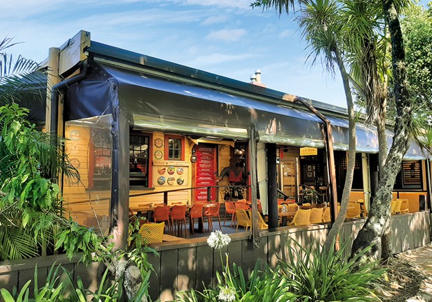
NZMCD View from The Jetty cafe at Shelly Beach
VIEW FROM THE JETTY CAFE AT SHELLY BEACH

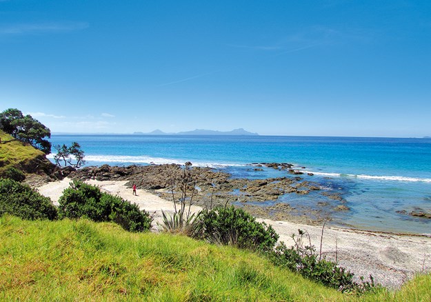
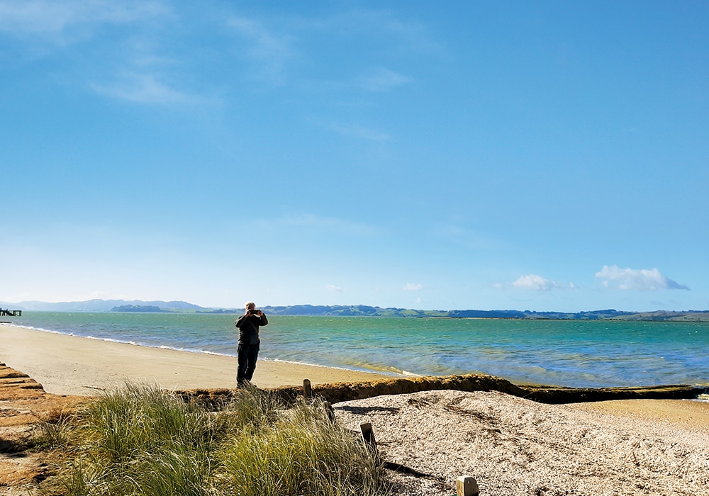
The stretch of Shelly Beach near the monument was actually sandy, but at the other side of a long wharf and a recently installed groyne we came to the shells. We walked along the beach, before taking a track up to the cliff-tops and then down through pōhutukawa to a carpark beside the wharf. At the end of the carpark we discovered an area for motorhome parking with powered sites.

This campground is administered by the folk at The Jetty cafe, which looks out over the beach, wharf and harbour. We couldn’t resist buying lunch here and enjoying the picturesque view.

Fishermen were busy launching boats, and casting their lines from the end of the 100 metre-long wharf. Locals advise taking care at the end of the wharf, especially in windy weather, as it has no handrails. Next time we’ll stay at Shelly Beach and also venture further north, as there are a regional park and lakes to explore at the end of the peninsula.

NZMCD Mural at The Jetty Cafe
MURAL AT THE JETTY CAFE

Hot pools and hot chips

We were keen to have a soak in Parakai’s hot pools, so returned to the little town and parked in the campground area next to Parakai Springs. The campground is now run by Auckland Council, and you have to pre-book to get the code for the gates. The kitchen and ablution blocks have been removed, so it is only suitable for self-contained vehicles. However, the location is picturesque as it is part of Kaipātiki Reserve, a grassy area with many mature trees.

People have been enjoying Parakai’s thermal water since 1881, when the first muddy ‘pool’ was dug. By the early 1900s the pools had been developed and there were hotels to cater for visitors. We spent the next hour at Parakai Springs, a big complex with a hydroslide, indoor and outdoor pools, and private spas. It was off-season so we practically had the place to ourselves. There’s another pool complex, Palm Springs, across the road. This has recently been upgraded and is lovely to visit on fine days (the pools are all outdoor).

Feeling relaxed after our soak, and too lazy to cook dinner, we wandered along to the Four Square, which has a hot food counter at one end with a variety of takeaway options. We got hot chips to go with the chicken and salad we had in the fridge in our bus. The other dinner options in Parakai are a Chinese restaurant and a pizza place.

NZMCD Parakai Springs hot pools
PARAKAI SPRINGS HOT POOLS

Plants and sculpture

Heading north on SH16, through Helensville and past the village of Kaukapakapa (which sticks to the watery theme as its name means ‘swim with much splashing’), we soon came to a sign for the Kaipara Coast Plant Centre and Sculpture Gardens. At the end of a driveway there’s a cafe and the entrance to 3.5km of garden, sculpture and forest trails.

David Bayly has run the plant centre since 1988, and he has developed the property to display over 40 sculptures, sited along the trails. The sculptures are changed every year, so it’s worth visiting regularly. We had coffee and cake at the cafe before strolling around the gardens and admiring the artworks, which ranged from tiny to huge. It takes about an hour and a half to complete the circuit. There’s a new track opening soon – the Harbour View Track – and, looking at the map, I think visitors will be able to look across the Kawau Parua Inlet to Shelly Beach on the far shore.

NZMCD On the sculpture walk at Kaipara Plant and Sculpture Gardens
ON THE SCULPTURE WALK AT KAIPARA PLANT AND SCULPTURE GARDENS
NZMCD The cafe at the Kaipara Plant and Sculpture Gardens
THE CAFE AT THE KAIPARA PLANT AND SCULPTURE GARDENS

More Information

Tuesday, 27 July 2021

Explore Waiheke’s Beaches, Vineyards and More

 NZMCD Explore Waiheke

Explore Waiheke’s Beaches, Vineyards and More

Waiheke Island is famous for its beaches and vineyards, but Heather Whelan discovers there are plenty of other attractions too.
Vines and wines

Of course, you can’t visit Waiheke without visiting a vineyard or two. There are more than 20 wineries, so visitors have lots of choice. Most offer tastings and food, and all are in beautiful surroundings. On a recent trip we visited a few old favourites, and tried some that were new to us. Casita Miro at Onetangi has award-winning dining and Gaudi-inspired mosaics. It’s popular, but when it’s fully booked you can sit under olive trees with a platter. Obsidian Wines are just a short walk away, through the vines.

It’s a bit of a trek out to Man O’ War Vineyard, at the far eastern end of the island, but it’s New Zealand’s only beachfront wine-tasting experience. We visited after a trip to Stony Batter, and sat in the afternoon sun with a glass of wine as the waves lapped on the beach.

nzmcd explore waiheke Wild on Waiheke
WILD ON WAIHEKE

Over a few days we visited the four vineyards clustered along Onetangi Road: Tantalus, Stonyridge, Te Motu and Wild on Waiheke. Stonyridge has been voted one of the top 10 wineries in the world – with its mellow brick and ivy-covered walls you could be in France. Next door at Te Motu we enjoyed wine-tasting and lunch in a shady courtyard, while another time we checked out the Tantalus craft brewery.

NZMCD explore waiheke stonyridge
STONYRIDGE VINEYARD

Fun and games

For something different, don’t miss Wild on Waiheke. Not only can you relax with wine and great food, you can try your hand at a few games and activities. There’s giant chess, petanque and Connect Four, but we were more adventurous and tried the laser clay bird shooting and archery. (Warning – laser guns are heavy to hold for the half-hour session.) The archery was a lot of fun, even though Malcolm managed to miss the target and skewer a vine.

Knowing we’d be spending time on Waiheke’s beaches, we packed our croquet set and had a go at Onetangi Bay. This was easier than you’d think, given the whole course was a sand trap.

Other adventures you can have on Waiheke include a zipline, Segway tours, electric bikes, mountain biking and horse treks. On the water you can go windsurfing and paddle boarding, as well as kayaking, sailing, diving and snorkelling.

Walk Waiheke

Waiheke boasts 100km of walking trails that circumnavigate the island. The network is called Te Ara Hura, and there are maps of the various sections: Headlands, Beaches ‘n’ Baches, Forest Heart and The Far End.

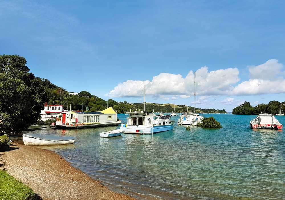
We love walks along beaches or with ocean views, so we headed to the well-known sandy beaches at Oneroa, Onetangi and Palm Beach. Then we discovered tiny Hekerua Bay and walked along the cliffs to Sandy Bay. We can also recommend the walk from Blackpool, along The Esplanade to Huruhi Bay, and the longer loop walk from Matiatia Bay via Cable Bay. And it’s worth stopping at Ostend’s causeway to admire the cluster of houseboats and interesting yachts moored there. Look out for the yellow submarine bobbing in the bay.

There are seven significant wetland areas on Waiheke. The community volunteers with the Love our Wetlands project are restoring and replanting these ecosystems. We wandered around Rangihoua Wetlands after visiting the museum. It’s a one-hour loop, taking in a Te Arawa waka landing site, and is a contrast to the wide ocean views on other parts of the island.

nzmcd explore waiheke Rangihoua wetlands
RANGIHOUA WETLANDS

Island history

Waiheke was known originally as Te Motu Arai Roa – the long sheltering island. The name Waiheke first appeared on a European map of 1821. More than 500 years after the first Polynesian people arrived on the island, Europeans began to make their homes there. Early in the 20th century the villages at the western end
of Waiheke were subdivided, electricity coming in 1953.

There’s plenty of information about this Māori and European history at the Museum of Waiheke and Historic Village, just across the road from the vineyards on Onetangi Road. The museum, housed in a reconstructed woolshed, is a treasure trove of artefacts, ranging from a very old Hei Tiki found at Whakanewha/Rocky Bay to a player piano brought by European settlers.

nzmcd explore waiheke museum
WAIHEKE MUSEUM EXHIBIT

We spent a while browsing displays that reflected island life through the years, before exploring the Historic Village. Here we found three cottages that showed household life in the early 1900s – only one had electricity. There was also a police cell and a long drop toilet (not in use).

nzmcd explore waiheke
COTTAGE INTERIOR AT WAIHEKE HISTORIC VILLAGE

Stony Batter

It’s a 25-minute drive from Onetangi to Stony Batter Historic Reserve, along a mostly unsealed, narrow road. This eastern end of the island is very different from the rest of Waiheke, with the 4500-acre Man O’ War Station, an area of vineyards, livestock paddocks and regenerating bush.

nzmcd explore waiheke stony batter
VINES AT STONY BATTER

Fort Stony Batter was built in secrecy during World War II as part of a series of gun emplacements protecting Auckland. Its labyrinthine tunnels were decommissioned after the war and were left for adventurous locals to explore. After being closed for six years, the tunnels were opened in December 2020 by local archaeologist Tim Moon. Tim and his team have fitted out the tunnels with safety features, such as handrails, lighting and additional exits.

We took the one-hour tour. After we purchased tickets from Tim (he’s a one-man band here) he passed out torches and we followed him into the 1.2km of subterranean passages and chambers. At first we were in darkness and slowly made our way to the gun emplacement, which is in the open air. There was some lighting in the other areas, where Tim explained the functions of the various rooms. Back in daylight we ate a picnic lunch with views of vines, boulders and the blue waters of the Hauraki Gulf.

Shopping and art

Oneroa is the island’s shopping centre, with a selection of stores selling desirable things, much of it locally made. I always try to buy something from Upcycle, which as its name suggests specialises in all things repurposed and handmade. Space Gallery is worth a look too – it has a changing selection of works by local artists. Art lovers can pick up a map showing 42 studios and galleries to visit.

nzmcd explore waiheke space art gallery
SPACE ART GALLERY

We were intrigued by the name Dead Dog Bay Wetland Garden and Sculpture, so headed along for a look. What a find. We spent ages wandering the extensive gardens, admiring sculptures big and small. Nearby we happened upon Rangihoua Estate – not a winery but an olive oil producer. We had a tasting here, and left with a jar of herb spread.

nzmcd explore waiheke dead dog bag
SCULPTURE AT DEAD DOG BAY

Luckily we were on Waiheke on a Saturday, so were able to visit the Ostend Market. This was jam-packed with stalls selling everything from books to baskets. There were food stalls, local produce and all manner of goods, old and new.

nzmcd explore waiheke Ostend market
OSTEND MARKET

There’s so much to see and do on Waiheke Island, we feel as though we’ve only scratched the surface. We’ll have to return.

Friday, 18 June 2021

Cambridge - Gem of the Waikato

 This article was recently published in Motorhomes, Caravans and Destinations Magazine


Heather Whelan finds there’s plenty to do in Cambridge – come rain or shine

nzmcd cambridge
St Andrews Church

We’ve always wanted to spend more time in Cambridge, and visited twice last year. Our   first attempt was hampered by rain but undeterred, we picked up a ‘Rainy Day Activities’ brochure at the i-SITE and headed down Victoria Street.

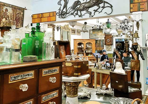
We soon discovered several antique shops filled with interesting objects of desire. On nearby Duke Street there were some op shops, where things had smaller price tags. I was interested to learn that the Lions Club hold a Trash and Treasure Market every second Sunday of the month, advertised as having over 200 stalls.

nzmcd cambridge
Antique treasures

HISTORY, HERITAGE AND HORSES

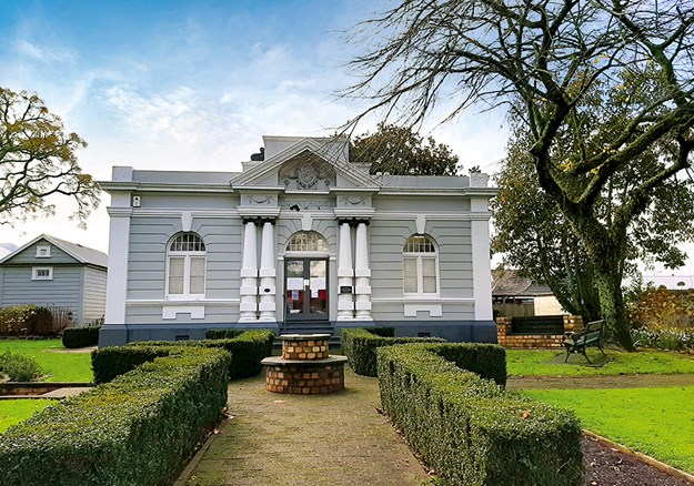
Avoiding a downpour, we scurried into Cambridge Museum, once the courthouse. This was a little gem, full of items relating to Maori, pioneer European, and horse racing history. We learned how the town was established – it once rivalled Hamilton as Waikato’s major settlement. We studied items including a copy of a newspaper written in te reo, dated 1894, and treasured pieces brought from England by early settlers to the district. A porcelain teapot, made in the late 1700s, came from a village near my birthplace in England. I found it amazing that it had survived the journey across the world: it must have been a precious possession.

nzmcd cambridge
Cambridge Museum

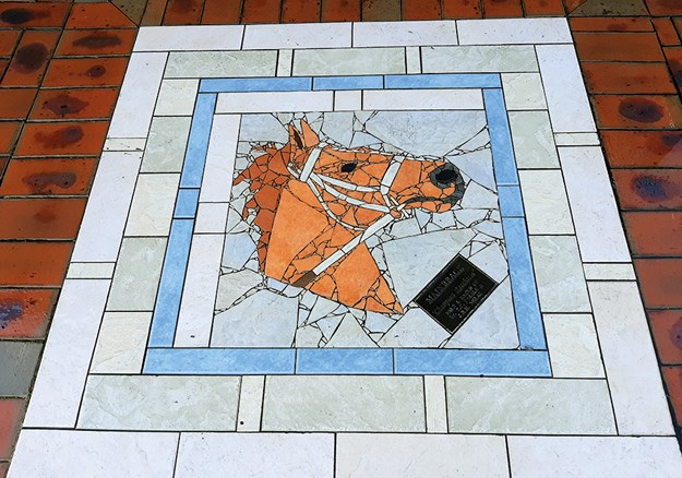
Cambridge is famous for its thoroughbred horses: 13 Melbourne Cup winners have been bred here. Outside the Town Hall there’s a life-sized bronze statue of a mare and foal. Set into the footpaths, mainly along Victoria Street, is a series of 22 mosaics of horses – the most famous being Olympic champion Mark Todd’s Charisma.

nzmcd cambridge
Horse mosaic

DOWN BY THE RIVER

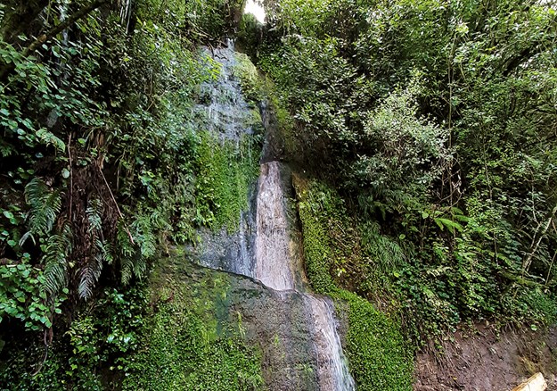
Making the most of some sunshine, we continued along Victoria Street and made our way down to the banks of the Waikato River. The cliffs were sheer and the descent to river level was by way of a steep wooden staircase. We walked the loop track that linked two bridges and took us through bush and past waterfalls. The walkway on the town side is known as the Settlers Track, and leads to the junction of the river with the Karapiro Stream. Steamers carrying passengers and freight used to turn around here, having travelled from Port Waikato.

Victoria Bridge
Victoria Bridge

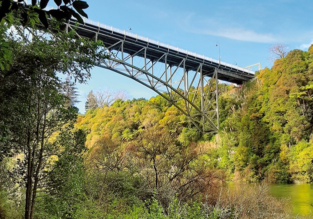
Crossing the bridges to the south bank, we passed through a kauri grove, and then followed the Soldiers Track to Victoria Bridge. From below we had admired this meccano-like structure spanning the river. We were interested to learn that the bridge was the first hinged, arched bridge to be built in Australasia. The components were made in New York and shipped to New Zealand. Photos on the information panels beside the bridge show crowds celebrating the opening in 1907. There are horse-drawn carriages waiting to cross, though cattle and pedestrians were the main users in those days. (Stock commonly crossed it en route to sale yards until the 1960s.) But times were changing and a newspaper noted that "motor cars are becoming almost as numerous as stray cows". A pedestrian footpath was later added and, with another rain shower imminent, we hurried across the bridge and back into town.

nzmcd cambridge
On the Settlers Track

FOODIE & SHOPPING PARADISE

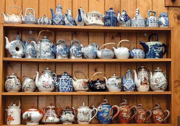
On our second visit, sunny, pre-Christmas Cambridge had a different vibe; the shops, galleries and cafes were festively busy. Malcolm dived into Over the Moon, a cheese shop and deli. The award-winning cheeses here are made by Over the Moon Dairy Company, who handcraft cheese from cow, sheep, goat and buffalo milk. Then we headed to Fran’s Cafe, the unpretentious home of good coffee and food – and more teapots than I’ve ever seen in one place. We’d discovered Fran’s on our previous visit and the food was just as good this time.

nzmcd cambridge
Teapots galore at Fran’s cafe

THE HIDDEN LAKE

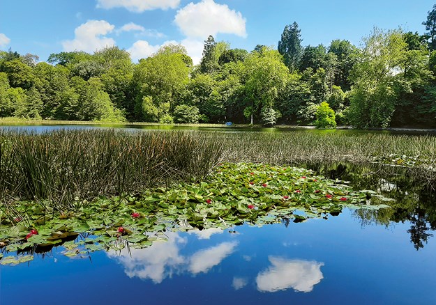
It was perfect weather to explore one of Cambridge’s best-kept secrets, Lake Te Ko Utu. Because the lake nestles below street level, it’s easy to drive past without realising what’s tucked out of sight.

nzmcd cambridge
Lake Te Ko Utu

The lake (also written as Te Koutu and Te Koo Utu) was formed when the eruption from Lake Taupo in 200 AD sent debris down the Waikato River, blocking side streams. Te Ko Utu translates as ‘to scoop up water’: the lake was used by Maori who lived at the adjacent pa. Now it is home to ducks, pukeko and coots (and their chicks).

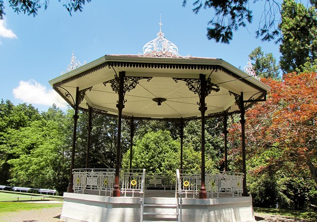
There are gates on Whittaker Road, marking the entrance to the Domain, home to the bowling club, tennis club, gardens, bandstand and other clubrooms, as well as the lake. We had parked our bus on Lake Road and entered the Domain there, walking around the lake at the lower level, admiring the aquatic life and the exotic and native trees.

nzmcd cambridge
The band rotunda

TOWN OF TREES

Cambridge markets itself as the Town of Trees and Champions – early settlers planted many elm, chestnut, oak, plane and gum trees in the town and around the lake. The Cambridge Tree Trust and the Lions Group have done a lot of work labelling trees, building viewing platforms, planting, and caring for the mature trees. Notable species include cedar of Lebanon and kauri. In 1962 a camellia grove was planted.

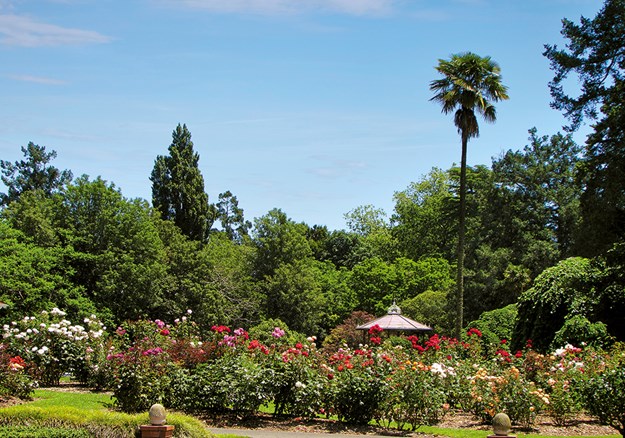
We enjoyed our circuit of the lake so much that we returned to the higher level and took a path that looped around past the Edwardian bandstand and sports clubs. The bandstand, built in 1908 from a kitset shipped from Glasgow, peeked out above a swathe of rose bushes.

The rose gardens
The rose gardens

CHURCHES AND CIDER

Cambridge is blessed with many historic buildings and churches. St Andrews Anglican Church looked like a picture postcard, framed by the trees at the entrance to the Domain. Built in 1861, it contains a peal of six bells and a WW1 memorial window commemorating New Zealand soldiers climbing the walls of Le Quesnoy, France, in the final weeks of the war. The red letterbox beside the church has been used since 1898.

It was another church that drew our attention though. The old Trinity Presbyterian St Pauls Union Church is now home to the Good Union Restaurant. We couldn’t resist the cider brewed by Good George Brewing. I had the Doris plum and Malcolm opted for blood orange. The food was equally delicious.

At the museum we’d picked up brochures, including a walk around the town’s heritage buildings. But we felt we’d done enough walking this hot day, so we drove the bus to the POP where we were staying and relaxed for the rest of the afternoon. There’s so much more to discover in Cambridge though, I’m sure we’ll be back.

MORE INFORMATION

There’s a TOP 10 Holiday Park at 32 Scott Street, Leamington, Cambridge, and for NZMCA members POPs (Park Over Properties) are available. Visit nzmca.org.nz for details. Cambridge i-Site is on the corner of Queen and Victoria streets.

Useful websites:

Friday, 4 June 2021

Matietie Track, Waiheke Island

 This story was recently published in Wilderness Magazine: www.wildernessmag.co.nz


There are over 100km of walking track on Waiheke Island and the Matietie Historic Reserve Track is a good example of what the island has to offer.  We chose the track because it started beside the ferry terminal, which is regularly serviced by the island’s busses - handy when using public transport – and found it a perfect one to two-hour circular walk.

The tide lapped against the rocks of Matiatia Bay as we ducked under the pohutukawas lining the beach.  This ten minute section of the walk is not accessible (or would be a paddle) at high tide but we kept our feet dry and knew the tide was on its way out so we’d be okay on our return too.  A sign marked our turn off the beach and we set off along a wide track through a valley, then uphill, before spotting a marker showing our route leading off through a short area of bush.  This took us to a ridge top road with our track, well-signed, on the other side.


Steps led down from here to Owhanake Bay.  The track was marked as a tramping track, and the DOC website describes the track as being ‘mostly unformed with steep, rough or muddy sections’, but we found it to be well-formed, with wooden stairs on the steeper parts. The track had obviously been up-graded recently.  It was summer and we walked in sandals, not boots as DOC advises, though the track may well be muddy in places during wet periods.

We turned left at Owhanake Bay and the walkway wound around clifftops, giving us peeks through the bush of yachts at anchor below.  As we got closer to Cable Bay our view was of the waters and islands of the Hauraki Gulf.  Cable Bay was memorable for a strange, large, dog-on-wheels sculpture, sitting on a section of railway track.  Sculptures were a feature of the next section of the walk too, as it took us past a number of large properties complete with manicured gardens and interesting and impressive examples of garden art.


As we followed the path southwards it took us through native bush and past hills punctuated by shingly beaches.  Kereru flapped noisily in pohutukawa that clung to the hillsides surrounding these little bays.  Kayakers had pulled their craft ashore in one place and were enjoying a break.  We could have been a million miles away from anywhere when, unexpectedly, the ferry from Auckland appeared and sailed into what looked like another tiny inlet.  Matiatia Bay was revealed around the next headland, the ferry tied up at the jetty.  The track took us down one final slope to the beach and we followed it around to our starting point.  


Friday, 21 May 2021

Paradise in Waipu


This is my latest article, published in Motorhomes, Caravans & Destinations Magazine

Scottish immigrants found an ideal setting in Waipu; locals and holidaymakers feel the same way. Heather Whelan discovers more about this idyllic Northland town

Whelan_18 At the Waipu Pancake Rocks.jpg

The small Northland town of Waipu is unique in that it was settled entirely by Scottish Highlanders, followers of a controversial minister, Norman McLeod. Back in 1817 the group fled from clearances and famine in their homeland and formed a community in Nova Scotia. This thrived until the 1840s, when cold winters and crop failures drove McLeod and some of his followers to leave for Australia. Here they had more bad luck, and they eventually continued to New Zealand. Settling in Waipu, they finally found the haven they were seeking. About 1000 family members and friends joined them from Nova Scotia, and the group became a tight-knit, Gaelic-speaking community.

Whelan_15 Bream Bay views on the coast walk.jpg

SCOTTISH TRADITIONS

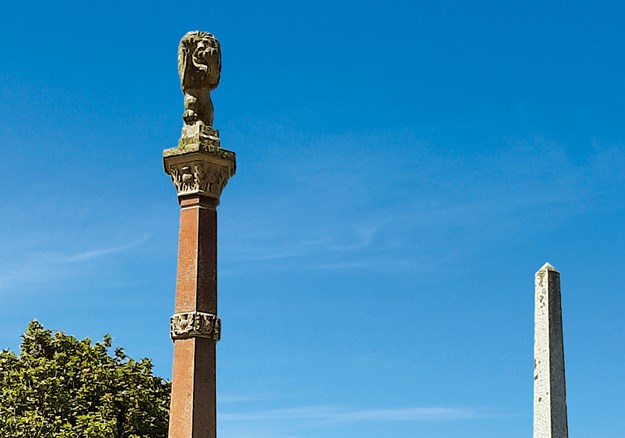
You can’t visit Waipu without being aware of the highland heritage. The town centre is dominated by tall memorials showing the pioneering ships and listing the settlers’ clan names. The adjacent museum sports a large sign of the serious-looking Rev McLeod, and visitors can learn all about the unique settlement. Descendants of the original families who are interested in genealogy will find all the information they desire – and there’s plenty to interest the non-Scots among us too. The museum boasts a UNESCO award and an international reputation.

Whelan_2 Memorials to the Scottish settlers.jpg

Waipu is famous locally for its Highland Games, held on New Year’s Day since 1871 – until Covid-19 put a damper on things. This year the town couldn’t hold the normal shindig: a day-long celebration with pipers, drummers and fiddlers, highland dancing, and shows of strength with tug-of-war teams and caber tossing. However, it did host a market day with stalls along the street and in the Caledonian Barn, and a family carnival at the adjacent park.

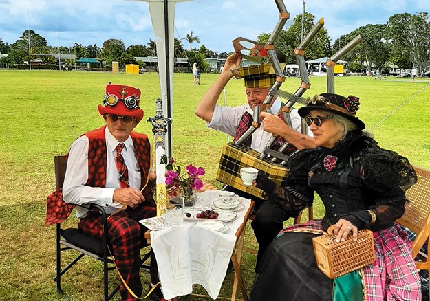
I wandered around the market stalls until I was drawn to a little stage where children were competing in Scottish dancing competitions. It’s not every day you see tiny boys in full Scottish costumes! Past the food stalls a group of steampunk enthusiasts had managed to combine Victoriana with tartan. Who could have imagined steam-powered bagpipes?

Whelan_7 Steampunk meets Scotland.jpg

ART ’N TARTAN

Also on display were some of the creations from previous Art ’n Tartan shows – the town’s wearable art extravaganza. Usually held in mid-winter, the event will be in October this year. It draws competitors from all over the country, and should be even bigger and better this year as it was cancelled last year, again due to Covid-19. The organisers believe the creative entrants will have used the lockdown to work on their designs.

Whelan_8 Art _n Tartan.jpg

Waipu is home to lots of artistic folk. Tucked in among the street stalls is the Old Garage, where I couldn’t resist buying a print by Patsy Montgomery, one of the artists who had work for sale inside. The picture showed tui flying above the river mouth, with Hen/Taranga Island on the horizon. You can see this stunning view on the road between Waipu and Waipu Cove, a short drive away.

COASTAL PARADISE

The Waipu river mouth and estuary are a haven for birds; there’s a wildlife refuge that’s a nesting area for the New Zealand dotterel, variable oystercatcher and fairy tern. Other protected, threatened or rare species visit the area, including the banded dotterel, reef heron, wrybill and Caspian tern. Waipu Cove is buzzing in summer, but the reserve and estuary areas are quieter – a birdwatcher’s paradise.

Whelan_17 Rock formations at Waipu Cove.jpg

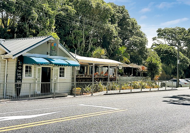
The cove has a long sandy beach with a campground behind the dunes. There’s a traditional little store and, across the road, the Cove Cafe overlooks the beach. I recently had a long lunch with friends there and can thoroughly recommend it. For those who don’t have time to visit Waipu Museum, a look at the impressive murals on the toilet block will provide a quick history lesson. The beach is safe for swimming; it’s patrolled by lifeguards every day during the holiday period and on weekends between Labour Day and Easter. At the southern end, a shallow tidal creek overhung by pohutukawa is a favourite spot for littlies to splash around and build sand castles.

PANCAKE ROCKS

Across the creek there’s the start of one of our favourite walks – to Waipu’s own ‘pancake rocks’. This track has been created and maintained by the local Lions Club and takes walkers through magnificent coastal scenery. In some parts there are ancient pohutukawa forests, and the views across Bream Bay to the Hen and Chicken Islands and the Whangarei Heads are stunning.

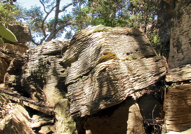
The most fascinating features of the walk are the pancake rocks, similar to the famous ones at Punakaiki. These limestone outcrops, dating back 36 million years, have weathered to the unusual stack-of-pancakes shape after being exposed to the elements. Unlike at Punakaiki though, Waipu’s rocks are never crowded with tourists, and they are unfenced: in some places the track goes through and over them.

Whelan_10 Waipu shopping.jpg

Whelan_14 Coastal dining.jpg

SHOPPING AND DINING

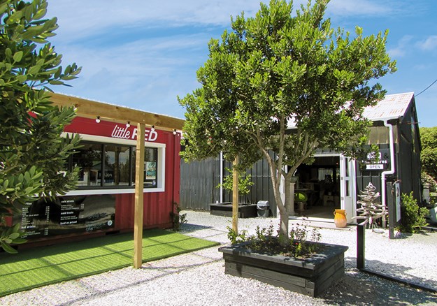
The township is fun to explore. As well as the supermarket, hardware store, butcher and chemist, there are antique and op shops to rummage through. Goody Goody Deli and Cafe, rebuilt after a fire a couple of years ago, is better than ever. Across the road there are a couple of summertime pop-ups, Little Red Coffee and the Black Barn Homewares store.

Whelan_3 McLeod_s Pizza Barn.jpg

In the evening McLeod’s Pizza Barn and Brewery is the place to eat. In what was once the town’s post office, you can sample a range of hand-made pizzas and award-winning beers, including Black Watch Imperial Dark Ale and (of course) Paradise Pale Ale.

Whelan_20 Jazz Festival at Waipu Cove.jpg

FIND OUT MORE

  • Waipu hosts lots of markets. Street markets are held on Easter Saturday and the Sundays of Auckland Anniversary, Queen’s Birthday and Labour Weekend. Antique markets are also held on these Sundays. Boutique markets are held the second Sunday of each month, with crafts, food and music.
  • The town has plenty to offer music lovers, especially during summer. We recently enjoyed an afternoon of jazz at a farm overlooking Waipu Estuary, and a Scottish folk music duo at the church hall.
  • The Waipu Cove walkway is a 2km track taking about 1.5 hours to Waterman Drive. There’s an extension to Ding Bay that takes a further 45 minutes.
  • Information about camping at Waipu Cove: campwaipucove.com. There’s a DOC campground at Uretiti, o SH1, 5km north of Waipu. Caledonian Park has an area for motorhome parking, with powered sites and an honesty box.
  • Details of the museum opening times and prices: waipumuseum.com