Friday, 4 June 2021

Matietie Track, Waiheke Island

 This story was recently published in Wilderness Magazine: www.wildernessmag.co.nz


There are over 100km of walking track on Waiheke Island and the Matietie Historic Reserve Track is a good example of what the island has to offer.  We chose the track because it started beside the ferry terminal, which is regularly serviced by the island’s busses - handy when using public transport – and found it a perfect one to two-hour circular walk.

The tide lapped against the rocks of Matiatia Bay as we ducked under the pohutukawas lining the beach.  This ten minute section of the walk is not accessible (or would be a paddle) at high tide but we kept our feet dry and knew the tide was on its way out so we’d be okay on our return too.  A sign marked our turn off the beach and we set off along a wide track through a valley, then uphill, before spotting a marker showing our route leading off through a short area of bush.  This took us to a ridge top road with our track, well-signed, on the other side.


Steps led down from here to Owhanake Bay.  The track was marked as a tramping track, and the DOC website describes the track as being ‘mostly unformed with steep, rough or muddy sections’, but we found it to be well-formed, with wooden stairs on the steeper parts. The track had obviously been up-graded recently.  It was summer and we walked in sandals, not boots as DOC advises, though the track may well be muddy in places during wet periods.

We turned left at Owhanake Bay and the walkway wound around clifftops, giving us peeks through the bush of yachts at anchor below.  As we got closer to Cable Bay our view was of the waters and islands of the Hauraki Gulf.  Cable Bay was memorable for a strange, large, dog-on-wheels sculpture, sitting on a section of railway track.  Sculptures were a feature of the next section of the walk too, as it took us past a number of large properties complete with manicured gardens and interesting and impressive examples of garden art.


As we followed the path southwards it took us through native bush and past hills punctuated by shingly beaches.  Kereru flapped noisily in pohutukawa that clung to the hillsides surrounding these little bays.  Kayakers had pulled their craft ashore in one place and were enjoying a break.  We could have been a million miles away from anywhere when, unexpectedly, the ferry from Auckland appeared and sailed into what looked like another tiny inlet.  Matiatia Bay was revealed around the next headland, the ferry tied up at the jetty.  The track took us down one final slope to the beach and we followed it around to our starting point.  


Friday, 21 May 2021

Paradise in Waipu


This is my latest article, published in Motorhomes, Caravans & Destinations Magazine

Scottish immigrants found an ideal setting in Waipu; locals and holidaymakers feel the same way. Heather Whelan discovers more about this idyllic Northland town

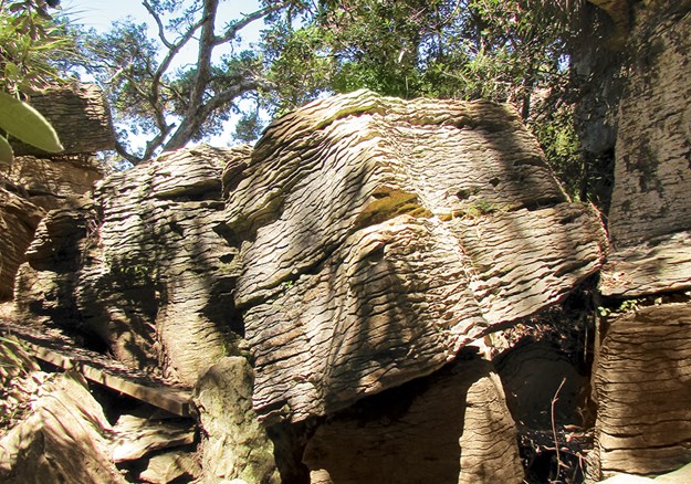
Whelan_18 At the Waipu Pancake Rocks.jpg

The small Northland town of Waipu is unique in that it was settled entirely by Scottish Highlanders, followers of a controversial minister, Norman McLeod. Back in 1817 the group fled from clearances and famine in their homeland and formed a community in Nova Scotia. This thrived until the 1840s, when cold winters and crop failures drove McLeod and some of his followers to leave for Australia. Here they had more bad luck, and they eventually continued to New Zealand. Settling in Waipu, they finally found the haven they were seeking. About 1000 family members and friends joined them from Nova Scotia, and the group became a tight-knit, Gaelic-speaking community.

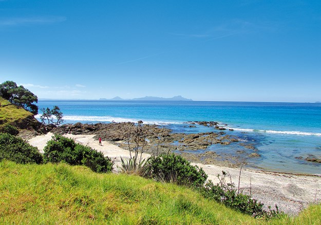
Whelan_15 Bream Bay views on the coast walk.jpg

SCOTTISH TRADITIONS

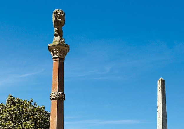
You can’t visit Waipu without being aware of the highland heritage. The town centre is dominated by tall memorials showing the pioneering ships and listing the settlers’ clan names. The adjacent museum sports a large sign of the serious-looking Rev McLeod, and visitors can learn all about the unique settlement. Descendants of the original families who are interested in genealogy will find all the information they desire – and there’s plenty to interest the non-Scots among us too. The museum boasts a UNESCO award and an international reputation.

Whelan_2 Memorials to the Scottish settlers.jpg

Waipu is famous locally for its Highland Games, held on New Year’s Day since 1871 – until Covid-19 put a damper on things. This year the town couldn’t hold the normal shindig: a day-long celebration with pipers, drummers and fiddlers, highland dancing, and shows of strength with tug-of-war teams and caber tossing. However, it did host a market day with stalls along the street and in the Caledonian Barn, and a family carnival at the adjacent park.

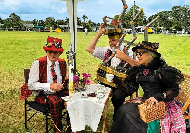
I wandered around the market stalls until I was drawn to a little stage where children were competing in Scottish dancing competitions. It’s not every day you see tiny boys in full Scottish costumes! Past the food stalls a group of steampunk enthusiasts had managed to combine Victoriana with tartan. Who could have imagined steam-powered bagpipes?

Whelan_7 Steampunk meets Scotland.jpg

ART ’N TARTAN

Also on display were some of the creations from previous Art ’n Tartan shows – the town’s wearable art extravaganza. Usually held in mid-winter, the event will be in October this year. It draws competitors from all over the country, and should be even bigger and better this year as it was cancelled last year, again due to Covid-19. The organisers believe the creative entrants will have used the lockdown to work on their designs.

Whelan_8 Art _n Tartan.jpg

Waipu is home to lots of artistic folk. Tucked in among the street stalls is the Old Garage, where I couldn’t resist buying a print by Patsy Montgomery, one of the artists who had work for sale inside. The picture showed tui flying above the river mouth, with Hen/Taranga Island on the horizon. You can see this stunning view on the road between Waipu and Waipu Cove, a short drive away.

COASTAL PARADISE

The Waipu river mouth and estuary are a haven for birds; there’s a wildlife refuge that’s a nesting area for the New Zealand dotterel, variable oystercatcher and fairy tern. Other protected, threatened or rare species visit the area, including the banded dotterel, reef heron, wrybill and Caspian tern. Waipu Cove is buzzing in summer, but the reserve and estuary areas are quieter – a birdwatcher’s paradise.

Whelan_17 Rock formations at Waipu Cove.jpg

The cove has a long sandy beach with a campground behind the dunes. There’s a traditional little store and, across the road, the Cove Cafe overlooks the beach. I recently had a long lunch with friends there and can thoroughly recommend it. For those who don’t have time to visit Waipu Museum, a look at the impressive murals on the toilet block will provide a quick history lesson. The beach is safe for swimming; it’s patrolled by lifeguards every day during the holiday period and on weekends between Labour Day and Easter. At the southern end, a shallow tidal creek overhung by pohutukawa is a favourite spot for littlies to splash around and build sand castles.

PANCAKE ROCKS

Across the creek there’s the start of one of our favourite walks – to Waipu’s own ‘pancake rocks’. This track has been created and maintained by the local Lions Club and takes walkers through magnificent coastal scenery. In some parts there are ancient pohutukawa forests, and the views across Bream Bay to the Hen and Chicken Islands and the Whangarei Heads are stunning.

The most fascinating features of the walk are the pancake rocks, similar to the famous ones at Punakaiki. These limestone outcrops, dating back 36 million years, have weathered to the unusual stack-of-pancakes shape after being exposed to the elements. Unlike at Punakaiki though, Waipu’s rocks are never crowded with tourists, and they are unfenced: in some places the track goes through and over them.

Whelan_10 Waipu shopping.jpg

Whelan_14 Coastal dining.jpg

SHOPPING AND DINING

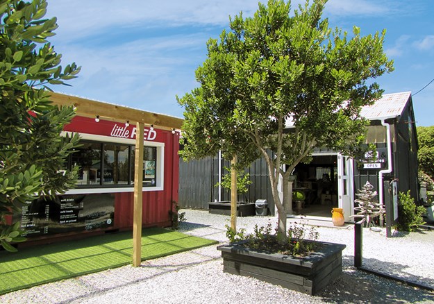
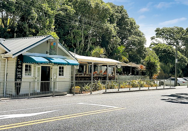
The township is fun to explore. As well as the supermarket, hardware store, butcher and chemist, there are antique and op shops to rummage through. Goody Goody Deli and Cafe, rebuilt after a fire a couple of years ago, is better than ever. Across the road there are a couple of summertime pop-ups, Little Red Coffee and the Black Barn Homewares store.

Whelan_3 McLeod_s Pizza Barn.jpg

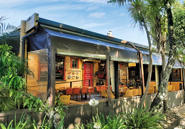
In the evening McLeod’s Pizza Barn and Brewery is the place to eat. In what was once the town’s post office, you can sample a range of hand-made pizzas and award-winning beers, including Black Watch Imperial Dark Ale and (of course) Paradise Pale Ale.

Whelan_20 Jazz Festival at Waipu Cove.jpg

FIND OUT MORE

  • Waipu hosts lots of markets. Street markets are held on Easter Saturday and the Sundays of Auckland Anniversary, Queen’s Birthday and Labour Weekend. Antique markets are also held on these Sundays. Boutique markets are held the second Sunday of each month, with crafts, food and music.
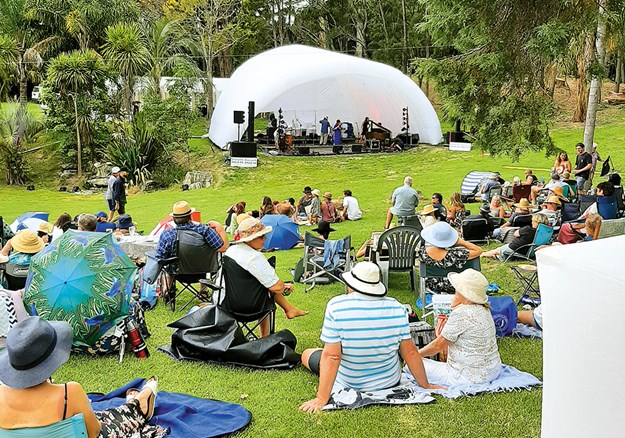
  • The town has plenty to offer music lovers, especially during summer. We recently enjoyed an afternoon of jazz at a farm overlooking Waipu Estuary, and a Scottish folk music duo at the church hall.
  • The Waipu Cove walkway is a 2km track taking about 1.5 hours to Waterman Drive. There’s an extension to Ding Bay that takes a further 45 minutes.
  • Information about camping at Waipu Cove: campwaipucove.com. There’s a DOC campground at Uretiti, o SH1, 5km north of Waipu. Caledonian Park has an area for motorhome parking, with powered sites and an honesty box.
  • Details of the museum opening times and prices: waipumuseum.com

Friday, 5 March 2021

Hidden Treasures: Kai Iwi to Pouto

 Heather Whelan and partner Malcolm discover some peaceful and picturesque spots near Dargaville

Whelan_23 Shipwreck remains at Pouto.jpg
Shipwreck remains at Pouto

The weather was forecast to be good for a few days, so we stocked up our bus and headed west from Whangarei – first stop the Kai Iwi Lakes. These rain-fed, freshwater lakes are part of a 538-hectare recreational reserve, 35km north-west of Dargaville, and are popular with campers, fishermen and those who enjoy water sports.

There are two campgrounds on the shores of Lake Taharoa, the largest of the Kai Iwi Lakes. One is called Pine Beach – though the pines have been removed in recent years – and the other is at Promenade Point. We didn’t plan to stay overnight, so parked overlooking Marina Bay and set off to walk around the lake. There are tracks around all three of the lakes, and side paths lead to Lake Waikare and Lake Kai Iwi from the Lake Taharoa track. On a hot afternoon we thought the 8km loop would give us enough exercise, so stuck to the main track.

We started our stroll at the boat ramp, where a group were launching jet skis. Visitors can enjoy a whole range of water activities on Lake Taharoa and Lake Waikare, including waka ama, kayaking, sailing, windsurfing, water skiing, fishing and swimming. However, motorised craft are not allowed on Lake Kai Iwi.

Whelan_1 Lake Taharoa, Kai Iwi Lakes.jpg
Lake Taharoa, Kai Iwi Lakes

Lake Taharoa is New Zealand’s third largest dune lake and the country’s deepest. The lakes were formed 1.8 million years ago when rain fell in depressions of sand that had impermeable ironstone pans beneath them. There are no inlets or outlets so the depth in the lakes can vary, as can the water temperature; extremes range from 12C to 21C.

Kai Iwi Lakes have unique biodiversity and are home to many native species, some endangered. Bird life includes the North Island brown kiwi, white-faced heron, paradise shelduck, grey teal and the Australasian bittern. Rainbow trout were introduced in the 1960s.

Kai Iwi means ‘food for the people’ and early Maori settlers in the area enjoyed catching fish and eels in the lakes. During times of war, injured warriors recuperated at the lakeside. Later kauri gum diggers built huts in the area, however this industry died out in the 1920s, leaving little trace.

There were plenty of campers at Pine Beach, enjoying the shallow waters fronting the campground, the children’s playground, and generally relaxing. One family were unloading bikes as the loop tracks are suitable for cycling as well as walking.

Our path continued beside crystal-clear water and golden sandy beaches, giving the lake a tropical look. There were few walkers on the track as we passed the aptly named Sandy Bay and continued past Deep Water Cove to the strangely named Sin Bin area and on to Promenade Point. The campground here has fewer facilities than Pine Beach and is described as a relaxed kiwiana experience.

We arrived back at our bus after taking just over two hours to walk the Lake Taharoa loop. We stayed for a while longer, and then headed into Dargaville.

Whelan_7 Sunset at the Dargaville NZMCA Park.jpg
Sunset at the Dargaville NZMCA Park

HISTORIC DARGAVILLE

We always enjoy staying at the NZMCA Park, which is situated picturesquely at the junction of the Kaihu and Wairoa rivers. We spent happy hour – actually close to two hours – chatting with other motorhomers in one of the historic boatsheds that once belonged to Thompson Boat Builders.

Whelan_8 The NZMCA Park beside the Kaihu River.jpg
The NZMCA Park beside the Kaihu River

Swedish-born Erik Thompson was the first of three generations of boat builders to produce craft here. Hundreds of launches, sailing boats and whalers were constructed from kauri over the years, the most famous being the whaleboats constructed for Ernest Shackleton’s 1907-1909 Antarctic expedition. Full-scale drawings of these were discovered sketched out in pencil on the boatshed’s loft floor.

Earlier we’d strolled along Dargaville’s waterfront from the band rotunda, past the Boating Club and through the Riverside Gardens. Prominent at the junction of Parenga Street and Hokianga Road is a statue erected as a tribute to the area’s early gum diggers, who came mainly from Dalmatia (now Croatia).

Whelan_9 Statue commemorating gum diggers.jpg
Dargaville honours the memory of its gum diggers

There’s a brochure available at the information centre that details a 5km walking trail around Dargaville’s historic buildings. We just looked at some of the sites, including the ‘petticoat houses’, six identical cottages built for workers at the Dairy Company. They were built with fireplaces but you had to pay extra for a chimney!

Whelan_5 View of Lake Taharoa with Maunganui Bluff in the distance.jpg
Lake Taharoa with Maunganui Bluff in the distance

The following day we went to discover more local history at the Dargaville Museum. There’s a wealth of information here about early European pioneers, especially the gum diggers. Another section of the museum is dedicated to shipwrecks, as the Pouto Peninsula and Kaipara Harbour entrance were notorious for shifting shoals and a dangerous bar.

Whelan_12 Reconstructed gum diggers huts at Dargaville Museum.jpg
Reconstructed gum diggers’ huts at Dargaville Museum

Among the flotsam and jetsam displayed are portholes, anchors and substantial parts of ships and boats dug up from the sands of the area. These range from a punt used from the 1880s to the 1950s, an American ship built in 1870, and the Mathieu, wrecked in 1885.

PLACE OF HIDDEN TREASURES

From Dargaville we drove south on the Pouto Peninsula. This 55km long spit stretches from Dargaville to Pouto Point, separating the Kaipara Harbour from the Tasman Sea. Described as one of Northland’s best-kept secrets, the peninsula is off the beaten tourist track. Visitors and bach owners enjoy a quiet spot for fishing – Pouto means float for a fishing net – though tourist information describes it as ‘the place of hidden treasures’.

Whelan_16 Te Kopuru Church with Maungaraho Rock on the horizon.jpg
Te Kopuru Church with Maungaraho Rock on the horizon

Our first stop along the road was the little settlement of Te Kopuru. Once a thriving town with sawmills and a shipbuilding industry, in its heyday Te Kopuru had a population of 3000. It had banks, shops, a post office, church, library and cinema, but when the kauri was all gone the town’s prosperity dwindled. Now Te Kopuru has only a school, a post office/ store, a pretty wooden church and a community veggie garden.

Whelan_17 Entrance to the community gardens.jpg
The community veggie garden in the tiny settlement of Te Kopuru

It also has what must be Te Kopuru’s most photographed spot. Near the church on the main street there’s an old villa that has its garden decorated with hundreds of fishing floats and buoys. As well as the floats there are old ropes, fishing nets, sails, shells, whale bones and structures made from all kinds of things thrown up by the tide. It’s worth stopping in Te Kopuru just to gaze at this whimsical place. 

Whelan_18 Quirky garden decoration at Te Kopuru.jpg
Hundreds of floats and buoys decorate this garden in Te Kopuru

The road down the peninsula is sealed until the turn for Kellys Bay. From here the road to Pouto Point is gravelled, as is Kellys Bay Road. We took a short detour to the little community and parked on the grass beside the beach. While we enjoyed our morning tea we watched flocks of terns, oyster-catchers, stilts and gulls advance towards us as the incoming tide gave them wet feet. There’s a campground at the end of the road with some powered sites and lots of room for self-contained campers. Facilities are minimal here with long drop toilets and solar showers, but the beach is safe for children and is a good spot for catching flounder.

Finally we arrived at Pouto Point and parked beside the hall at the tiny campground. We signed in across the road and settled down to enjoy stunning views across the Kaipara Harbour. It’s always been hard for boats to enter the harbour, as evidenced by the remains of wrecks we’d seen at the Dargaville Museum. Maori history tells how the captain of the waka Mahuhu drowned when his ship was wrecked at the entrance. Both Cook and Tasman sailed by, leaving Marion du Fresne to be the first European explorer to identify the entrance, though it was 1836 before the first European sailors made their way into the harbour.

Whelan_21 At Pouto Campground.jpg
A fine view of the Kaipara Harbour at Pouto campground


Although the entrance was known as ‘the graveyard’ (there have been 113 recorded shipwrecks), the harbour offered ease of access to lucrative kauri. Early charts were misleading, and sandbars shifted constantly, but many sailing captains took the risk and entered. By 1884 there was a lighthouse, a signal station and custom house at Pouto. (In fact, the Marine Hall at the campground is the old custom house, New Zealand’s first.)

It’s a 7km walk out to Pouto lighthouse (disused since 1952 and now maintained by Heritage New Zealand) followed by an energetic 10-15 minute climb up steep dunes, but we opted for a stroll along the beach. We were delighted to come across the remains of a boat’s ribs protruding from the sand; another of the ‘graveyard’s’ wrecks coming to light, to be either recovered or reburied by the shifting sands.

FURTHER INFORMATION

  • Details about the camping grounds at Kai Iwi Lakes can be found at: kaiiwicamp.nz. There are limited power sites at Palm Beach and it is vital to book sites in both camps in advance in summer and on holiday weekends.
  • The NZMCA Park is at 2 River Road, Dargaville. Overnight parking is also available at Dargaville Museum, $15 per night, $12 for NZMCA members.
  • Phone 09 4390781 or 0274 509473 to book at Kellys Bay Reserve Campground.
  • Pouto Marine Hall Campground is at 16 Signal Station Road, Pouto.
  • At Kai Iwi Lakes the Lake Taharoa track is an easy 8km, Lake Waikare and Lake Kai Iwi are both 4km. There is also a walk along the beach from Kai Iwi to Maunganui Blu , 1.5 hours one way.

Thursday, 1 October 2020

Love and Lemons - Exploring Paeroa and Te Aroha

This is my latest story in Motorhomes, caravans & Destinations Magazine


 Heather Whelan discovers there’s more to the quiet townships of Paeroa and Te Aroha than soda water

Whelan_14 Te Aroha Hot Pools.jpg
Te Aroha Hot Pools

Linked by SH26, bounded by the Kaimai Ranges and Hauraki Plains, Paeroa and Te Aroha are often overlooked by visitors. ey are relaxing places to visit, a far cry from the days when they were busy settlements, swarming with gold miners and tourists.

Voyage back through time

European history in the Paeroa area dates back to 1769, when Captain Cook anchored the Endeavour near the mouth of the Waihou River – which he renamed the Thames – and a small party explored inland. After visiting a nearby pa, they continued for about 14 nautical miles. Here the party disembarked to explore the forest that grew beside the riverbanks. Cook was impressed by the size of some kahikatea; he measured the height of one and declared it to be ‘eighty-nine feet and as straight as an arrow’. is was the furthest inland that Cook would venture in New Zealand. His discovery of timber suitable for mast-building led to the arrival of many other ships and pioneering settlers.

Whelan_6 Paeroa Maritime Museum.jpg
The Paeroa Historical Maritime Museum is home to a treasure trove of artefacts

Later, when gold was discovered in the Karangahake Gorge, the small town of Paeroa became a staging post for goods and machinery that were brought up the Waihou River to supply the ‘rush’. The river had a regular passenger and cargo service until 1947.

Whelan_8 Steamship memorabilia.jpg
Steamship memorabilia

We learned all this and more as we explored the Paeroa Historical Maritime Park and Museum, at the site of the old Puke Wharf. This small museum is a treasure trove of information and artefacts related to the area, as well as boating in general. There were detailed models of yachts and ships – including the Endeavour, the Victory and the Cutty Sark – paintings, flags, nautical instruments and all manner of maritime memorabilia.

Outside, we contemplated the remains of the paddle steamer Kopu, salvaged after 40 years on the riverbed. Built in ames in 1896, the Kopu had an illustrious history with the Northern Steamship Company and it is hoped she can be restored one day.

Whelan_9 Paeroa Maritime Museum.jpg
The propellor of the Manawanui

Famous fizz

Paeroa is synonymous with L&P, the much-loved zzy beverage. e town’s huge bottle is a Kiwi icon and everyone likes to get a photo beside it. Surprisingly, it was originally a space rocket, built for the Christmas celebrations in 1967 and subsequently developed into the big bottle we all know so well.

The Paeroa soda spring was well known to Maori and early settlers. Bubbling up from a paddock, it was not only thirstquenching, but was claimed to have health-giving properties. The miners used it as a hangover cure. After some enterprising people added slices of lemon to their water, Lemon & Paeroa was born.

Whelan_3 Antique shops galore, Paeroa.jpg
Paeroa is a mecca for lovers of antiques...

Antiques galore

Paeroa markets itself as the country’s ‘antiques capital’ and we always love browsing around the many stores. Although there was motorhome parking at the museum, we preferred to join the row of buses and vans parked beside the Hauraki Rail Trail, a few minutes’ walk from the town centre. Once settled, we headed for the antique shops and spent a long time surrounded by everything from china and glassware to vintage linen, toys, jewellery, clocks and much more.

Whelan_2 The historic Paeroa Hotel.jpg
The historic Paeroa Hotel

There’s a whole block of antique shops, bounded by Granville’s at one end and Arkwrights at the other, and a smattering of stores on nearby streets. We headed back to our bus for coffee, intending to continue browsing later, but had run out of stamina. Ah well, there’s always next time.

Whelan_4 (alternative!) Antique shop interior.jpg
... you could spend the whole day fossicking

Town of flowing love

The nearby town of Te Aroha is said to have been named by a Maori chief, who spied his home from the mountain, the highest point in the Kaimai Range, and declared, "Te Aroha-a-uta," or in English, ‘love flowing inland’.

A township developed at the foot of the mountain when gold was discovered in 1880. The boom didn’t last long, but an area containing hot springs became a popular spot with miners as well as local Maori. After Ngati Rahiri chief Mokena Hau gifted the land to the government to be used as a public reserve, the Hot Springs Domain was developed as a spa. In its Victorian and Edwardian heyday the springs attracted thousands of visitors, but its popularity waned in the early 20th century.

Whelan_20 Te Aroha town centre.jpg
Te Aroha town centre

Today the Hot Springs Domain is a picturesque example of an Edwardian spa complex. We always wander through the grounds and go for a soak at what’s now called Te Aroha Leisure Pools. The adjacent Number Two Bathhouse, the last remaining in the domain, has recently opened after a 13-year hiatus.

It has had an $188,000 refurbishment, and now boasts a glass wall at the end of the pool. Bathers can look down on the old piles and rocks where warm mineral water used to bubble up to heat the pool.

Whelan_12 Newly restored bathhouse, Te Aroha.jpg
Te Aroha’s newly restored bathhouse

Unfortunately the 15-minute sessions at the bathhouse were booked out; we couldn’t get a slot for three days! Instead we took refuge in the Number 15 Spring and Shelter, a hot spa pool that overlooks the leisure pool. We usually visit in midsummer; now, in mid-winter clouds of steam billowed up into the cold, clear blue skies.

Whelan_1 Recently purchased bus with the iconic bottle in the background.jpg
Malcolm with the new bus and the iconic bottle in the background

Te Aroha and lemon

You can spend several hours walking around the Domain. There’s an information office at the entry on Whitaker Street, where we picked up a brochure that lists 21 points of interest.

Number three on the list is the Mokena Geyser, named for the chief who gifted the land. The geyser was caused by drilling work which created the only hot soda water geyser in the country.

Whelan_7 L_P wasn_t Paeroa_s only brew.jpg
L&P wasn't Paeroa's only brew

What was once called the Cadman Bath House is now the centrepiece of the Domain. Described in 1902 as the best appointed bathhouse in the southern hemisphere, it is now the Te Aroha & District Museum.

Inspecting exhibits here, we discovered that a drink called Te Aroha and Lemon was created 19 years before its more famous rival down the road in Paeroa. Launched in 1888, the fizzy drink was produced until the 1960s. Visitors to the spa not only bathed in the waters, they drank them too. Te Aroha’s mineral water was claimed to cure everything from bladder problems to gout.

Whelan_17 Parked beside the Te Aroha Domain.jpg
Parked beside the Te Aroha Domain

Walking trails

For walkers there’s plenty of choice in Te Aroha. Starting beside the Mokena Geyser, there’s a track up to the summit of Mount Te Aroha. Malcolm and I walked for about 45 minutes up this track to the Whakapipi Lookout, from where we had great views across the Hauraki Plains. From here I returned to Te Aroha to browse around the shops, while Malcolm continued on to the summit. At the top he looked down into the Bay of Plenty and right across the Waikato.

Whelan_21 On the wetlands walk.jpg
On the wetlands walk

One summer’s evening we strolled around the Howarth memorial Wetlands. There’s a freedom camping area for self-contained vehicles at Spur Street, close beside the start of the track. It’s an hour’s easy loop-walk around the wetlands, on a formed track with areas of boardwalk. There’s a bird-watching point where you might spot king sher and heron, pied stilt, grey teal, black shag and pukeko. At one point the wetlands pass close to the Waihou River, where a group of youngsters were cooling off by jumping into the water from a handy tree.

Whelan_18 One of Adrian Worsley_s wacky sculptures.jpg
One of Adrian Worsley’s wacky sculptures

Summer or winter, there’s plenty to explore in Te Aroha and Paeroa. We’re planning to revisit; we want to have a soak in the newly restored bathhouse in Te Aroha – and we definitely need to spend more time in Paeroa’s antique shops.

FURTHER INFORMATION

  • There are a variety of places to stay in the area. Self-contained campers can stay at the Paeroa Maritime Park for $15 per night. In Paeroa the overnight parking is $5. Freedom camping is allowed at Spur Street, Te Aroha, for a maximum of four consecutive nights.
  • Paeroa’s Information Centre is on Normanby Road; Te Aroha’s i-SITE is at the Domain entrance on Whitaker Street.
  • Te Aroha’s Wetland Track is an easy one-hour loop; Te Aroha Summit Track is a tramping track and takes three hours one way.
  • Useful websites: historicalmaritimepark.co.nztearohamineral spas.co.nz.

Sunday, 26 July 2020

Go Gisborne!

This is my latest article, published in Motorhomes, Caravans & Destinations

From soaking in hot springs to cycling adventures and adrenalin-fuelled rock sliding, there’s something for everyone in Gisborne
nzmcd go gisborne Whelan_10 On the Wainui-Makorori Headland.jpg
On the Wainui Makorori Headland

It was 8.15am when my partner Malcolm and I arrived at the railway line at Muriwai, just south of Gisborne, and the day was already hot. We were all set for a cycling adventure on Gisborne Railbikes, a unique concept thought up by Geoff Main, the director and driving force behind the venture. Geoff greeted us and showed us our bikes, which sit side by side, rigidly connected and attached to the rails. The other cyclists on today’s ride had chosen the e-bike option but we were happy with standard bikes, which came complete with a basket at the front and packs behind to carry whatever we’d brought for morning tea.
The 16km section of disused railway line took us through a bush-filled valley, over wooden bridges that spanned rivers and roads, before reaching the first tunnel. Geoff checked we had our lights switched on and we pedalled into the darkness. Then it was back into the sunshine again before entering another tunnel, finally emerging at the coast. We cycled along, admiring views from cliffs 140 metres above sea level, before reaching the end of the line. Literally. Stormy weather had caused a slip that left the track twisted and suspended in mid air. After taking photographs of the dramatic sight, we retraced our route for a few minutes to the picnic spot. Geoff produced chairs from a shed beside a grassy area and we ate our snacks while enjoying the sea view.
nzmcd go gisborne Whelan_5 The bikes were easy to use.jpg
The bikes were easy to use
Geoff hopes that in the future riders will be able to take the rails all the way to Wairoa but for now the ride is a there-and-back-again trip. Going back was fun, we’d barely noticed the slow incline on the outward journey but the return trip was definitely downhill – we hardly needed to pedal at all. Four hours after leaving we were back at Muriwai, having enjoyed a really unique experience.
nzmcd go gisborne Whelan_3 Clifftop views.jpg
Clifftop views

Historic Gisborne

Gisborne City began its life as a commercial centre in 1831 when 23-year-old John Harris set up a trading post. Soon the port was thriving, as local Maori grew potatoes, flax and wheat for export.
Maori had sailed from Polynesia and settled in the area more than 650 years ago, naming their new home Turanga. Links to their seafaring heritage can be seen at the small harbour on the Esplanade where two double-hulled sailing waka are moored. The Tahitian waka Fa’afaite is in Gisborne following last year’s Tuia celebrations, while the waka hourua Tairāwhiti offers cultural and sailing trips. This is on the bucket list for our next visit.
Gisborne is famously the first place in the world to see the light of the new day. It is also famous for its surf beaches, having some of the best breaks in the country, but for non-surfers there are lots of other options, such as parks, walkways and cycle paths.
The i-SITE has plenty of brochures – we found a short walk in one that took us to the top of the Wainui-Makorori headland. We didn’t get there early enough to see the sunrise but we did have great views, especially to the south over Wainui Beach to Tuahine Point and Young Nick’s Head.
We also strolled along Gisborne’s palm tree-lined main street, Gladstone Road, towards the art deco clock tower, with a stop for lunch at one of the many cafes and a lengthy peruse through the bookshop.
go gisborne Whelan_15 Entering 'the Cathedral'.jpg
Entering ‘the Cathedral’

Beautiful Botanics 

There are more walks at Eastwoodhill, New Zealand’s National Arboretum, a 30 minute drive from Gisborne. The arboretum boasts more than 25kms of walking tracks looping around its 100 hectares, allowing visitors to discover over 3500 different trees, shrubs and climbing plants. The arboretum is home to the largest collection of Northern Hemisphere trees south of the equator as well as many species of native and exotic birds.
The arboretum began in 1910 when Douglas Cook bought the farm he called Eastwoodhill. Cook spent the next 50 years expanding the plantings before selling the arboretum to H B (Bill) Williams. The Williams family gifted Eastwoodhill to the people of New Zealand and it is now administered by a trust.
We picked up a map in the visitor centre and decided to follow the 3km purple walk (the six trails have coloured leaf signs to keep you on track). This took us along some of Eastwoodhill’s higher ground and gave great views of the arboretum. As the track zigzagged down we came to a Canadian-style cabin with a sign that told us that it had been used as accommodation for naturists in the past, and that Douglas Cook used to keep a supply of sherry here, so his guests could stop for a glass on their walks.
nzmcd go gisborne Whelan_14 Magestic trees at Eastwoodhill.jpg
Magestic trees at Eastwoodhill
In one place there was an area where the tall trees were cathedral-like and, we discovered, this was what Cook had in mind when he planted the cypress and eucalyptus trees here. During a visit to England in 1936 Cook took note of the outline and proportions of Westminster Abbey. On his return to Eastwoodhill he planted cypress and eucalyptus to represent a cathedral. By the 1950s the foliage drooped to ground level, creating an enclosed private space. The trees were planted too closely and the effect is now lost, though the area still has a spiritual feel. One tree that formed a pillar in ‘the cathedral’ is, at 53 metres in height, the tallest tree at Eastwoodhill.
Close to the visitor centre is Eastwoodhill’s Fibonacci spiral. Constructed from volcanic rock and limestone, the spiral radiates out from a 750kg rock ball that floats in a pool. Water pressure eliminates friction, which means the ball can be rotated easily.
nzmcd go gisborn eWhelan_9 Gisborne street art.jpg
Gisborne street art
nzmcd go gisborne Whelan_8 The waka Fa'afaite with Tairawhiti in the background.jpg
The waka Fa’afaite with Tairawhiti in the background

Free fun 

If you turn right when you leave Eastwoodhill and drive about 10 minutes further along the Wharekopae Road there’s a sign for Rere Falls. This pretty waterfall is not high but it is wide – and when there is plenty of water pouring over it you can walk behind the cascade. There’s a swimming hole and picnic area too – but we didn’t stay long because we wanted to see the ‘world famous in New Zealand’ Rere Rockslide, just a little further up-river.
go gisborne Whelan_17 Rere Falls.jpg
Rere Falls
This natural playground is composed of a 60-metre-long mossy and slippery waterslide, smoothed by the waters of the Wharekopae River that flows over it and empties into a pool at the bottom. If you’re adventurous you can grab a lilo, boogie board or inner tube and ride the waterfall. We were content to just watch the happy folk slithering down and splashing into the pool, then rushing back up for another turn. It was obviously the best free fun for miles.

Relax in seclusion 

We prefer our water activity to be a bit more sedate so, when we left Gisborne, we stopped at the Morere Hot Springs on SH2 where, after walking through shady palm-filled rainforest we relaxed in the hot pools.
Morere’s water has been called ‘fossilised sea water’ because of the length of time it has been underground before bubbling to the surface. Visitors have enjoyed calming, therapeutic soaks at Morere since the 1890s and it’s quiet, green ambience was the perfect end to a fun filled, but tiring, exploration of Gisborne.
nzmcd go gisborne IMG_0432.jpg
Morere Hot Springs

FURTHER INFORMATION

Useful websites with details about the places mentioned in this story: railbikeadventures.co.nzeastwoodhill.org.nzwakavoyagers.commorerehotsprings.co.nz
Gisborne i-SITE Visitor Information Centre is at 209 Grey Street
NZMCA members can stay at the park at 7 Pacific Street, Awapuni, Gisborne, and there are several motor camps and POPs in the area, including one at Rere, near the Falls. Self contained motorhomes can stay at Eastwoodhill Arboretum for a fee of $10.

Saturday, 20 June 2020

Buy the book

I love to travel, most of the stories on this blog are related to sailing, walking, cycling or travelling by motorhome. This is the story of how I built and sailed a catamaran from England to New Zealand.


Copies of my book, Voyage of the Ika Roa, are available from: http://bigwords-books.com/product/voyage-of-the-ika-roa-heather-whelan/
Please ignore the 'out of stock' notice.   Postage within New Zealand is $5.50, extra postage: Australia $7, USA and Europe $20.