Recently published in Motorhomes Caravans and Destinations Magazine
Pataua and Whananaki are tricky to get to, but once you discover their delights, it’s all water under the bridge, says Heather Whelan
The communities of Pataua and Whananaki on the Northland coast are each divided in half by rivers, both halves connected only by picturesque footbridges. There is no road that joins these two settlements, clustered around estuaries on the coast north of Whangarei. Each is discovered individually after a tortuous drive through rugged bush and rural paddocks, but they are well worth it.
A honey of a place
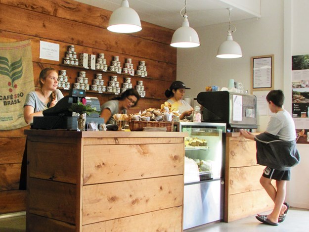 |
The Honey House Cafe
|
The road to Pataua North wiggled east from Whangarei, skirting the banks of the Horahora River before turning south. A couple of kilometres before reaching Pataua we saw brightly coloured flags at the roadside and a paddock full of cars.
People were buzzing around a red barn like the bees around the hives across the road. We discovered that Tahi – home to honey producers, a cafe and a nature sanctuary – was having its annual open day.
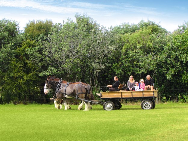 |
Clydesdale rides at the open day
|
We were keen to see what was happening, and before long had signed up for the ‘bee experience’ and ‘honey house’ visit. We strolled over to the cafe for a coffee before our first tour was due.
Sustained by some very chocolate-y brownies, we joined a group of people donning beekeepers’ suits and, looking something like a crowd of astronauts, we gathered around the hives and learned all about bees and honey.
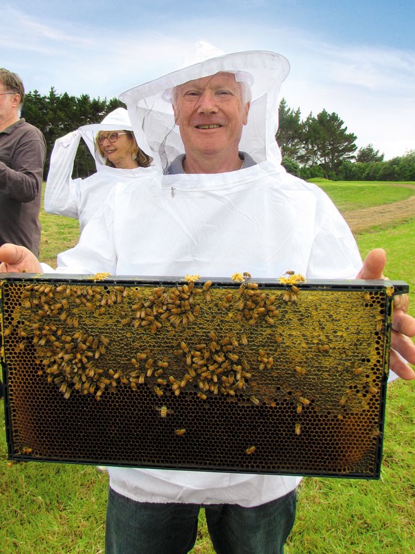 |
Learning about honey at Tahi
|
Later we were shown around the processing area and discovered how the honey gets from comb to jar. Tahi’s name comes from the mountain and pa, Ohua Tahi, which means ‘first place of plenty’. The honey they sell is a testament to the pristine location of the hives.
Before leaving Tahi we explored one of the four walks in the 315-hectare sanctuary. The boardwalk track took us beside a lake and through wetlands. We had tackled the longer forest walk previously (Tahi is open to the public on Sundays over summer) and looked forward to doing the estuary walk and beach walk another time.
Picturesque Pataua
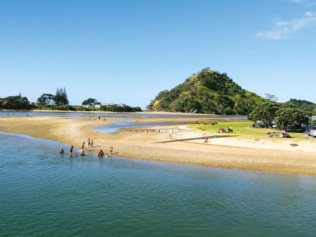 |
Pataua South
|
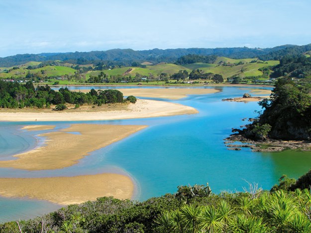
Leaving Tahi, we soon arrived at Pataua North. There’s not a lot of parking space during busy times but there is usually room to freedom camp at the little reserve close to where the estuary meets the sea.
 |
Pataua estuary
|
There is also a small car park near the footbridge that links Pataua North with Pataua South. Clustered around the river mouth and beachfront, much of the settlement is made up of holiday homes and baches.
Pataua is a typical Kiwi holiday spot. Pohutukawa trees line the sandy shores of the estuary, brilliant red with blossom in summer. The calm water is popular with kayakers and swimmers, while the footbridge is often crowded with those waiting their turn to fling themselves down into the water.
Surfers love the long, sandy Parauwanui Beach, while families flock to the shallow estuary and more protected beach at Pataua South, known to locals as Frogtown. Lively in summer, Pataua is peaceful out of season.
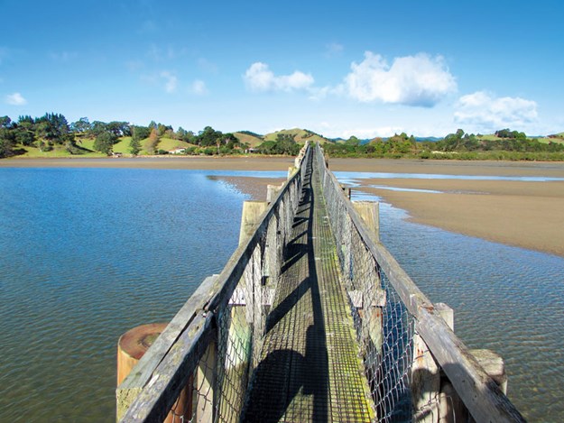
Longest footbridge
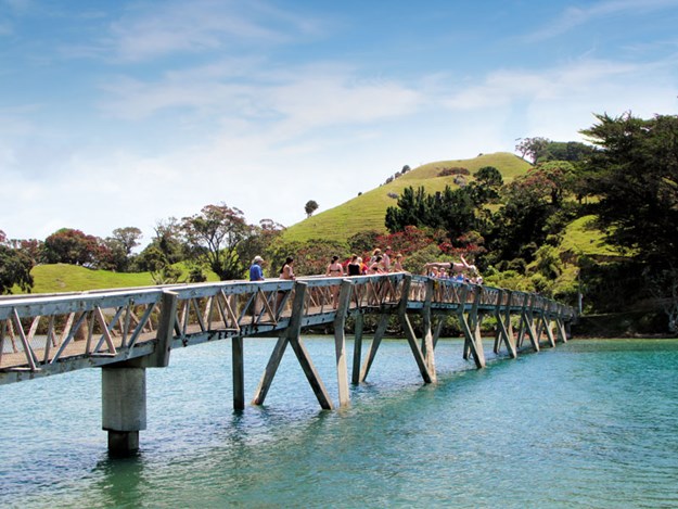
Further north, Whananaki boasts an even longer footbridge than Pataua’s. With a length of 395 metres, it’s the longest footbridge in the southern hemisphere, and was built so children living on the south side of the Whananaki Inlet could attend the school in Whananaki North.
Before it was constructed the teacher had to row the students back and forth. There is still a school at Whananaki and the village also boasts a store, hall and holiday park. There is a long history of Maori settlement in the area.
 |
Whananaki footbridge
|
Whananaki, which means kicking, is said to have been named by the captain of the Mataatua canoe, who spent a sleepless night on account of the mosquitoes here. Insect screens make life easier nowadays – motorhomers can stay at the holiday park, one of the two campgrounds, or freedom camp at the reserve on Whananaki North Road.
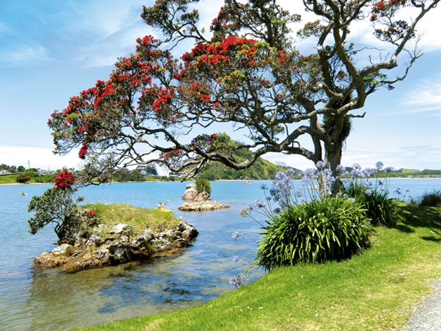 |
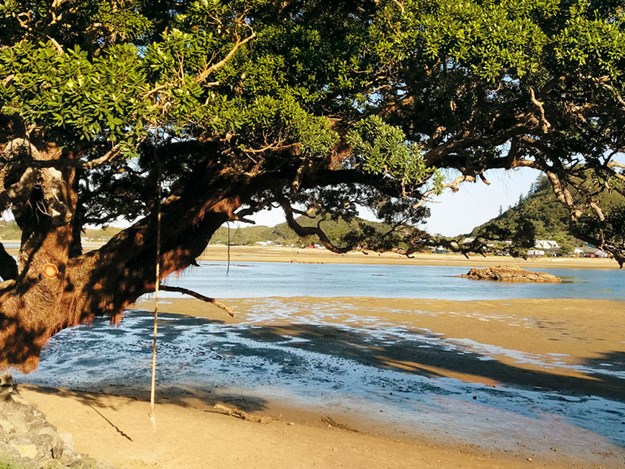
The estuary at Pataua North
|
Like Pataua, Whananaki has a sheltered estuary, great for swimming, fishing and gathering pipis. Kayakers can explore the mangroves, a haven for birdlife. There are popular beaches tucked into headlands along the coast – Moureeses and Otamure Bay are accessible from the road while Tauwhara Bay is a short walk through flax, cabbage trees and manuka.
.jpg) |
On the Headland Track at Whananaki North
|
A longer, two-hour return walk took us along the Motutara Track to the headland, where we had gorgeous 360 degree views of the coast, mountains and forests of the interior.
A shipwreck memorial
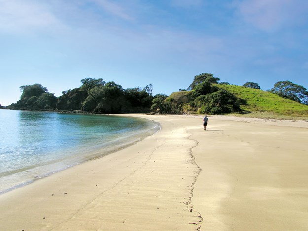 |
Beautiful beaches at Whananaki North
|
Across the footbridge at Whananaki South we found we were even further off the beaten track. A long, sandy beach led us to rocky Pitokuku Point, and from here we walked part of the Whananaki Walkway.
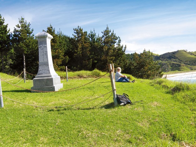 |
The Capitaine Bougainville Monument
|
The whole track goes south to Sandy Bay and takes three hours one way, but we only completed the first section this time, to the Capitaine Bougainville Monument. A side track took us through pine forest to the monument marking the place where the Capitaine Bougainville, a freighter carrying meat and dairy products, caught fire and sank in 1975.
Sixteen of the crew and passengers aboard perished, as lifeboats capsized in stormy seas. On a peaceful, sunny day, with fabulous views, it was hard to imagine the deadly conditions that led to the tragedy.
Back in Whananaki North we enjoyed a coffee at the cafe outside the store. We might have had to travel long and winding roads to reach both Whananaki and Pataua, but we were glad we did. And discovering the remarkable footbridges that linked the two halves of the settlements was the icing on the cake.
FURTHER INFORMATION
- Details about the cafe and walks at Tahi can be found at tahinz.com.
- Access to Pataua North is via Whareora and Pataua North Roads, while to get to Pataua South, take Whangarei Heads Road, then turn onto Pataua South Road. Both routes are around 30km from Whangarei.
- Details of the Pataua South campground can be found at treasureislandnz.co.nz.
- Freedom camping at Pataua North is for self-contained vehicles only; maximum stay three nights
- Whananaki North is about 35km north of Whangarei. Turn off SH1 onto Whananaki North Road. To get to Whananaki South turn off SH1 at Hikurangi and follow Marua and Whananaki South Roads.
- Information about camping at Whananaki can be found at whananakiholiday.co.nz; Motutara Farm’s website is campingholiday.co.nz; for the DOC campsite at Otamure Bay visit doc.govt.nz.
- Details of the Whananaki Walkway can be found on the Whangarei District Council’s website: wdc.govt.nz. If walking the track one-way, it is good to be picked up at Sandy Bay, though the drive back to Whananaki is 32km.


.jpg)


.jpg)

.jpg)


.jpg)


